|
|
 |
|
 |
|
Rhode Island Home
|
|
|
|
Conservation Security Program 2008 (CSP)Narragansett Bay Watershed
|
|
Land Cover/Land Use (from 1995, RIGIS and 1999 Land Use data, MassGIS) |
Acres |
% |
|
Cropland |
8,767 |
4% |
|
Pastureland |
4,283 |
2% |
|
Forestland |
56,453 |
27% |
|
Other Open land |
5,078 |
2% |
|
Water/Wetland/Shrub |
22,347 |
11% |
|
Residential/urban/other |
114,928 |
54% |
|
TOTAL |
|
100 |
Though some areas in the watershed are highly developed (urbanized), small farms
and nurseries still persist. A huge market for locally produced food provides a
great outlet for small farms to persist with direct sales to consumers. Many
Farmer’s markets in the cities keep this local agricultural economy running
(Rhode Island ranks second in the nation for farm gate sales.

|
The following documents require
Adobe
Acrobat Reader. |
By going through the CSP Self-Assessment Workbook, potential CSP participants will get a good idea about whether they are eligible for CSP at this time. Producers who may not be eligible can find out about programs that can help them achieve a higher level of conservation so that they may apply for CSP
in the future.
|
|
The Conservation Steward Plan will be used to document "Enhancement Activities" that are eligible for payments. An Enhancement Activity is an action other than a conservation practice that is included as a part of a conservation stewardship contract; such as a measure, incremental movement on a conservation index or scale, or an on-farm demonstration, pilot, or assessment. Enhancement Activities can include actions such as Nutrient Management using Geographic Positioning Systems, decreasing ozone emissions, use and production of alternative energy and providing habitat for fish and wildlife. For a detailed list and Enhancement Activities descriptions please click here.
Contact: Joseph Bachand
Title: CSP Program Manager
Email:
joseph.bachand@ri.usda.gov
Phone: 401-822-8818
Contact: Michael Merrill
Title: District Conservation for the Northern RI Conservation District
Email:
michael.merrill@ri.usda.gov
Phone: 401-822-8841
Contact: Mike Kenyon
Title: District Conservation for the Southern RI Conservation District
Phone: 401-822-8821
Email:
michael.kenyon@ri.usda.gov
Last Modified:
04/09/2008
|
|
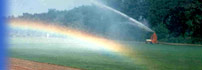
 In 2008 the Rhode Island and Massachusetts Natural Resources Conservation
Service will be offering the Conservation Security Program jointly in the
portions of the Narragansett Bay Watershed.
In 2008 the Rhode Island and Massachusetts Natural Resources Conservation
Service will be offering the Conservation Security Program jointly in the
portions of the Narragansett Bay Watershed.