|
||
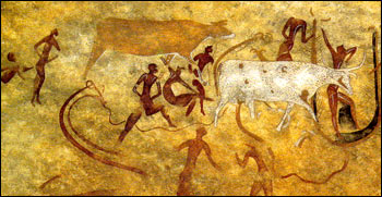
Central Sahara: A Wet Past
| ||||
On August 25, 2000, the Moderate-resolution Imaging Spectroradiometer (MODIS) acquired this spectacular image of a region in Africa's Sahara Desert, including the southern part of the border between Algeria and Libya. Three large rock massifs appear to be pushing up from beneath red sand dunes: from left to right are the Tassili, Tadrart-Acacus, and Amsak massifs. Different rock types account for rock colors varying from dark brown (Acacus) to the pale tone of Amsak eastern portion (Amsak Mellet means Pale Amsak in the local Tuareg dialect). The dendritic structures of ancient riverbeds are clearly visible in the Acacus-Amsak region. Multidisciplinary studies (including paleo-climatology and paleo-botany) suggest that this area was wet during the last glacial era, covered by forests and populated by wild animals. On the same rocks, archaeologists have found a large number of rock paintings and engravings, faint tracks of one of the most ancient civilizations of the world. Starting about 12,000 years ago, the hunters rapidly learned domestication of buffalo and goat, and developed one of the first systems of symbolic art. Extremely dry weather conditions began here about 5,000 years ago, perhaps leading to the decline of this civilization but helping to preserve their ancient masterpieces.
This natural color image (top) was produced using three MODIS bands corresponding to red, green, and blue wavelengths. The ground resolution is 250 meters per pixel and was made by "injecting" the high-resolution red channel into lower resolution green and blue channels. The image was processed by Telespazio's Earth Observation division, in its new products development facility in Rome, Italy. The MODIS sensor flies aboard NASA's Terra spacecraft, launched in December 1999. Image courtesy Luca Pietranera, Telespazio, Rome, Italy Recommend this Image to a Friend Back to: Newsroom
Also see |
View Images Index
| |||
|
Subscribe to the Earth Observatory About the Earth Observatory Contact Us Privacy Policy and Important Notices Responsible NASA Official: Lorraine A. Remer Webmaster: Goran Halusa We're a part of the Science Mission Directorate |
 Click here to view full image