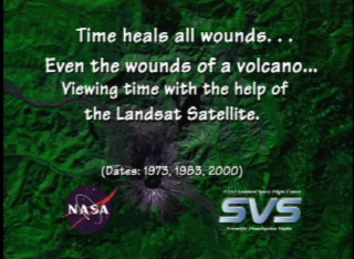
Time heals all wounds. A look at Mt. St. Helens (slower dissolve)
|
Mount St. Helens over time (1973, 1983, and 2000) via the Landsat satellites. Scientists can see how the local area is healing after the 1980 eruption of the volcano.
|
|
|
|
Looking at Landsat images of Mt. St. Helens, Looking at the regrowth after the disaster.
Duration: 4.0 seconds
Available formats:
320x240 (30 fps)
MPEG-1
569 KB
160x80
PNG
26 KB
80x40
PNG
7 KB
320x266
JPEG
17 KB
720x480 (29.97 fps)
DV
42 MB
How to play our movies
|
|
|
|
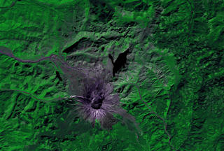
Mt. St. Helens 2 years after the disaster.
Available formats:
2880 x 1944
TIFF
5 MB
320 x 216
JPEG
18 KB
|
|

|
|
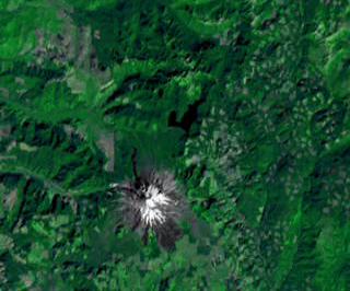
12 years before the disaster. Notice the vegetation, how thick it is.
Available formats:
2880 x 1944
TIFF
6 MB
320 x 216
JPEG
19 KB
|
|
|
|
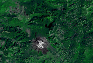
20 years afterwards the disaster, notice how much the vegetation has grown back.
Available formats:
2880 x 1944
TIFF
8 MB
320 x 216
JPEG
22 KB
|
|

|
|
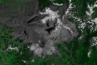
None
Available formats:
720 x 528
JPEG
179 KB
320 x 234
PNG
389 KB
|
| Animation Number: | 2103 |
| Animator: | Stuart A. Snodgrass (Lead) |
| Studio: | NASA |
| Completed: | 2001-04-12 |
| Scientist: | Darrel Williams (NASA/GSFC) |
| Instrument: | Landsat |
| Data Collected: | 1973, 1983, 2000 |
| Series: | Mt. St. Helens |
| Video: | SVS2001-0013 * |
Keywords:
DLESE
>> Forestry
DLESE
>> Geology
SVS
>> Mt. St. Helens
DLESE
>> Natural hazards
GCMD
>> Location
>> Washington
|
|
Please give credit for this item to
NASA/Goddard Space Flight Center
Scientific Visualization Studio |
*Please note: the SVS does not fulfill requests for copies of the tapes in our library. On some of our animation pages, there is a direct link to a video distribution service from which tapes, handled by the Public Affairs Office (PAO)/Goddard TV, including some of our animations may be ordered. General information on this service can be found here. |
|
Back to Top
|

