Topography, History, and Programs
Las Vegas is located in a broad desert valley in extreme
southern Nevada. Mountains surrounding the valley
extend 2,000 to 10,000 feet above the valley floor.
The Las Vegas Valley comprises about 600 square
miles and runs from northwest to southeast. The
valley is bounded on the north by the Sheep Range,
while Boulder City and the Lake Mead National
Recreation Area are generally considered its southern
extent. To the west are the Spring Mountains,
which include Mt. Charleston, the region’s
highest peak at 11,918 feet. Several smaller ranges
line the eastern rim of the valley, including
the McCullough Range, the Muddy Mountains, the
Black Mountains, and the Eldorado Range.
Official weather observations began in 1937 at what is
now Nellis Air Force Base. In late 1948, the U.S.
Weather Bureau moved to McCarran Field, now McCarran
International Airport. McCarran is located 7 miles
south of downtown Las Vegas. It is approximately
5 miles southwest of, and 300 feet higher than
the lowest part of the valley. Thus, for most
of the Las Vegas metropolitan area, the valley
floor slopes downward from west to east. This
affects the local climatology significantly in
terms of driving variations in wind, precipitation,
and storm runoff.
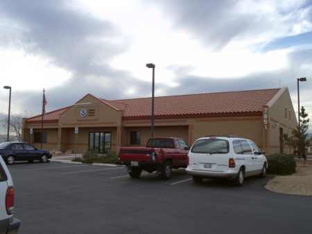
The office is located on 9.5 acres of desert terrain,
is bordered on two sides by homes and one side by a strip mall. Open land
to the south, immediately gives way to one of
the area's casinos less than .5 miles away. The
WSR-88D is located roughly 35 air miles to the
southeast of the NWSO and is located at roughly
5,000 ft on top of Nelson Peak.
The NWSO in Las Vegas services the largest population
center in the state and provides weather services
for one of the largest County Warning Areas (CWA)
within the CONUS (approximately 70,000 square
miles). The CWA covers parts of Nevada,
California, and Arizona. The Las Vegas CWA has
had the fastest growing population of any since
1990. Weather forecasting is a challenge with
the lowest and highest points in the CONUS being
in or on our CWA border. A diversified program
entails watch/warning responsibility, public and
aviation forecasts, public service, an extensive
ALERT network, NOAA Weather Radio, cooperative
stations, and climate.
Reference
Skrbac, P. and S. Cordero, 1995: Climate of Las Vegas.
NOAA Technical Memorandum NWS WR-235.
Our Staff
Click here to see a listing of the people that serve you in this office.
Sample List of Critical Products
Click here to see a listing of our warning, watch, and advisory criteria.
|