
 Feeds & Data
Magnitude 4.5 - WESTERN MONTANA
2007 May 08 15:46:49 UTC
Earthquake Details
| Magnitude | 4.5 |
|---|---|
| Date-Time |
|
| Location | 45.394°N, 112.130°W |
| Depth | 13.5 km (8.4 miles) set by location program |
| Region | WESTERN MONTANA |
| Distances |
|
| Location Uncertainty | Error estimate not available |
| Parameters | NST=117, Nph=117, Dmin=36.7 km, Rmss=0 sec, Gp= 22°, M-type=teleseismic moment magnitude (Mw), Version=U |
| Source |
|
| Event ID | us2007ccay |
- This event has been reviewed by a seismologist.
- Did you feel it? Report shaking and damage at your location. You can also view a map displaying accumulated data from your report and others.
Earthquake Summary


The following is a release by the United States Geological Survey, National Earthquake Information Center: An earthquake occurred 60 km (35 miles) NE of Dillon, Montana at 9:46 AM MDT, May 8, 2007 (8:46 AM PDT in Us). The magnitude and location may be revised when additional data and further analysis results are available. There have been no reports of damage.
Felt Reports
MD 4.7 (BUT). Several buildings slightly damaged at Sheridan. Felt (V) at Sheridan and Twin Bridges; (IV) at Dillon, Norris and Virginia City; (III) at Anaconda, Bozeman, Butte, Clancy, Corvallis, Deer Lodge, Divide, Ennis, Gallatin Gateway, Hamilton, Helena, Manhattan, Missoula, Salmon, Stevensville, Three Forks, Victor and Whitehall; (II) at Boise, Florence and Great Falls. Felt at Belgrade, Big Timber, Billings, Boulder, Cardwell, Cascade, Darby, East Helena, Elk City, Fort Benton, Gardiner, Garrison, Helmville, Leadore, Lewistown, Lincoln, Lolo, Moscow, North Fork, Philipsburg, Pony, Radersburg, Silverstar, Sula and Warm Springs. Also felt at Pullman, Washington.
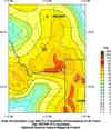
Earthquake Maps


Scientific & Technical Information

- Preliminary Earthquake Report
- U.S. Geological Survey, National Earthquake Information Center:
World Data Center for Seismology, Denver
