The California Information Node (CAIN) is a regional node of the National Biological Information Infrastructure (NBII). The primary mission is to provide access to critical biological and natural resources information that facilitates data integration, visualization, coordination, and collaboration to support the conservation of biodiversity in California.
From the deserts to the Redwood forests, California encompasses the most diverse biological region in the West. Home to more than 36 million residents, the state faces many issues that affect the landscape, wildlife, and people. Sharing and integrating information and data holdings from multiple institutions across the region can help address these challenges.
This is a collaborative project between the University of California Davis, Information Center for the Environment, the California Department of Fish and Game, and other partners.
Go directly to featured projects below, or use the menu to navigate the site.
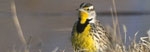
. image: Larry Moats, U.S. Fish and Wildlife Service")
. image: Joyce Gross")

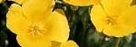
. image: J.S. Peterson @ USDA-NRCS PLANTS Database")
. image: J.S. Peterson @ USDA-NRCS PLANTS Database")
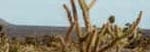
. image: Mark W. Skinner @ USDA-NRCS PLANTS Database")
