|
|

|
 |
|
|
 |

|
Latest
El Niño/La Niña
Jason Data |
|
The latest image from NASA's Jason satellite is updated every
two weeks. Check out the
latest ocean conditions here!
|
|
|
|
|
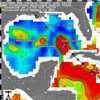
Hurricane Gustav's path through the Gulf |
Sea surface height data provides important information on Gustav's path over the Loop Current in the Gulf of Mexico.
Read more ...
|
|
|