|
|


|
AWIPS Fire Weather Briefing |
| created by the National Weather Service Forecast Office in Seattle |
|
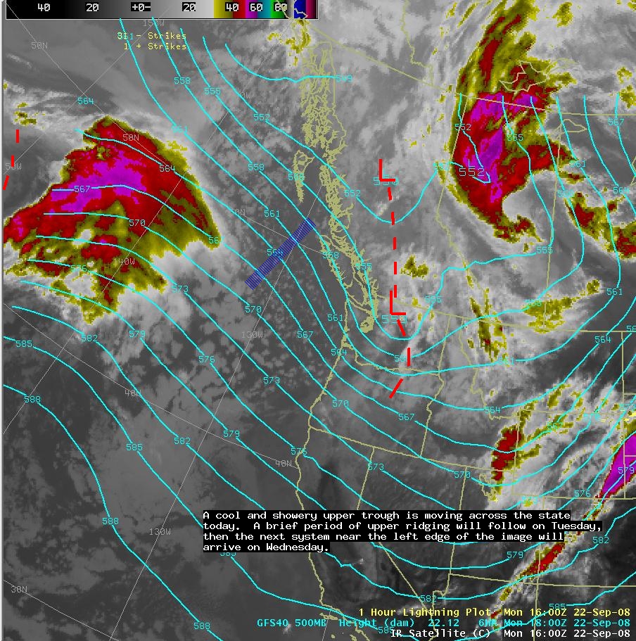
| IR Satelllite with 500mb Heights |
|
|
 |
| Visible Satellite with MSL Pressure |
|
|
 |
|
|
Regional/Radar or Current Water Vapor Image |
|
|
|
 |
|
| 60hr Animation of 500mb Heights, Wind, and Precipitation |
|
| |
|
| 60hr Animation of MSL Pressure, Sfc Wind, and 850-700mb Average Relative Humidity |
|
|
|
|
| Chart of
the Day |
|
|
|
|
| 6-10 Day Outlook |
|
|

 |
| 30-90 Day Outlook |
|
|
 |
| Keetch-Byram Drought Index |
|
| |
 |
| Palmer Drought Index |
|
| |
 |
| Observed Fire Danger |
|
| |
 |
|
|
|
Webmaster
US Dept of Commerce
National Oceanic and Atmospheric Administration
National Weather Service
Seattle Weather Forecast Office
7600 Sandpoint Way NE
Seattle, Washington 98115-6349
Tel: (206) 526-6087
|
Disclaimer
Information Quality
Credits
Glossary |
Privacy Policy
Freedom of Information Act
About Us
Career Opportunities
|
National Weather Service Mission: "The
National Weather Service (NWS) provides weather,
hydrologic, and climate forecasts and warnings for
the United States, its territories, adjacent waters
and ocean areas, for the protection of life and
property and the enhancement of the national economy.
NWS data and products form a national information
database and infrastructure which can be used by
other governmental agencies, the private sector,
the public, and the global community." |
|
|


