 |
|||||
|
|
|
|
|||


| |
Great Lakes Sea Grant Extension Office
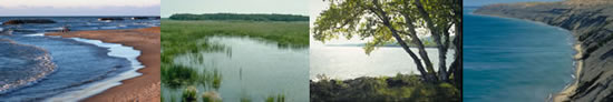
About Our Great Lakes: Great Lakes Basin Facts
| Introduction
| Background | Ecology
| Economy Great Lakes Facts | Threats | Lake by Lake Profiles |
Water Volume: 5,500 cubic miles (22,809 cubic km), 90% of U.S. supply, 18% of world supply Water Surface Area: 95,000 square miles (245,759 square km). Largest surface area of freshwater in the world. Shoreline Length: 10,210 miles (17,017 km). Shoreline Use:
Population: 35 million. Outlets: St. Lawrence River and Chicago Sanitary & Ship Canal Retention Times (amount of time it takes for lakes to get rid of pollutants):
$4 billion sports fishery industry. 250 species of fish. Provides drinking water for 40 million people. Provides 56 billion gallons of water per day for municipal, agricultural, and industrial use. Commercial shipping of 200 million tons over 1,270 mile route. Provides power generation and cooling water. Produces 90% of iron ore. Also, 58% of automobiles in the U.S. and Canada are manufactured in the Great Lakes basin. 1,000 mile international border.
|
*Source: The Great
Lakes: An Environmental Atlas and Resource Book. Available online
through the U.S. EPA web site.
Last updated: 2004-06-18 jjs