| TEXT ONLY VERSION | NATIONAL
HURRICANE CENTER |
 |
 |
|
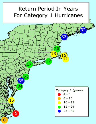
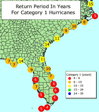
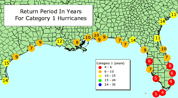
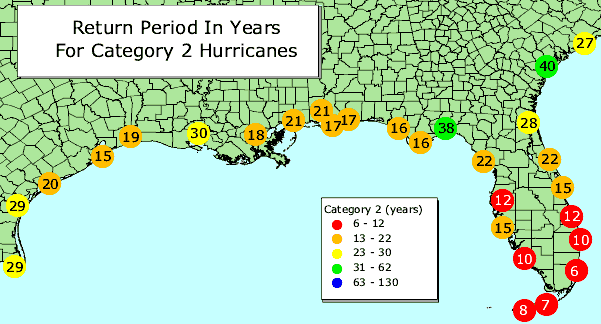
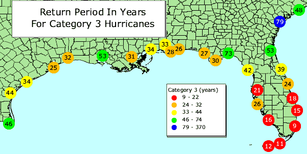
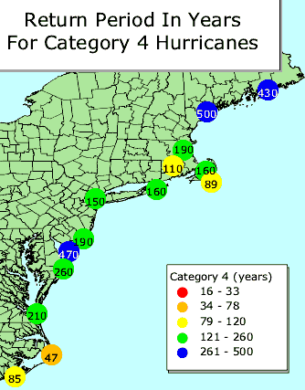
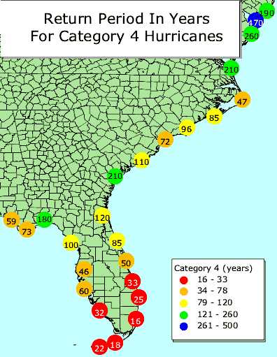
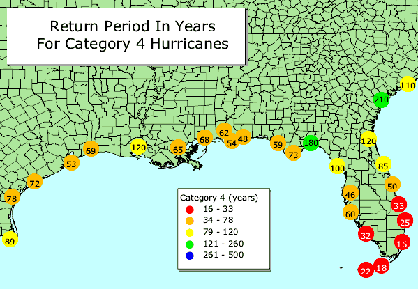
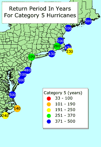
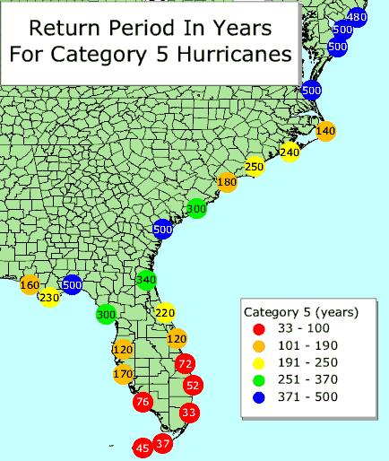
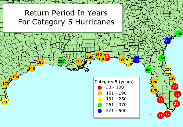
Hurricane return periods are the frequency at which a certain intensity or category of hurricane can be expected within 75 nm (86 statute miles) of a given location. In simpler terms, a return period of 20 years for a Category 3 or greater hurricane means that on average during the previous 100 years, a Category 3 or greater hurricane passed within 75 nm (86 miles) of that location about five times. We would then expect, on average, an additional five Category 3 or greater hurricanes within that radius over the next 100 years. To the right are links to either a PDF file of the entire U.S. Atlantic and Gulf Coast or GIF images of specific sections of that coastline. The return period maps include data up through 1999. This data is produced by the National Hurricane Center Risk Analysis Program (HURISK) by Charles Neumann. The basic idea is that a population of tropical cyclones falling within the 65 nm (75 miles) circle is obtained from the best-track file. For that set of storms, the maximum wind within the circle is found. Then, a count is conducted to find how many systems had winds of 30-34 kt, 35-39 kt etc. Once the count is known, a function is used to "fit" the distribution. Since there are only a few intense tropical cyclones typically in the 100-year record for a particular site, the mathematical function helps to smooth this out and "fill in the holes". The smooth function is then used to estimate the number of systems that would occur over a longer time period. We would expect that if we actually had a much longer historical record (several centuries) that the number of extreme events (i.e., category 5 hurricanes) observed would roughly match our estimates based on the shorter period of record. |
|
|
Visit these websites to learn more |
|
