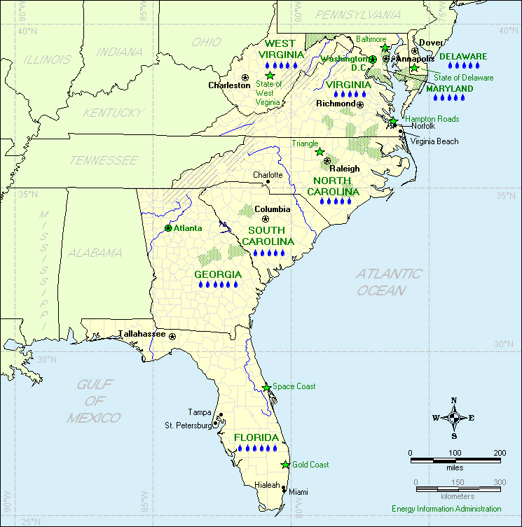
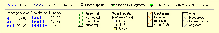
Renewable Potential Maps
S
OUTH
A
TLANTIC
D
IVISION
D
ELAWARE,
F
LORIDA,
G
EORGIA,
M
ARYLAND,
N
ORTH
C
AROLINA,
S
OUTH
C
AROLINA,
V
IRGINIA, AND
W
EST
V
IRGINIA
Print this map from a pdf file
See sources of map data
Sign up for email notification of new maps
South Atlantic Residential Energy Map 2000
South Atlantic Appliance Report 2001
U.S. Census Regions and Divisions Map
Return to Renewable Potential Maps home page
File last modified: November 29, 2005
Map design by Barbara Fichman
Map production by James O'Sullivan
Contact:
For general questions about energy:
The National Energy Information Center
infoctr@eia.doe.gov
For help with technical problems:
The Webmaster
wmaster@eia.doe.gov
Phone: 202-586-8959
URL:
http://www.eia.doe.gov/emeu/reps/rpmap/rp_so-atl.html
If you are having any technical problems with this site, please contact the EIA Webmaster at
wmaster@eia.doe.gov