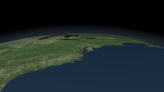
Chesapeake Bay Cities
|
|
This animation takes us on a tour around the Chesapeake Bay region visiting major city centers in the surrounding states: Maryland, Virginia, Delaware and the District of Columbia. The imagery utilized for this animation is a false-color Chesapeake Bay Landsat-7 Mosaic (#3473) composed of eight scenes acquired between 1999-2002, which were put together and color corrected to resemble natural looking colors.
|
|
|
|
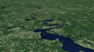
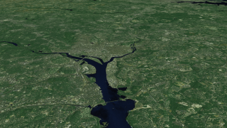
Chesapeake Bay Cities animation
Duration: 4.7 minutes
Available formats:
1280x720 (30 fps)
MPEG-4
217 MB
640x360 (30 fps)
MPEG-4
50 MB
512x288 (30 fps)
MPEG-1
92 MB
1280x720 (60 fps)
Frames (BayCities 60p)
1280x720 (30 fps)
Frames (BayCities 30p)
3840x2160
TIFF
4 MB
1280x720
TIFF
568 KB
320x180
PNG
143 KB
160x80
PNG
38 KB
80x40
PNG
10 KB
How to play our movies
|
|
|
|
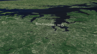
Chesapeake Bay Cities with major cities text labels
Duration: 4.7 minutes
Available formats:
1280x720 (30 fps)
MPEG-4
224 MB
640x360 (30 fps)
MPEG-4
50 MB
512x288 (30 fps)
MPEG-1
92 MB
1280x720 (60 fps)
Frames (Composite 60p)
1280x720 (30 fps)
Frames (Composite 30p)
1920x1080
TIFF
3 MB
1280x720
TIFF
1 MB
320x180
PNG
299 KB
How to play our movies
|
|

|
|
This frame sequence contains the city text labels overlay
Available formats:
1280x720 (60 fps)
Frames (LabelOverlay 60p)
1280x720 (30 fps)
Frames (LabelOverlay 30p)
1280x720
TIFF
48 KB
320x180
PNG
5 KB
How to play our movies
|
|
|
|
Flying above Virginia Beach, VA
Available formats:
3840 x 2160
TIFF
10 MB
1280 x 720
TIFF
1 MB
320 x 180
PNG
278 KB
|
|
|
|
Overlooking the area of Williamsburg, VA
Available formats:
3840 x 2160
TIFF
10 MB
1280 x 720
TIFF
1 MB
320 x 180
PNG
297 KB
|
|
|
|
Flying above Virginia and the James River
Available formats:
1920 x 1080
TIFF
3 MB
1280 x 720
TIFF
1 MB
320 x 180
PNG
306 KB
|
|
|
|
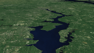
Potomac River
Available formats:
1920 x 1080
TIFF
2 MB
1280 x 720
TIFF
1 MB
320 x 180
PNG
290 KB
|
|
|
|
Traversing the Potomac River
Available formats:
1920 x 1080
TIFF
3 MB
1280 x 720
TIFF
1 MB
320 x 180
PNG
297 KB
|
|
|
|
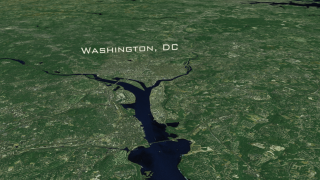
Aerial view of Washington, DC with text label
Available formats:
1920 x 1080
TIFF
3 MB
1280 x 720
TIFF
1 MB
320 x 180
PNG
307 KB
|
|
|
|
Aerial view of Washington, DC
Available formats:
1920 x 1080
TIFF
3 MB
1280 x 720
TIFF
1 MB
320 x 180
PNG
307 KB
|
|
|
|
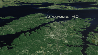
The city of Annapolis, MD, Bay Bridge and the Eastern Shore with text label
Available formats:
1920 x 1080
TIFF
2 MB
1280 x 720
TIFF
1 MB
320 x 180
PNG
288 KB
|
|

|
|
The city of Annapolis, MD, Bay Bridge and the Eastern Shore.
Available formats:
1920 x 1080
TIFF
2 MB
1280 x 720
TIFF
1 MB
320 x 180
PNG
286 KB
|
|
|
|
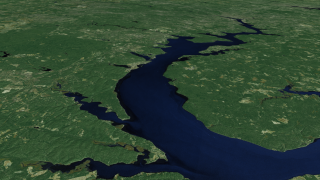
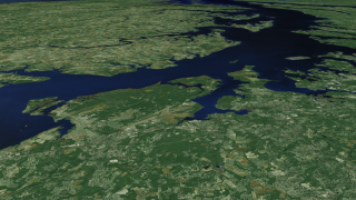
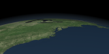
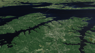
View of the Chesapeake Bay
Available formats:
1920 x 1080
TIFF
3 MB
1280 x 720
TIFF
1 MB
320 x 180
PNG
297 KB
|
|

|
|
Flying above Wilmington, DE and the Eastern Shore
Available formats:
3840 x 2160
TIFF
12 MB
1280 x 720
TIFF
1 MB
320 x 180
PNG
302 KB
|
|
|
|
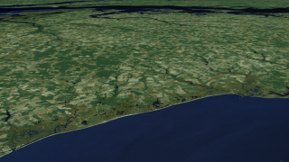
Eastern Shore view on the side of the Delaware Bay
Available formats:
3840 x 2160
TIFF
10 MB
1280 x 720
TIFF
1 MB
320 x 180
PNG
285 KB
|
|
|
|
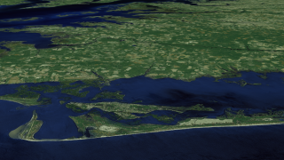
Chincoteague Island, VA
Available formats:
3840 x 2160
TIFF
9 MB
1280 x 720
TIFF
1 MB
320 x 180
PNG
283 KB
|
|
|
|
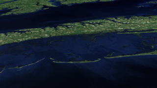
Wetlands of the Eastern Shore
Available formats:
3840 x 2160
TIFF
8 MB
1280 x 720
TIFF
957 KB
320 x 180
PNG
245 KB
|
|
|
|
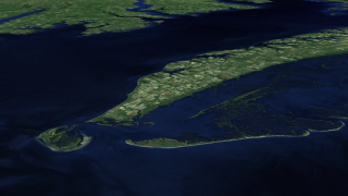
Wetlands of the Eastern shore and Fishermans Island
Available formats:
1920 x 1080
TIFF
2 MB
1280 x 720
TIFF
991 KB
320 x 180
PNG
249 KB
|
| Animation Number: | 3493 |
| Animators: | Helen-Nicole Kostis (SVS) (Lead) |
| | Greg Shirah (SVS) |
| | Cindy Starr (SVS) |
| | Lori Perkins (SVS) |
| Completed: | 2008-02-28 |
| Producer: | Andy Freeberg (NASA/GSFC) |
| Scientists: | Darrel Williams (NASA/GSFC) |
| | Laura Rocchio (SSAI) |
| Instrument: | Landsat-7/ETM+ |
| Data sets: | ETM+
|
| | Landsat |
| Data Collected: | The mosaic was created by EarthSat under contract with NASA as part of the GeoCover 2000 product. All images used in GeoCover were acquired by Landsat 7 during the period of 1999-2002. The pixel size of the full resolution image represents 14.25 m on the ground.
The Chesapeake Bay mosaic uses portions of eight Landsat-7 scenes. Below you will find a listing of the eight Landsat 7 images that were put together to create the composite image. Landsat scenes are organized by a Path and Row number according to the Worldwide Reference System. (To learn more about Landsat's Worldwide Reference System, please visit: http://landsat.gsfc.nasa.gov/about/wrs.html)
Scenes used in the Chesapeake Bay mosaic:
Landsat 7 WRS Path 15-Row 32 acquired on Oct. 05, 2001
Landsat 7 WRS Path 14-Row 32 acquired on Sept. 23, 1999
Landsat 7 WRS Path 15-Row 33 acquired on October 05, 2001
Landsat 7 WRS Path 14-Row 33 acquired on July 10, 2001
Landsat 7 WRS Path 15-Row 34 acquired on Sept. 30, 1999
Landsat 7 WRS Path 14-Row 34 acquired on July 10, 2001
Landsat 7 WRS Path 15-Row 35 acquired on Sept. 30, 1999
Landsat 7 WRS Path 14-Row 35 acquired on Sept. 23, 1999 |
| Series: | Landsat 7 |
| | Chesapeake Bay |
| Goddard TV Tapes: | G2008-034HD -- NASAs HD Chesapeake Bay Resource Tape |
| | G2008-041HD -- NASAs Landsat in HD 2008 Resource Tape |
Keywords:
SVS
>> Chesapeake Bay
SVS
>> Earth Science
SVS
>> Flyover
SVS
>> HDTV
SVS
>> Landsat
GCMD
>> EARTH SCIENCE
GCMD
>> Location
>> Delaware
GCMD
>> Location
>> District Of Columbia
GCMD
>> Location
>> Maryland
GCMD
>> Location
>> Virginia
|
|
Please give credit for this item to
NASA/Goddard Space Flight Center Scientific Visualization Studio |
|
Back to Top
|

