| |
(click to enlarge)
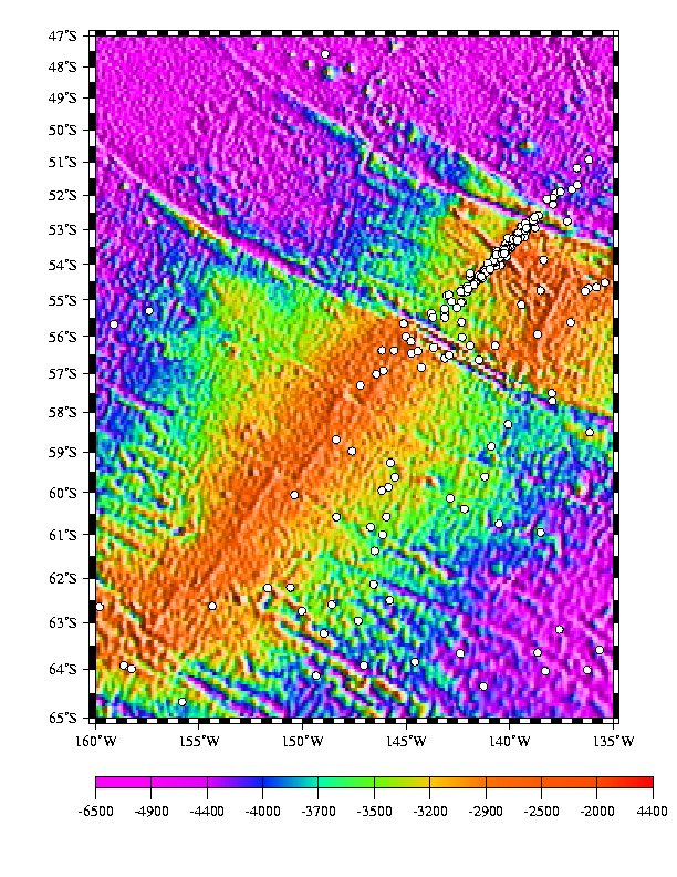
Plot of Earthquake Epicenters; Bathymetry is based
on satellite altimetry model of Smith and Sandwell.
Estimated error for the site based on a numerical
simulation is 35-minutes in latitude and 45-minutes in longitude.
Mean position is 53 42.59' S, 140 23.82' W. |
|
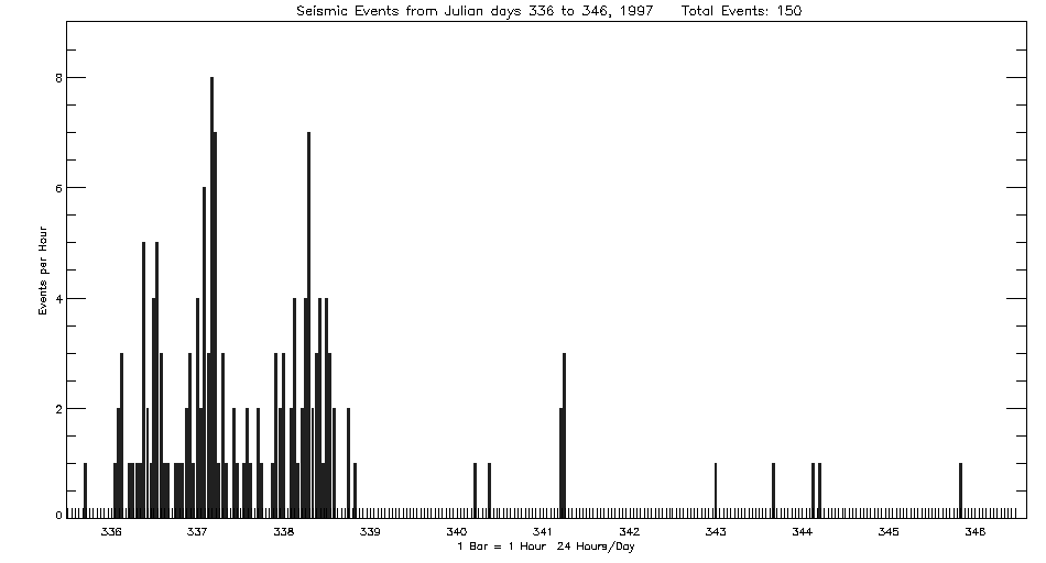
Beginning
December 1, 1996, the Autonomous
Hydrophone Array deployed by PMEL in the Eastern Equatorial
Pacific recorded what appears to be volcanic seismicity from
the off-axis of the southern extension of the East Pacific
Rise near 54 S and 140W. The activity continued for 7 days
with a total of 150 events located.
The location
is on a volcanic ridge west of the Eltanin Fracture Zone that has produced
volcanic seismicity in the past (Talandier and Okal, BSSA,?) . The character
of the seismicity is very similar to that observed at 3-20N on the EPR
in May, 1996, and other locations on the ridge. It does NOT show the monochromatic
(7Hz) nature described by Talandier and Okal.
 Histogram
of number of earthquakes recorded from the volcanic site per one-hour
period.
Histogram
of number of earthquakes recorded from the volcanic site per one-hour
period.
(click to enlarge)
Listing
of earthquake epicenters from the EPR at 54 S recorded December, 1996.
|
|