

Images & Animations
-
Credit
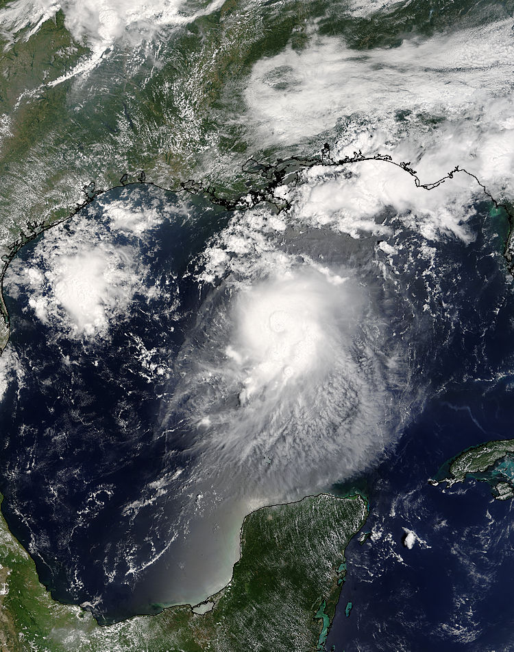
Jacques Descloitres, MODIS Rapid Response Team, NASA/GSFC
The Moderate Resolution Imaging Spectroradiometer (MODIS) aboard NASA’s Terra satellite captured this true-color image of Tropical Storm Bonnie on August 11, 2004, at 12:50 p.m. EDT. At the time this image was taken Bonnie had maximum sustained winds of 65 miles per hour with an estimated minimum central pressure of 1000 millibars. Bonnie was expected to make landfall between Panama City and Apalachicola, Florida during the morning of August 12.
Metadata
-
Sensor
Terra/MODIS -
Visualization Date
2004-08-12