
Images & Animations
-
Credit
Scientific Visualization Studio, NASA Goddard Space Flight Center,
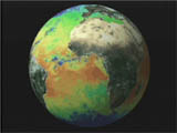
MODIS provides frequent (every 1-2 days) global views of many of the Earth's vital signs. This image shows a true-color land surface and a false color sea surface temperature map (red and yellow are warmer, blues are cooler).
Metadata
-
Sensor
Terra/MODIS -
Visualization Date
2000-04-18