

Images & Animations
-
Credit
Jacques Descloitres, MODIS Land Rapid Response Team, NASA/GSFC
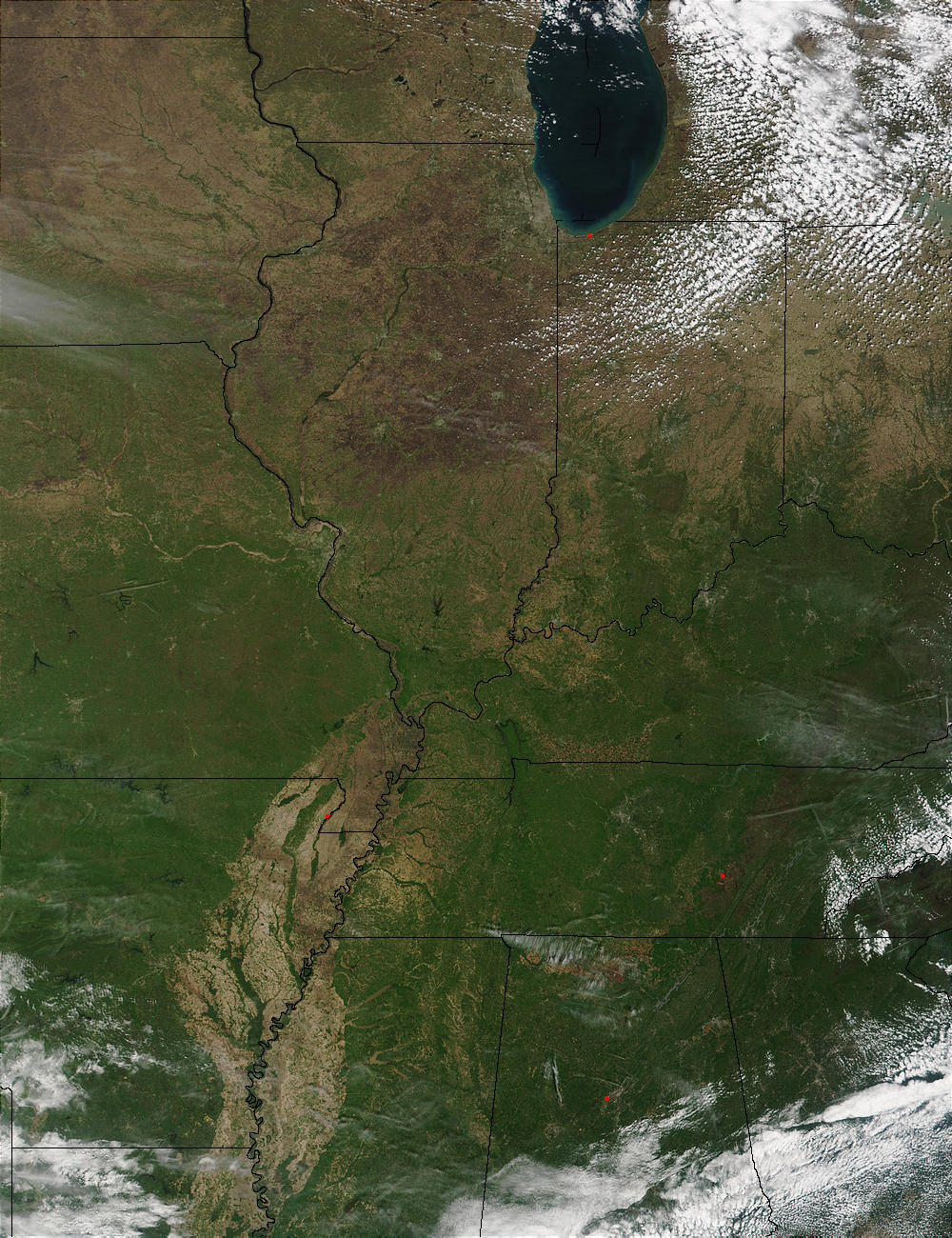
Spring green is making its way northward through the central United States in this true-color MODIS image from April 25, 2002. The Mississippi River Alluvial Plain cuts a wide, brown swath through the center of the image. The low-lying plain receives large deposits of silt and clay during the river's periodic flooding. These deposits make the soil very fertile, and complex, flood-tolerant ecosystems, such as bottomland hardwood forests have evolved in the plain.
In the northernmost portion of the image, spring has not progressed as far, with much of the land around the southern tip of Lake Michigan still brown. The iron-rich, reddish soils of northern Alabama (second state from bottom right) stand out from behind some thin clouds. A brownish arc running northeast from Alabama, through Tennessee, and into Kentucky suggests spring has not reached the higher elevations of the Cumberland Plateau.
Metadata
-
Sensor
Terra/MODIS -
Visualization Date
2002-05-03