

Images & Animations
-
Credit
Jeff Schmaltz, MODIS Rapid Response Team, NASA/GSFC
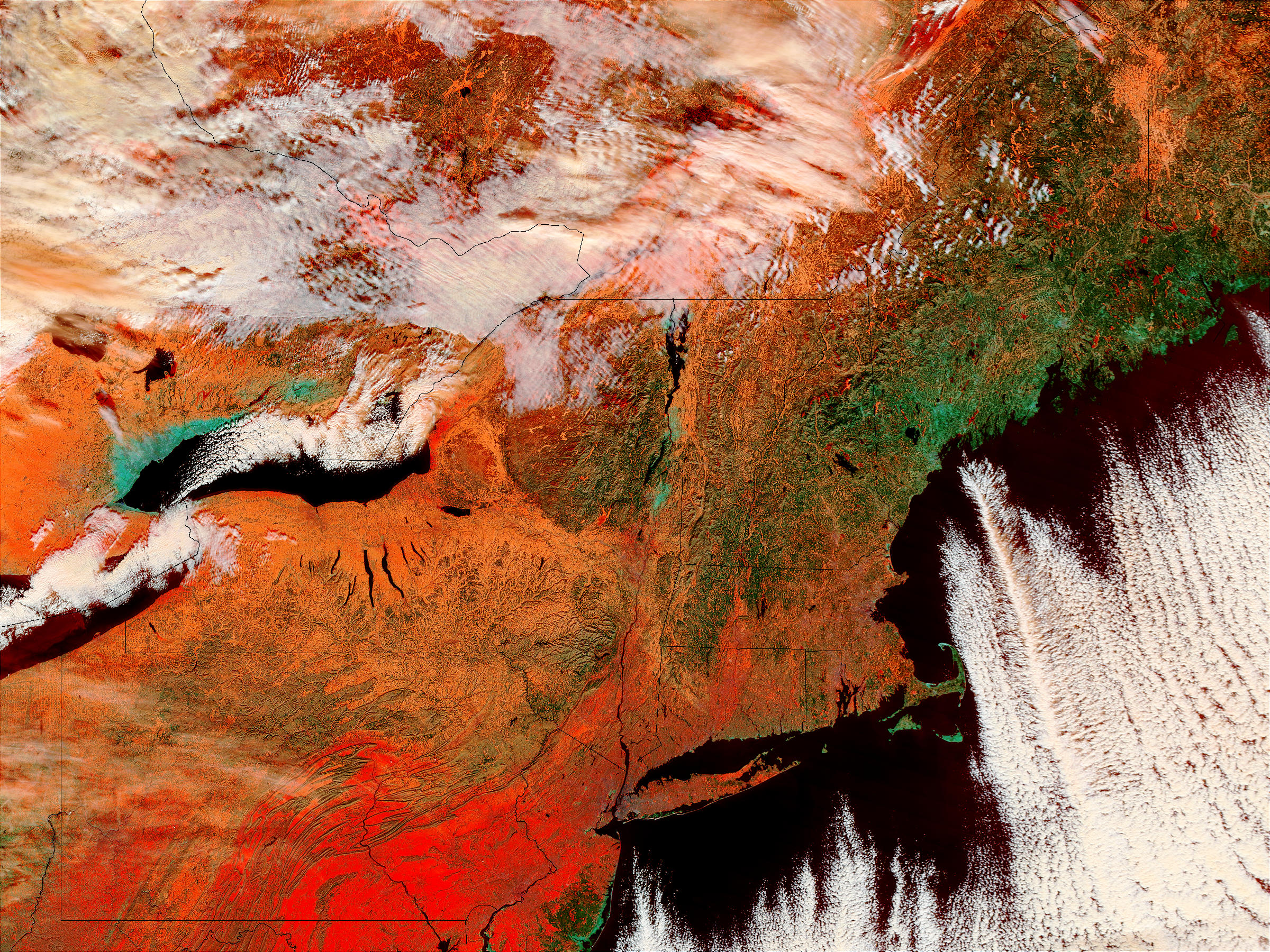
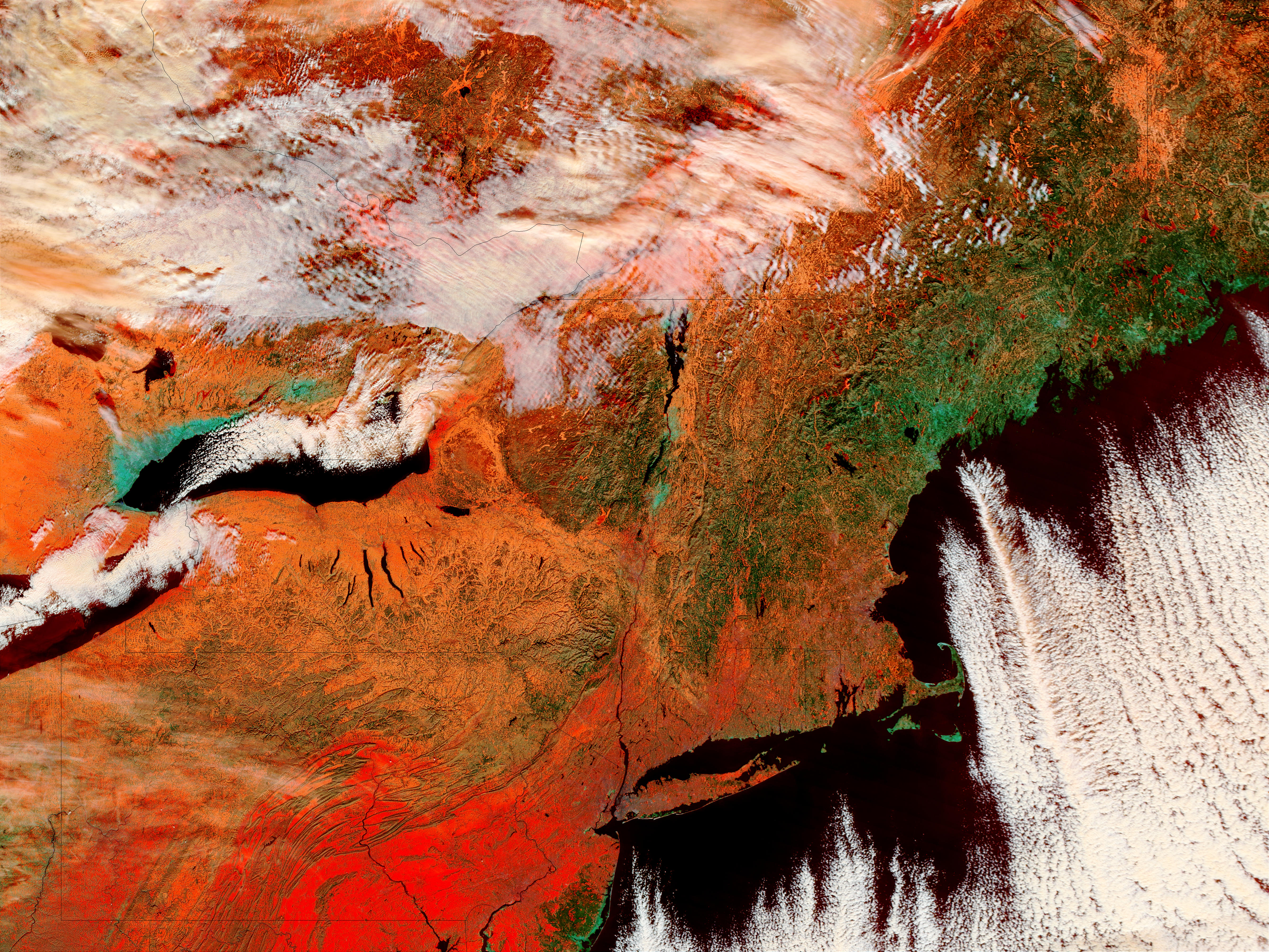
On December 9 and 18, 2002, snow lay on the ground in the Northeast. Complete states visible from bottom left (Dec. 9)are Pennsylvania, with almost all of New Jersey to its east; New York, Connecticut, Rhode Island, Massachusetts, Vermont, New Hampshire, and Maine. At top left is Ontario, and top center, Quebec. In the false-color image, snow is red, snow-free terrain is green, and water is black. Clouds are white. These images were captured by the Moderate Resolution Imaging Spectroradiometer (MODIS) on the Terra satellite.
Metadata
-
Sensor
Terra/MODIS -
Visualization Date
2002-12-11