
 Climate Monitoring /
Climate At A Glance /
Help
Climate Monitoring /
Climate At A Glance /
Help
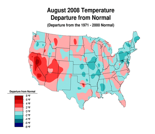
U.S. Climate at a GlanceThese data are primarily intended for the study of climate variability and change. Whenever possible, observations have been adjusted to account for the artificial effects introduced into the climate record by factors such as instrument changes, station relocations, observer practice changes and urbanization. As a result, some values available on this site differ from the official observations. For official station observations, please contact the NCDC Climate Services and Monitoring Division at ncdc.orders@noaa.gov.
Data provided on these pages are compiled from the following datasets.
 Climate Monitoring /
Climate At A Glance /
Help
Climate Monitoring /
Climate At A Glance /
Help
   Downloaded Tuesday, 16-Sep-2008 01:58:10 EDT Last Updated Thursday, 04-Sep-2008 13:35:03 EDT by Karin.L.Gleason@noaa.gov Please see the NCDC Contact Page if you have questions or comments. |