High-Resolution
Bathymetric Mapping of an Entire Tectonic Plate: Gorda
Plate, Northeast Pacific Ocean
A.M. Bobbitt, R.P. Dziak (NOAA/Oregon State University, CIMRS, Hatfield Marine Science Center, Newport, OR 97365 USA)
C. G. Fox
(NOAA, Pacific Marine Environmental Laboratory, Newport, OR 97365 USA)
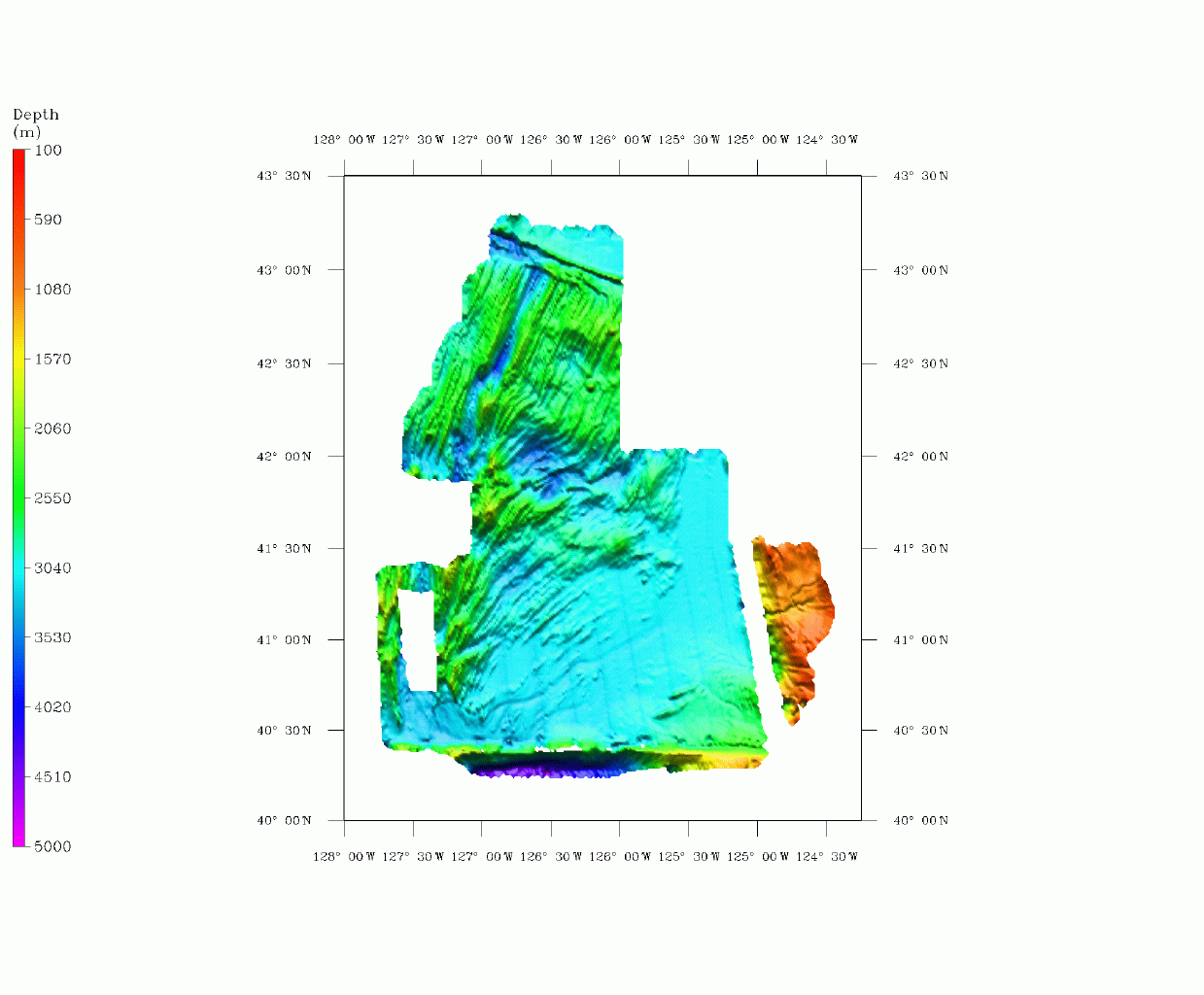
The Gorda Plate encompasses one of the smallest of the tectonic plates of the Pacific region, measuring roughly 270 km N-S and varying from about 200 km E-W at the southern boundary to less than 150 km at the northern limit. The plate is generated to the west at the Gorda Ridge, which consists of at least five distinct spreading segments that vary in strike from nearly N-S in the south to N22oE in the north. The Gorda Plate is bounded to the south by the Mendocino Fracture Zone, a right lateral strike slip fault zone with older Pacific Plate to the south. The northern limit is likely the extension of the Blanco Fracture Zone, but is poorly defined and may be strongly coupled to the adjacent Juan de Fuca Plate. At the eastern margin, the Gorda Plate subducts beneath North America at the Cascadia Subduction Zone, an area of potential seismic hazard. Numerous geophysical surveys have been conducted over this region in the past thirty years, including extensive multibeam bathmetric mapping by NOAA's National Ocean Service and NOAA's Vents Program, and other smaller mapping efforts. In October, 1997, the NOAA Ship RONALD H. BROWN conducted an extensive SeaBeam 2112 survey to complete coverage of the entire region and provide a comprehensive bathymetric map. Auxillary data sets collected include gravity and sub-bottom profiles. The composite bathymetry should give new insights into the pattern of deformation of this small, weak plate, which have implications for the seismotectonics of the region.
Combined Gorda
Plate Bathymetry:
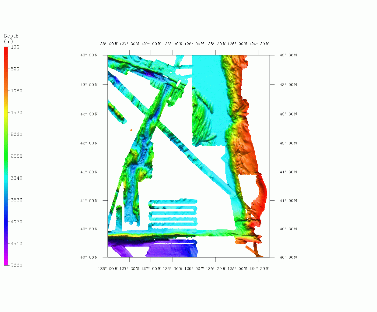
Data collected
on Brown VENTS Leg 3:
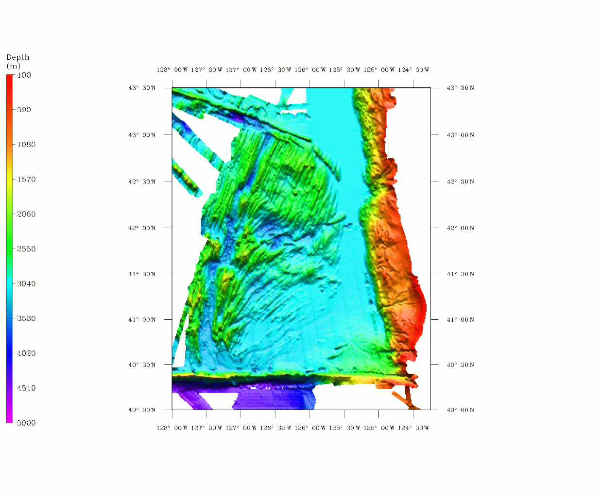
Data prior 1997: