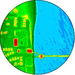
This Digital Elevation Model (DEM) grid of Rodanthe Pier on the Outer Banks of North Carolina, was derived from LIDAR point data and color-coded to ground elevations.
This Digital Elevation Model (DEM) grid of Rodanthe Pier on the Outer Banks of North Carolina, was derived from LIDAR point data and color-coded to ground elevations.