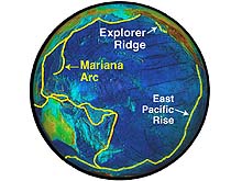
A global view of the Pacific Ring of Fire, showing the mid-ocean ridge and island arc/trench systems. Click image for larger view.
Submarine Ring of Fire 2003 - Mariana Arc Part II: Initial Survey of the Mariana Submarine Volcanoes
February 9 – March 5, 2003
An interdisciplinary team of scientists explored the submarine volcanoes of the Mariana Arc lying north of Guam in the western Pacific from February 9 to March 5.
It is here that most of the ocean crust, born along the mid-ocean ridges millions of years ago in the eastern Pacific, is “recycled” back into the Earth’s mantle as the ocean floor descends into the Mariana Trench. A portion of the ocean crust remelts and rises to the surface behind the trench along a line of more than 40 submarine volcanoes and volcanic islands extending north of Guam for more than 1,000 kilometers.
Most submarine volcanoes occur where tectonic plates are either moving apart or colliding. Click image for expanded view of many types of plate boundaries.
The team used the latest sea-floor mapping tools and sensors to image the volcanoes and to detect plumes of heat, gas and metals rising from the hydrothermal systems along the arc.
Although previous investigators have mapped and sampled portions of the Mariana Trench and many of the arc volcanoes during the past several decades, this was the first dedicated exploration of the submarine hydrothermal systems of the arc.
Feb 12 The team locates the southern Mariana back-arc spreading center, where hydrothermal activity was detected during a CTD tow-yo.
The Ring of Fire Missions Click images or links below for more information on all Ring of Fire missions.
Magic Mountain Virtual Site
Take a trip to the seafloor! Explore the hydrothermal vents of the Magic Mountain Chimney Fields via a series of interactive computer animations and videos. (Where is Magic Mountain?)
Submarine Ring of Fire 2006
(April - May) Scientists return to explore active submarine
volcanoes lying along the Mariana Arc, extending for more than 800 nautical miles.
New Zealand American Submarine Ring of Fire 2005 (April - May) Join scientist as they explore the active submarine volcanoes
along the Kermadec Arc, located north of New Zealand, with a pair of manned
submersibles the PISCES IV and V.
Submarine Ring of Fire 2004 - Mariana Arc (March - April) An interdisciplinary team of scientists returned to the submarine volcanoes of the Mariana Arc to explore, utilizing an underwater tethered robot (ROPOS).
Pacific Ring of Fire 2003 (February - March) An interdisciplinary team of scientists explored the submarine volcanoes of the Mariana Arc lying north of Guam in the western Pacific.
Submarine Ring of Fire 2002 (June - August) An interdisciplinary exploration team used new technology to investigate the birth of new ocean crust off the coast of western North America, part of the Pacific "Ring of Fire."