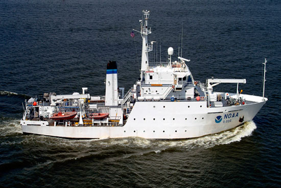

The THOMAS JEFFERSON is one of a fleet of research and survey vessels used by NOAA to improve our understanding of the marine environment. The ship is home ported in Norfolk, Virginia, and primarily operates along the Atlantic and Gulf coasts, including Puerto Rico and the U.S. Virgin Islands. The primary mission of the THOMAS JEFFERSON is to conduct hydrographic surveys for updating NOAA’s nautical charts. The THOMAS JEFFERSON continues the work of its predecessor, the WHITING.
Hydrographic surveys used for nautical charting include thousands of systematic depth measurements, as well as positions of wrecks or obstructions in navigable waters. These data are acquired by THOMAS JEFFERSON and its two survey launches equipped with specialized echo sounders, multibeam sonars, and side-scan sonars. Data acquisition and processing relies heavily on state-of-the-art computers, specialized software, and highly skilled ship personnel. Commercial shipping relies on accurate nautical charts for the safe transportation of goods such as petroleum, coal, steel, automobiles, grain, and containerized cargo.
| Visitor Information | Ship Specifications | |
|---|---|---|
|
General Information
|
All Ship Specifications
|
THOMAS JEFFERSON's E-mail address is:
Noaa.Ship.Thomas.Jefferson@noaa.gov
THOMAS JEFFERSON's Mail address is:
NOAA Ship THOMAS JEFFERSON
Marine Operations Center, Atlantic
439 York Street
Norfolk, VA 23510-1145
THOMAS JEFFERSON's Telephone Numbers
• Return to Marine Operations Home Page
• Inquires and Comments
• URL: http://www.moc.noaa.gov/tj/index.html
• Updated: Sep 02, 2005