Oculina / Gag-Grouper Survey
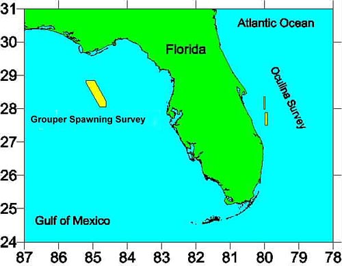

The Oculina / Gag-Grouper Survey is conducted by the Oregon II off the east and west coasts of Florida in February and March. Submersible ROVs are utilized to examine existing and artificially transplanted Oculina coral modules for growth, survival, and abundance of fish. Side-scan sonar and ship mounted acoustics are used to map the bathymetry of the survey areas. Fish Trap and Camera Deployments and hook and line fishing are used to obtain samples of the fish aggregations on various bottom features. CTD casts are conducted to obtain environmental characteristics of the varying fish habitat, while sediment grabs obtain bottom samples for examination ashore.
Return to Oregon II's Home Page
Return to Marine Operations Home Page
Inquires and Comments
URL: http://www.moc.noaa.gov/ot/oculina.htm
Updated: March 29, 2000