Examining Hurricane Frances' Cloud Structure
|
The MODIS instrument on Terra captures great details in the beautiful clouds surrounding Hurricane Frances.
|
|
|
|
Viewing the clouds structure of Hurricane Frances.
Duration: 1.2 minutes
Available formats:
1280x720 (29.97 fps)
Frames
720x486 (29.97 fps)
Frames
640x480 (29.97 fps)
MPEG-1
31 MB
720x480 (29.97 fps)
MPEG-2
48 MB
352x240 (29.97 fps)
MPEG-1
16 MB
320x240
JPEG
10 KB
320x218
JPEG
8 KB
How to play our movies
|
|

|
|
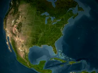
This and the following images show the high detail that the Terra Satellite sensor MODIS can acquire.
Available formats:
2560 x 1920
TIFF
6 MB
160 x 80
PNG
23 KB
320 x 240
JPEG
11 KB
80 x 40
PNG
6 KB
|
|
|
|
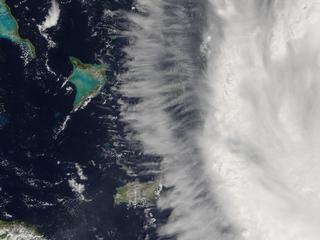
Eventhough Frances is a hurricane, Terra-MODIS views the calm before the storm. Crooked and Acklins Islands are seen on the edge of the outer band.
Available formats:
2560 x 1920
TIFF
5 MB
320 x 240
JPEG
11 KB
|
|
|
|
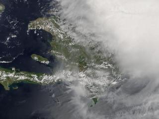
Haiti and the Dominican Republic are engulfed by Hurricane Frances.
Available formats:
2560 x 1920
TIFF
6 MB
320 x 240
JPEG
11 KB
|
|
|
|
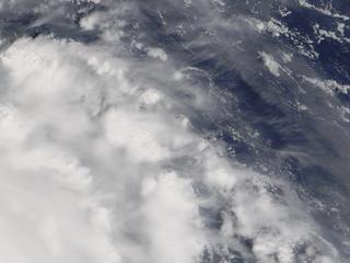
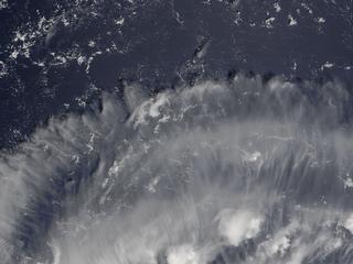
Scientist are able to view the detail in the cloud formation of Hurricane Frances. Using this and other data the scientist will understand what makes hurricanes tick.
Available formats:
2560 x 1920
TIFF
5 MB
320 x 240
JPEG
10 KB
80 x 40
PNG
6 KB
|
|
|
|
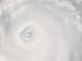
Terra-MODIS can look down the funnel Eye of Hurricane Frances.
Available formats:
2560 x 1920
TIFF
3 MB
320 x 240
JPEG
3 KB
|
|
|
Back to Top
|

