Canadian Smoke Invades the East Coast
|
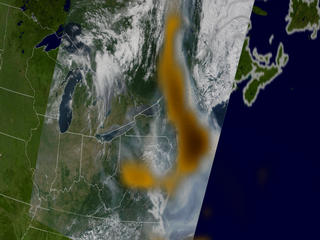
Smoke from multiple large wildfires in Canada blanketed the Great Lakes and eastern United States. The enormous smoke plume was almost 200 miles wide. The thick pall affected air quality from New York, to Baltimore, and Washington, D.C. and blocked the sunlight cooling the East Coast. The first image was taken by the Moderate Resolution Imaging Spectroradiometer (MODIS) on the Terra satellite on July 7, 2002. The second image comes from NASA's Total Ozone Mapping Spectrometer (TOMS) on the Earth Probe Satellite.
|
|
|
|
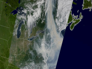
Canadian Smoke from July 7th, 2002.
Duration: 4.0 seconds
Available formats:
1280x720 (30 fps)
Frames
720x480 (29.97 fps)
MPEG-2
3 MB
720x480 (29.97 fps)
MPEG-1
1 MB
320x240 (29.97 fps)
MPEG-1
680 KB
320x179
JPEG
9 KB
320x202
JPEG
9 KB
How to play our movies
|
|
|
|
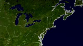
The East Coast of the United States. Blue Marble data set with state lines and country boundaries.
Available formats:
960 x 720
TIFF
1 MB
160 x 80
PNG
20 KB
320 x 240
JPEG
13 KB
80 x 40
PNG
5 KB
|
|

|
|
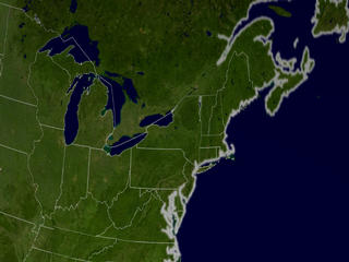
Terra-MODIS dataset from July 7th, 2002. Data is co-registered to the Blue Marble dataset.
Available formats:
960 x 720
TIFF
1 MB
320 x 240
JPEG
14 KB
|
|
|
|
TOMS Aerosals dataset from July 7th, 2002, overlaid the Terra-MODIS dataset.
Available formats:
960 x 720
TIFF
1 MB
320 x 240
JPEG
15 KB
|
|
|
Back to Top
|

