Salt Lake City, Utah Area Flyover during Fall (NASM2002)
|
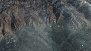
Landsat 7 imagery is combined here with terrain elevation data to create a view of the Salt Lake City area. This image was taken in the Fall of 2001 and can be compared to identical animations using images taken at other times of the year. This visualization was created for the NASM2002 presentation and is based on a earlier visualizations created for the 2002 Winter Olympics in Salt Lake City.
|
|
|
|
Fall 2001 Flyover of Salt Lake City, Utah
Duration: 1.3 minutes
Available formats:
1280x720 (60 fps)
Frames
1280x720 (60 fps)
Frames
1280x720 (60 fps)
MPEG-2
169 MB
352x240 (30 fps)
MPEG-1
10 MB
320x218
JPEG
11 KB
720x480 (29.97 fps)
DV
299 MB
How to play our movies
|
|

|
|
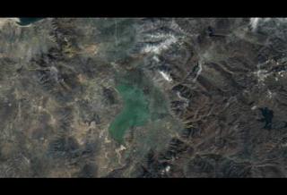
Fall 2001 in the Provo, Utah area
Available formats:
1280 x 720
TIFF
1 MB
160 x 80
PNG
27 KB
320 x 180
JPEG
10 KB
80 x 40
PNG
7 KB
|
|

|
|
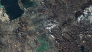
Fall 2001 in the southern Salt Lake City, Utah area
Available formats:
1280 x 720
TIFF
1 MB
320 x 180
JPEG
10 KB
|
|
|
|
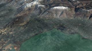
Fall 2001 in the Salt Lake City, Utah area
Available formats:
1280 x 720
TIFF
1 MB
320 x 180
JPEG
11 KB
|
|
|
|
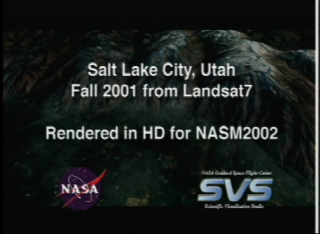
Slate image from video tape reads, 'Salt Lake City, Utah. Fall 2001 from Landsat 7. Rendered in HD for NASM 2002.'
Available formats:
720 x 528
JPEG
109 KB
320 x 234
PNG
344 KB
|
| Animation Number: | 2556 |
| Animators: | Greg Shirah (SVS) (Lead) |
| | James W. Williams (SVS) |
| | Marte Newcombe (SVS) |
| Completed: | 2002-07-18 |
| Scientist: | Darrel Williams (NASA/GSFC) |
| Instrument: | Landsat-7/ETM+ |
| Data set: | USGS/DEM |
| Data Collected: | Landsat-7: 2001/10/19 |
| Series: | NASM2002 |
| Video: | SVS2002-0031 * |
| Goddard TV Tape: | G2008-041HD -- NASAs Landsat in HD 2008 Resource Tape |
Keywords:
SVS
>> HDTV
DLESE
>> Physical geography
SVS
>> Seasons
|
|
Please give credit for this item to
NASA/Goddard Space Flight Center
Scientific Visualization Studio |
*Please note: the SVS does not fulfill requests for copies of the tapes in our library. On some of our animation pages, there is a direct link to a video distribution service from which tapes, handled by the Public Affairs Office (PAO)/Goddard TV, including some of our animations may be ordered. General information on this service can be found here. |
|
Back to Top
|

