|
|
 |
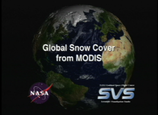
Global Snow Cover from MODIS
|
The Moderate Resolution Imaging Spectroradiometer (MODIS) provides data in 36 spectral bands, some of which are used in an algorithm to map global snow cover. The animation shows the dynamic behavior of the advance and retreat of continental snow cover in the Northern Hemisphere for the winter of 2001 - 2002 from MODIS-derived 8-day composite snow maps with a spatial resolution of about 5 km. A time series of MODIS snow-cover maps of the Sierra Nevada Mountains in California, derived from MODIS-derived daily snow maps with 500-m resolution, is also shown for the winter and spring of 2001.
|
|

|
|
This animation shows the dynamic behavior of the advance and retreat of continental snow cover in the Northern Hemisphere for the winter of 2001-02.
Duration: 1.8 minutes
Available formats:
720x486 (29.97 fps)
Frames
1280x720 (29.97 fps)
Frames
1280x720 (30 fps)
MPEG-2
240 MB
720x480 (29.97 fps)
MPEG-1
44 MB
512x288 (29.97 fps)
MPEG-1
39 MB
320x240
PNG
57 KB
80x40
PNG
6 KB
160x80
PNG
17 KB
720x480 (29.97 fps)
MPEG-2
77 MB
720x480 (29.97 fps)
DV
411 MB
How to play our movies
|
|

|
|
This image shows global snow cover over the Northern Hemisphere during the winter of 2001-02.
Available formats:
2880 x 1924
PNG
11 MB
320 x 213
PNG
148 KB
160 x 80
PNG
30 KB
80 x 40
PNG
8 KB
|
|
|
|
None
Available formats:
720 x 528
JPEG
94 KB
320 x 234
PNG
319 KB
|
| Animation Number: | 2484 |
| Animator: | Cindy Starr (SVS) (Lead) |
| Completed: | 2002-06-26 |
| Scientist: | Dorothy Hall (NASA/GSFC) |
| Instrument: | Terra/MODIS |
| Data sets: | Blue Marble Clouds
|
| | Blue Marble landcover |
| | MODIS/Terra Snow Cover 8-day composite L3 Global 0.05Deg CMG (MOD10C2) |
| Data Collected: | 10/16/2001 to 04/23/2002 |
| Video: | SVS2002-0025 * |
| Goddard TV Tape: | G2007-002HD -- NASA’s HD Blue Marble Resource Tape |
Keywords:
DLESE
>> Cryology
SVS
>> HDTV
SVS
>> Snow
|
|
Please give credit for this item to
NASA/Goddard Space Flight Center
Scientific Visualization Studio. Snow Data Preparation was done by The MODIS Snow and Ice Team, Janet Y. L. Chien. Blue Marble data courtesy of Reto Stockli.
Technical Assistance from the following SVS team members: Randall Jones, Kevin Mahoney, Marte Newcombe, Tom Bridgman, Lori Perkins, Gregory Shirah, Eric Sokolowsky, James Williams. |
*Please note: the SVS does not fulfill requests for copies of the tapes in our library. On some of our animation pages, there is a direct link to a video distribution service from which tapes, handled by the Public Affairs Office (PAO)/Goddard TV, including some of our animations may be ordered. General information on this service can be found here. |
|
Back to Top
|
|
|
|

