THEMIS and the March 2007 Substorm
|
NASA's Time History of Events and Macroscale Interactions during Substorms (THEMIS) mission observed the dynamics of a rapidly developing substorm in March of 2007. This visualization combines the orbits of the THEMIS satellites with a magnetohydrodynamical simulation of the Earth's magnetosphere corresponding to this time.
|
|

|
|
Opening with a view over the North geographic pole, we see the five THEMIS satellites moving along their common orbit. The camera then moves down into the equatorial plane and behind the Earth before we fade in the isosurface enclosing the regions where particles have at least 5keV of energy.
Duration: 18.0 seconds
Available formats:
512x288 (30 fps)
MPEG-1
4 MB
1280x720 (30 fps)
MPEG-2
19 MB
640x360 (30 fps)
MPEG-4
3 MB
1280x720 (30 fps)
MPEG-4
42 MB
1920x1080 (30 fps)
MPEG-4
74 MB
1280x720 (30 fps)
Frames
1920x1080 (30 fps)
Frames
320x180
PNG
223 KB
How to play our movies
|
|
|
|
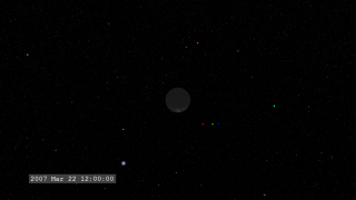
A view of the five THEMIS satellites (the color dots) from a location above the north geographic pole.
Available formats:
2560 x 1440
TIFF
2 MB
320 x 180
PNG
217 KB
|
|
|
|
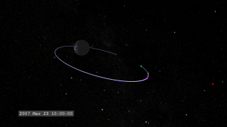
The camera moves down near the equatorial plane presenting a side view of the satellites in their orbits.
Available formats:
2560 x 1440
TIFF
3 MB
320 x 180
PNG
251 KB
|
|
|
|
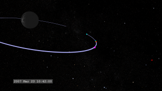
Zooming in on the location of the satellites...
Available formats:
2560 x 1440
TIFF
3 MB
320 x 180
PNG
255 KB
|
|
|
|
we move to a location behind the Earth.
Available formats:
2560 x 1440
TIFF
3 MB
320 x 180
PNG
268 KB
|
|
|
|
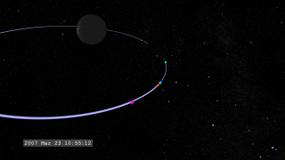
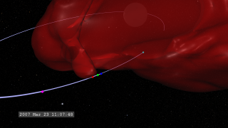
Red isosurfaces fade in, representing the boundary of regions where electron temperature (AKA mean energy) exceeds 5 kilo-electron volts.
Available formats:
2560 x 1440
TIFF
2 MB
320 x 180
PNG
250 KB
|
|
|
|
The boundaries of the high-energy electrons engulf the THEMIS satellites.
Available formats:
2560 x 1440
TIFF
2 MB
320 x 180
PNG
246 KB
|
|
|
|
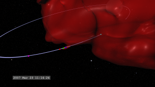
Energetic electrons continue to flow around the satellites.
Available formats:
2560 x 1440
TIFF
2 MB
320 x 180
PNG
249 KB
|
|
|
|
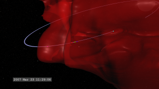
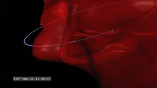
The substorm begins to subside around 11:30UTC.
Available formats:
2560 x 1440
TIFF
2 MB
320 x 180
PNG
250 KB
160 x 80
PNG
58 KB
80 x 40
PNG
15 KB
|
|
|
Back to Top
|

