CloudSat, Calipso and MODIS over Central America
|
Associated with tropical thunderstorms are broad fields of cirrus clouds that flow out of the tops of the vigorous storm systems that form over warm tropical oceans. These clouds play a role in how much infrared energy is trapped in Earth's atmosphere. NASA's Tropical Composition, Cloud and Climate Coupling (TC4) mission, which runs from July 16, 2007 through August 8, 2007, aims to document the full lifecycle of these clouds. Observations from four A-Train satellites flying in formation will complement the aircraft measurements with large-scale views of many different features of the atmosphere. Observations from this mission along with previous studies will improve our understanding of what effect a warming climate with rising ocean temperatures will have on these cloud systems. These images over Central America, produced in support of the TC4 mission, show a tropical storm system over Central and South America on August 2, 2006 as measured from multiple satellite sensors, including Aqua MODIS, CloudSat and CALIPSO. In this view from the Pacific Ocean, Panama is on the left and South America is shown on the right. In the following series of still images, each satellite's measurement is shown individually and in combination with the others from the same camera viewpoint. The profile showing CloudSat and CALIPSO data is truncated at a height of twenty kilometers and exaggerated ten times. The land topography is also exaggerated by a factor of ten.
|
|
|
|
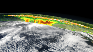
Both CloudSat and CALIPSO detect attributes of clouds on slices through the atmosphere. Here both are shown over an image of MODIS reflectance which is mapped onto the terrain.
Available formats:
2560 x 1440
TIFF
4 MB
320 x 180
PNG
234 KB
160 x 80
PNG
55 KB
80 x 40
PNG
14 KB
|
|
|
|
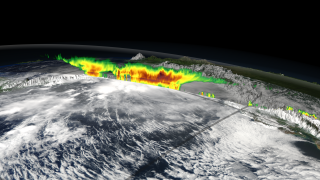
The curtain of CloudSat data is shown above an image of MODIS reflectance which is mapped onto the terrain.
Available formats:
2560 x 1440
TIFF
3 MB
320 x 180
PNG
229 KB
|
|
|
|
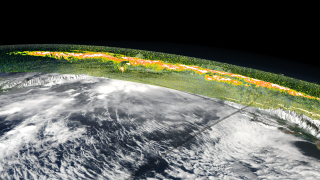
The curtain of CALIPSO data is shown above an image of MODIS reflectance which is mapped onto the terrain.
Available formats:
2560 x 1440
TIFF
5 MB
320 x 180
PNG
234 KB
|
|
|
|
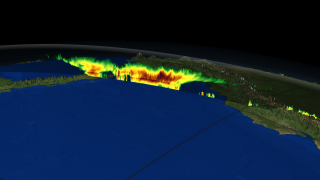
The curtain of both CloudSat and CALIPSO data is shown over Central and South America.
Available formats:
2560 x 1440
TIFF
3 MB
320 x 180
PNG
189 KB
|
|
|
|
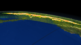
The curtain of CloudSat is shown over Central and South America.
Available formats:
2560 x 1440
TIFF
2 MB
320 x 180
PNG
180 KB
|
|
|
|
The curtain of CALIPSO is shown over Central and South America.
Available formats:
2560 x 1440
TIFF
3 MB
320 x 180
PNG
189 KB
|
|

|
|
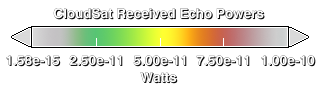
Color bar for CloudSat data in the images above.
Available formats:
320 x 90
PNG
16 KB
|
|

|
|
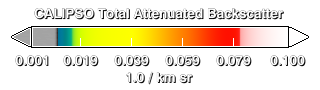
Color bar for Calipso data in the images above.
Available formats:
320 x 90
PNG
15 KB
|
|
|
|
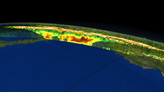
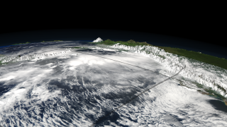
MODIS reflectance is shown overlayed on the topography.
Available formats:
2560 x 1440
TIFF
3 MB
320 x 180
PNG
227 KB
|
|
|
Back to Top
|

