|
Using Maps to Evaluate Environmental Tradeoffs
These pages contain instructions and materials for an exercise in which you (or your students, if you're an instructor) plan a protection strategy for a coastline threatened by an oil spill--just as responders to a real-life spill must do. You can follow these instructions yourself, or use them to present the exercise to a class.
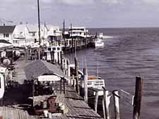
When a shoreline is threatened by an approaching oil spill, responders must quickly decide which locations along a shoreline to protect from the spill. That is, they must set their protection priorities. To do this, they first identify the places that are most important to protect, then determine which of those locations they can protect, given the resources available to them. Making these decisions sometimes requires difficult tradeoffs.
In this exercise, you present an oil spill scenario in which winds and currents are moving an oil slick towards a section of the shoreline of Delaware Bay. Your students, working in teams, (or you yourself) then use an Environmental Sensitivity Index map to identify the sensitive locations along the threatened coastline that are especially vulnerable to damage from oiling. They'll then set their protection priorities--that is, they'll decide which of those areas they can protect, and how they can do it.
The exercise is appropriate either for middle school and high school students or for adult audiences. You can download all the materials you'll need to plan and lead this exercise from these pages. Find out more about the exercise by clicking on the Map Intro link.
For More Information
|
|
|
- Training Exercise Training module for ESI users. The manual and associated training materials will help spill responders and planners learn to use ESI data in multiple formats.
|
|
|
|
|
|