
home » about nssl » research divisions » radar r&d » doppler radar & remote sensing
Polarimetric Doppler Radar
HOW DO POLARIMETRIC RADARS WORK?
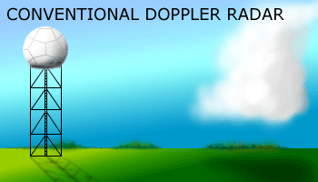
Radars send out short bursts of radio waves called pulses. The pulses bounce off particles in the atmosphere and the energy is reflected back to the radar dish. A computer processes the returned signals and, through algorithms, can make conclusions about what kinds of particles it "saw," including the directions they are moving (the Doppler effect), and the speed of their movement. The WSR-88D radar transmits horizontal pulses, which give a measure of the horizontal dimension of the cloud (cloud water and cloud ice) and precipitation (snow, ice pellets, hail and rain particles).
 Polarimetric radars,
also called dual-polarization radars, transmit radio wave pulses that have
both horizontal and vertical orientations. The additional information from
vertical pulses will greatly improve many different types of forecasts and
warnings for hazardous weather. NSSL's KOUN research radar also has the ability
to transmit the horizontal and vertical pulses at the same time, using a
"simultaneous transmission scheme," (most
research polarimetric radars use an alternate horizontal/vertical transmission
scheme). This reduces the time it takes to scan an area.
Polarimetric radars,
also called dual-polarization radars, transmit radio wave pulses that have
both horizontal and vertical orientations. The additional information from
vertical pulses will greatly improve many different types of forecasts and
warnings for hazardous weather. NSSL's KOUN research radar also has the ability
to transmit the horizontal and vertical pulses at the same time, using a
"simultaneous transmission scheme," (most
research polarimetric radars use an alternate horizontal/vertical transmission
scheme). This reduces the time it takes to scan an area.
WHAT VARIABLES ARE MEASURED?
- Differential Reflectivity – The differential reflectivity is a ratio of the reflected horizontal and vertical power returns. Among other things, it is a good indicator of drop shape. In turn the shape is a good estimate of average drop size.
- Correlation Coefficient – A statistical correlation between the reflected horizontal and vertical power returns. It is a good indicator of regions where there is a mixture of precipitation types, such as rain and snow.
- Linear Depolarization Ratio – This is a ratio of a vertical power return from a horizontal pulse or a horizontal power return from a vertical pulse. It, too, is a good indicator of regions where mixtures of precipitation types occur.
- Specific Differential Phase – The specific differential phase is a comparison of the returned phase difference between the horizontal and vertical pulses. This phase difference is caused by the difference in the number of wave cycles (or wavelengths) along the propagation path for horizontal and vertically polarized waves. It should not be confused with the Doppler frequency shift, which is caused by the motion of the cloud and precipitation particles. Unlike the differential reflectivity, correlation coefficient and linear depolarization ratio, which are all dependent on reflected power, the specific differential phase is a "propagation effect." It is a very good estimator of rain rate.
- Cross-polar terms – other variables yet to be explored!
WHAT DID WE LEARN FROM JPOLE?
NSSL conducted the Joint Polarization EXperiment (JPOLE) during 2002-2003 to demonstrate the operational capabilities of the polarimetric KOUN. During JPOLE, data were delivered in "real-time" to the NWS and other users with NSSL scientists aiding in the interpretation of data. The KOUN data archive from JPOLE contained an unprecedented collection of exceptional quality polarimetric measurements of 98 events containing meteorological and non-meteorological data.
Polarimetric radar data provided numerous benefits to Norman, OK WFO forecasters during JPOLE. Radar depiction of features such as hail cores, tornadic debris, and heavy rain cores, which are much smaller than the overall storm scale, made it easier for forecasters to understand the immediate weather situation. Identification of these very small-scale signatures associated with dangerous weather enabled forecasters to issue more timely and more focused warnings, statements, and graphical guidance for these events with a higher level of confidence than ever before.
JPOLE proved that significant improvements in data quality, rainfall estimation, hail detection and rain/snow discrimination could be gained by using polarized radar.
