|
|
projects > groundwater cooperative data program
Groundwater Cooperative Data Program
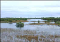
IntroductionThe Water Resources Division of the U.S. Geological Survey, in cooperation with State, County, and other Federal agencies, obtains a large amount of data pertaining to the water resources of Florida each water year. These data, accumulated during many water years, constitute a valuable data base for developing an improved understanding of the water resources of the State. To make these data readily available to interested parties outside the Geological Survey, the data are published annually in this report series entitled "Water Resources Data - Florida, Volume 2A: South Florida Surface Water and Volume 2B: South Florida Ground Water." (You can download introductory text for both the Surface Water (PDF, 567 Kb) and the Groundwater (PDF, 631 Kb) reports for the 1999 Water Year. You will need the free Adobe Acrobat Reader to view these files.) This report series includes records of stage, discharge, ground-water levels, and water quality of streams, and stage, contents, and water quality of lakes, and ground-water wells. The data for south Florida include continuous or daily discharge for 75 streams, continuous or daily stage for 121 streams (includes stage published at discharge and stage only sites), continuous elevations for 1 lake; continuous ground-water levels for 210 wells, periodic ground-water levels for 215 wells; quality-of-water data for 25 surface-water sites and 117 wells. Ground-Water Monitoring NetworkDuring the 1999 water year (October 1, 1998 to September 30, 1999), the Miami Subdistrict monitored 455 wells in southern Florida to assess regional ground-water conditions. The wells penetrate the Biscayne aquifer in Dade and Broward Counties (201 wells) and the surficial aquifer system in Palm Beach, St. Lucie, and Martin Counties (36 wells). In southwestern Florida, the principal aquifers are the surficial aquifer system (water-table aquifer) (70 wells), lower Tamiami aquifer (42 wells), sandstone aquifer (37), mid-Hawthorn aquifer (37 wells), lower Hawthorn aquifer (also called the lower Hawthorn producing zone) (25 wells), and the Floridan aquifer system (7 wells). Stratigraphic units included in these aquifers are shown in figures 3 and 4. In Dade and Broward Counties, the Biscayne aquifer is the upper part of the surficial aquifer system, but mainly consists of the Miami Limestone (not shown in the cross sections due to the fact it is not present in those locations) and Fort Thompson Formation. PublicationsAbstracts
Water Data Reports
Related Links |
U.S. Department of the Interior, U.S. Geological Survey
This page is: http://sofia.usgs.gov/projects/index.php?project_url=gw_coop
Comments and suggestions? Contact: Heather Henkel - Webmaster
Last updated: 26 August 2008 @ 11:30 AM (BJM)