Special Interest
WRF Model Training
In response to the implementation of the new NAM WRF at NCEP on June 20, 2006, COMET provided a training series to help forecasters better understand the new model and its use.
- For training on using the WRF in the forecast process, see the new module, Using the WRF Mesoscale Model. This module uses two cases in southwest Asia, where the AFWA implementation of WRF is currently in use, to examine improvements offered by the WRF for forecasting fronts, topographic impacts, precipitation type, and hazards to aviation.
- On June 12, 2006 COMET made available two versions of The NCEP NAM WRF Model Webcast, which explains the nuts and bolts of the WRF numerics, physics, and postprocessed data. The Webcasts emphasize both what will be different and what will remain the same when comparing the NAM WRF with its predecessor, the NAM Eta. A 40-minute Short Version focusses on the most practical information, while the 65-minute Full Version provides more in-depth explanations of model changes.
- In late winter and spring 2007, COMET will be offering a series of teletraining sessions for the NWS and other sponsors. These sessions will discuss the strengths and problem areas of NAM-WRF model forecasts as well as model changes from summer through December 2006. Sign up for these sessions through the VISIT Program Website when the dates have been scheduled.
- In the Operational Models Matrix, we replaced the NAM Eta column with the NAM WRF, providing one-stop quick reference about model components.
- Any questions you have about the NAM WRF prior to or not addressed by this training would be good topics for the NWP Discussion Forum (see below for more on the Forum).
New NWP Discussion Forum
To improve communication among NWS and other meteorologists about NWP models, the GFS and NAM-Eta newsgroups have been replaced by the NWP Discussion Forum. Forum topics will include the GFS/Medium-Range Ensemble Forecasts/ WAVEWATCHIII wave forecast models, and the NAM-Eta to NAM-WRF transition, the NAM-WRF itself, and other mesoscale models based on WRF as they are brought on line (such as Rapid-Refresh WRF, which will eventually replace RUC). We encourage you to join and share your questions and experiences.
Ensembles Models
We've added a new one-stop Ensemble Model Matrix, which provides information on the configurations of the NCEP Short-Range Ensemble Forecast (SREF) and Medium-Range Ensemble Forecast (MREF) systems. Information on ensemble perturbation methods; NWP model resolution, dynamics, physics (precipitation, radiation, land surface and turbulence); and ensemble post-processing and verification links are provided. As the ensemble prediction systems (EPSs) are improved and new EPSs are added to AWIPS, the information in the Ensemble Model Matrix will be updated. The Ensemble Forecasting Explained module and the Introduction to Ensemble Prediction Webcast are also available.
Marine Models
A new Marine Wave Models Matrix now describes several wave models used by forecasters, including how these models forecast the generation, propagation, and dissipation of ocean waves, and the products they provide.
New Material Available
A streaming lecture by J. Sun on Assimilation of Radar Data into NWP Models.
Outreach Program Projects
The NWS funded a COMET Outreach project involving the State University of New York—Stony Brook, the forecast offices in Upton, NY, Mt. Holly, NJ, Taunton, MA, and the Northeast River Forecast Center. The final report, Application of numerical model verification and ensemble techniques to improve operational weather forecasting, describes their use of the MM5 and WRF models to create an ensemble system for the Northeast U.S.
Another Outreach Project—Improving the gridded forecast process using statistically post-processed model guidance based on high-density mesonet observations—involved the University of Utah and the NWS offices in
Boise, Grand Junction, Pocatello, Riverton, Salt Lake City. A paper that resulted from this project has been published in Weather and Forecasting. The title is "Strengths and Weaknesses of MOS, Running-Mean Bias Removal, and Kalman Filter Techniques for Improving Model Forecasts over the Western United States."
|
Materials: Courses | Modules | Case Studies | Translated Modules
Distance Learning Courses
| |
Course Title and Link |
| |
Numerical Weather Prediction Distance Learning Course
description (click to show/hide) |
 Description: Description:
Forecasters must have an understanding of the general methodology of numerical weather prediction in order to develop realistic expectations for guidance produced by operational models. This series of Web-based modules explains how numerical models are designed and implemented, and will help forecasters interpret model guidance through an understanding of model constraints and features. The course will also be valuable for upper-division and graduate meteorology students wanting a deeper understanding of how atmospheric processes are modeled. The course contains six modules and will take approximately 16-20 hours to complete. Individual modules will take from 1 to 4 hours. A final exam helps you gauge your learning.
Estimated time to complete: 16-20 h
close
|
Modules
content level: 0=for non-scientists, 1=basic, 2=intermediate, 3=advanced
| Level |
Module Title and Link |
Quiz Link |

|
Advances in Microwave Remote Sensing: Ocean Wind Speed and Direction
description (click to show/hide) |
Quiz
|
 Description: Description:
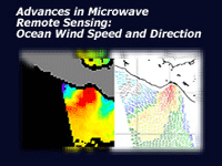
This Webcast covers the ocean surface wind retrieval process, the basics of microwave polarization as it relates to wind retrievals, and several operational examples. Information on the development of microwave sensors used to retrieve ocean surface wind speed and the ocean surface wind vector (speed and direction) is also included.
Objectives:
State some key meteorological applications for ocean surface winds
• Describe the benefits of using microwave remote sensing to observe ocean winds
• Describe the differences between active and passive microwave remote sensing
• Describe in general terms, the emission, transmission, and scattering of microwave energy within the Earth-atmosphere system
• State the key assumptions for derivation of wind speed and direction from passive observation of microwave radiation
• Describe the limitations of passive microwave remote sensing and impacts on deriving wind speed and direction (this applies to both product limits and accuracy)
• Use cloud liquid water imagery to help assess the validity of the wind speed and direction vector
Estimated time to complete: 45 min
Includes audio: yes
Required plug-ins:  Flash Flash  RealPlayer RealPlayer  Java Java  Adobe® Reader® Adobe® Reader®
* Plug-in information
Last published on: 2005-11-28
close
|

|
Ensemble Forecasting Explained
description (click to show/hide) |
Quiz
|
 Description: Description:
This module, the latest in our series on Numerical Weather Prediction, covers the theory and use of ensemble prediction systems (EPSs). The module will help forecasters develop an understanding of the basis for EPSs, the skills to interpret ensemble products, and strategies for their use in the forecast process. It contains six sections: an Introduction that briefly presents background theory; Generation, which describes how ensemble systems are constructed; Statistical Concepts, which provides a brief refresher on knowledge required for ensemble product interpretation; Summarizing Data, which describes common ensemble forecast products; Verification, which discusses how EPSs performance is assessed and documented; and Case Applications, which provides links to a number of forecast cases illustrating the use of EPSs in the forecast process. Questions and Exercises are offered throughout to help you test your learning and provide practical examples. The module also includes a pre-assessment and module final quiz.
Objectives:
Explain the basis for NWP ensemble prediction, and what we mean when we say that the atmosphere is chaotic (i.e. sensitive to initial conditions).
Describe the variety of methods used to generate the ensemble members of an ensemble prediction system, including perturbation of initial conditions, boundary conditions, and model configurations.
Understand the basic statistical concepts and methods used in the development of ensemble products, including probability distributions and their middleness, variability, and shape characteristics.
Recognize and interpret the variety of ensemble forecast products, including spatial and point forecast graphics, and including those that account for flow regimes (RMOP) and reveal NWP model bias and errors.
Interpret ensemble verification products, and apply them in using ensemble forecasts.
Estimated time to complete: 4-5 h
Includes audio: no
Required plug-ins:  Flash Flash  RealPlayer RealPlayer  Java Java  Adobe® Reader® Adobe® Reader®
* Plug-in information
Last published on: 2004-09-27
close
|

|
Ensemble Prediction System Matrix: Characteristics of Operational Ensemble Prediction Systems (EPS)
description (click to show/hide) |
No Quiz
|
 Description: Description:
This one-stop Ensemble Model Matrix provides information on the configurations of the NCEP Short-Range Ensemble Forecast (SREF) and Medium-Range Ensemble Forecast (MREF) systems. Information on ensemble perturbation methods; NWP model resolution, dynamics, physics (precipitation, radiation, land surface and turbulence); and ensemble post-processing and verification links are provided. As the ensemble prediction systems (EPSs) are improved, the information in the Ensemble Model Matrix will be updated. Additionally, as new EPSs are added to AWIPS, we will add new columns to the Ensemble Model Matrix.
Estimated time to complete:
Includes audio: no
Required plug-ins:  Flash Flash  RealPlayer RealPlayer  Java Java  Adobe® Reader® Adobe® Reader®
* Plug-in information
Last published on: 2006-04-05
close
|

|
Forecasting Dust Storms
description (click to show/hide) |
Quiz
|
 Description: Description:
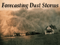
Forecasting Dust Storms is the latest module in the Mesoscale Meteorology Primer. The module starts by discussing the conditions required for a dust storm, including an appropriate source of dust, sufficient wind and turbulence, and an unstable atmosphere. The module then explores the fate of dust in the atmosphere including dispersion, advection, and settling. The concluding section on forecasting examines a case in the Middle East and demonstrates the use of a mesoscale NWP model, as well as next-generation dust forecasting models.
Objectives:
After completing this module, the learner should be able to do the following things:
With regard to dust storm characteristics:
• Describe how visibility varies near severe dust storms
• Recall the average height of dust storms
With regard to sources of dust:
• Describe the soil types in appropriate source regions for dust storms
• Recall that blowing dust usually does not occur for at least 24 hours after a rainfall
• Identify potential source regions with satellite imagery
With regard to atmospheric conditions required for dust storms:
• Recall the threshold wind speed for lifting fine dust particles.
• Describe the atmospheric conditions that promote lofting of dust in terms of stability and turbulence
• List the 3 ways that turbulence typically arises in the atmosphere
• Describe the effect of nightfall on dust storms
With regard to the dissipation and dispersion of dust storms:
• Describe the atmospheric factors that influence the dispersion of dust
• Describe the effect of precipitation on suspended dust and why this occurs
• Recall how quickly dust settles once winds die down
With regard to the climatology of dust storms:
• List the most common synoptic patterns for raising dust in the Middle East
• Define Shamal
• List at least 3 mesoscale weather phenomena that result in dust storms
• Describe how haboobs and dust devils originate
• Describe how winter dust storms differ from summer dust storms
With regard to the satellite detection of blowing dust:
• Describe how dust appears on IR images, during both day and night and over both land and water
• Describe how dust appears on visible images, during both day and night and over both land and water
• Describe the advantages of imagery from polar orbiting and geostationary satellites
• With regard to forecasting dust storms:
• List the tools available for observing dust storms.
• Describe how mesoscale NWP models can help with a dust storm prediciton
• List the dust storm forecasting models and describe their respective advantages
Estimated time to complete: 2 h
Includes audio: yes
Required plug-ins:  Flash Flash  RealPlayer RealPlayer  Java Java  Adobe® Reader® Adobe® Reader®
* Plug-in information
Last published on: 2003-10-23
close
|

|
Freezing and Melting, Precipitation Type, and Numerical Weather Prediction
description (click to show/hide) |
Quiz
|
 Description: Description:
This Webcast is based on a COMET classroom presentation by Dr. Gary Lackmann at the 2nd MSC Winter Weather Course held in Boulder, Colorado on 22 February 2002. Dr. Lackmann reviews the basic thermodynamics of freezing and melting and how operational models represent these processes. He also touches upon the biases that occur in the models by looking at examples of melting snow aloft, melting snow at the surface, freezing aloft (ice pellets), and freezing rain. Dr. Lackmann is a faculty member in the Department of Marine, Earth, and Atmospheric Sciences at North Carolina State University.
Objectives:
1. Examine four thermodynamic scenarios closely, each of which produces a different precipitation situation.
2. Compare sounding, radar, and model signatures associated with these scenarios.
3. Compare the representation of these thermodynamic processes in operational models at and near the surface.
4. Become aware of potential problems with the model forecasts.
5. Examine the limiting processes and requirements for freezing rain.
Estimated time to complete: 35 min
Includes audio: yes
Required plug-ins:  Flash Flash  RealPlayer RealPlayer  Java Java  Adobe® Reader® Adobe® Reader®
* Plug-in information
Last published on: 2002-07-03
close
|

|
How Mesoscale Models Work
description (click to show/hide) |
Quiz
|
 Description: Description:
The goal of this training module is to help you increase your understanding of how mesoscale models work. Such understanding, in turn, can help you more efficiently and accurately evaluate model-generated forecast products.
Objectives:
Terminal Objectives
By the end of this module you will be able to do the following:
1. Describe how mesoscale models work
2. Evaluate the strengths and weaknesses of different NWP models
Enabling Objectives
By the end of this module you will be able to do the following:
1. Describe the benefits and limitations of mesoscale NWP models.
2. Describe the relationship between grid spacing and model resolution for NWP models.
3. Describe the pros and cons of increasing model resolution
4. Describe hydrostatic balance and how hydrostatic NWP models differ from non-hydrostatic NWP models
5. Define Eta, sigma, and pressure vertical coordinates schemes and describe their respective advantages.
6. Define parameterization and describe the benefits of its use in NWP models
7. List at least 3 processes that are typically parameterized.
8. Describe limited area model (LAM), spin-up, and warm start, and how they are all related.
9. Describe the benefits and limitations of a warm start.
Estimated time to complete: 30 min
Includes audio: yes
Required plug-ins:  Flash Flash  RealPlayer RealPlayer  Java Java  Adobe® Reader® Adobe® Reader®
* Plug-in information
Last published on: 2002-04-22
close
|

|
How Models Produce Precipitation & Clouds
description (click to show/hide) |
Quiz
|
 Description: Description:
Part of the Numerical Weather Prediction Professional Development Series, this module explores how NWP models handle precipitation and cloud processes through parameterizations and/or explicit methods, with an emphasis on how a model's treatment of these processes affects its ability to depict and forecast precipitation and other related forecast variables.
The subject matter expert for this module is Dr. Ralph Petersen of the National Centers for Environmental Prediction, Environmental Modeling Center (NCEP/EMC).
Estimated time to complete: 3-6 h
Includes audio: no
Required plug-ins:  Flash Flash  RealPlayer RealPlayer  Java Java  Adobe® Reader® Adobe® Reader®
* Plug-in information
Last published on: 2000-07-27
close
|

|
Impact of Model Structure & Dynamics
description (click to show/hide) |
Quiz
|
 Description: Description:
Impact of Model Structure & Dynamics, part of the Numerical Weather Prediction Professional Development Series and the NWP Distance Learning Course, provides operationally significant information about model type, horizontal resolution, vertical coordinate systems, vertical resolution, and domain and boundary conditions, with an emphasis on how each aspect can affect a model's ability to depict and forecast weather.
The subject matter expert for this module is Dr. Ralph Petersen of the National Centers for Environmental Prediction, Environmental Modeling Center (NCEP/EMC).
Estimated time to complete: 3-5 h
Includes audio: no
Required plug-ins:  Flash Flash  RealPlayer RealPlayer  Java Java  Adobe® Reader® Adobe® Reader®
* Plug-in information
Last published on: 2000-09-21
close
|

|
Influence of Model Physics on NWP Forecasts
description (click to show/hide) |
Quiz
|
 Description: Description:
This module describes model parameterizations of sub-surface, boundary-layer,and free atmospheric processes, such as surface snow processes, soil characteristics, vegetation, evapotranspiration, PBL processes and parameterizations, and trace gases, and their interaction with the radiative transfer process. It specifically addresses how models treat these physical processes and how they can influence forecasts of sensible weather elements.
Objectives:
Working through the material will help you to
• Develop a basic understanding of how radiation and associated processes are emulated in NWP models
• Understand when model physics are most important to the model forecast (versus model dynamics)
• Understand that model physics are specifically tuned to work best in certain situations and specific models
• Understand that model physics parameterizations affect other parameterizations, model dynamics, and data assimilation, which may result in feedbacks
• Identify impacts of model physics and their errors on model forecasts both at and around the forecast location
• Identify effects that are smaller than the model can emulate (for example, the resolution of surface characteristics is coarse but real effects occur at fine resolution)
Estimated time to complete: 1.5 h
Includes audio: no
Required plug-ins:  Flash Flash  RealPlayer RealPlayer  Java Java  Adobe® Reader® Adobe® Reader®
* Plug-in information
Last published on: 2000-11-17
close
|

|
Intelligent Use of Model-Derived Products
description (click to show/hide) |
Quiz
|
 Description: Description:
This module was developed and released in three sections: Postprocessing/Products, Statistical Guidance, and Assessment Tools. Specific topics covered include the impact of postprocessing and how to account for it, the statistical methods used to enhance raw model output including how statistical guidance products like MOS are generated, as well as NWP verification methodologies and use of daily model diagnostics.
The subject matter expert for this module is Dr. Ralph Petersen of the National Centers for Environmental Prediction, Environmental Modeling Center (NCEP/EMC), and J. Paul Dallavalle of the National Weather Service (NWS), Meteorological Development Laboratory, Statistical Modeling Branch (MDL/SMB). The primary content author was Kirby Cook, NWS, Western Region Headquarters (WRH)/Scientific Services Division (SSD).
Estimated time to complete: 1-2 h
Includes audio: no
Required plug-ins:  Flash Flash  RealPlayer RealPlayer  Java Java  Adobe® Reader® Adobe® Reader®
* Plug-in information
Last published on: 2000-10-02
close
|

|
Introduction to Ensemble Prediction
description (click to show/hide) |
Quiz
|
 Description: Description:
This webcast is a shorter companion to the Ensemble Prediction Explained module, focusing more directly on immediate operational needs. Introductory content includes the role of ensemble forecasts, presentation of basic ensemble forecasting terms, and discussion of how ensemble prediction systems (EPSs) are created. The largest section is focused on common ensemble forecast products, including how they differ from traditional NWP products, how we interpret ensemble forecast products, the advantages and limitations of each product, how EPS products are verified, and how to use ensemble products in conjunction with one another to increase your understanding of forecast uncertainty. Finally, three brief cases from cold and warm seasons illustrate the use of ensemble products in the forecast process.
Objectives:
1. State the benefits of including ensemble model forecasts in the NWP product suite.
2. Define the following terms used in ensemble forecasting:
* Ensemble perturbation
* Ensemble member
* Control forecast
* Perturbation forecast
* Ensemble Prediction System (EPS)
3. Describe three methods commonly used to produce the members of an EPS.
4. Describe how ensemble forecast products differ from traditional NWP products.
5. Interpret ensemble forecast products to determine the probabilistic EPS forecast.
* Interpret spaghetti plots, mean and spread plots, probability of exceedance plots, most likely or dominant event plots, plume diagrams, box and whisker diagrams, and ensemble soundings.
* State advantages and limitations to each of the above products.
6. Use ensemble products in conjunction with one another to increase your understanding of forecast uncertainty.
7. Use ensemble verification products to evaluate the performance of an EPS, including reliability and Talagrand diagrams.
Estimated time to complete: 59 min
Includes audio: yes
Required plug-ins:  Flash Flash  RealPlayer RealPlayer  Java Java  Adobe® Reader® Adobe® Reader®
* Plug-in information
Last published on: 2005-06-27
close
|

|
Marine Wave Model Matrix
description (click to show/hide) |
No Quiz
|
 Description: Description:
The Marine Wave Model Matrix provides information on the formulation of wave models developed by the National Centers for Environmental Prediction (NCEP) and other modeling centers, including how these models forecast the generation, propagation, and dissipation of ocean waves using NWP model forecasts for winds and near-surface temperature and stability. Additionally, information is provided on data assimilation, post-processing of data, and verfication of wave models currently in operation. Within the post-processing pages are links to forecast output both in graphical and raw form, including links for data downloads. Links to COMET training on wave processes are also provided.
Estimated time to complete: 30 min
Includes audio: no
Required plug-ins:  Flash Flash  RealPlayer RealPlayer  Java Java  Adobe® Reader® Adobe® Reader®
* Plug-in information
Last published on: 2006-05-16
close
|

|
Model Fundamentals
description (click to show/hide) |
Quiz
|
 Description: Description:
Model Fundamentals, part of the Numerical Weather Prediction Professional Development Series and the NWP Distance Learning Course, describes the components of an NWP model and how they fit into the forecast development process. It also explores why parameterization of many physical processes is necessary in NWP models.
The module covers background concepts and terminology necessary for learning from the other modules in this series on NWP.
The subject matter expert for this module is Dr. Ralph Petersen of the National Centers for Environmental Prediction, Environmental Modeling Center (NCEP/EMC).
Estimated time to complete: 1 h
Includes audio: no
Required plug-ins:  Flash Flash  RealPlayer RealPlayer  Java Java  Adobe® Reader® Adobe® Reader®
* Plug-in information
Last published on: 1999-06-01
close
|

|
NWP Workshop on WRF and NAEFS
description (click to show/hide) |
Quiz
|
 Description: Description:
The Workshop on the Weather Research and Forecast model and the North American Ensemble Forecast System was given at the regional training center in Pretoria, South Africa in October, 2007, sponsored by NOAA NWS, coordinated by Wassila Thiaw (African Training Desk Coordinator, NCEP), and organized with the assistance of the WMO and South Africa Weather Service (SAWS). The goal of the workshop was to support capacity building efforts on the use of numerical weather prediction (NWP) products in Africa. This Webcast collection offers seven lectures from the workshop, including Introduction to Mesoscale Models (WRF), Introduction to Local Area Modeling (WRF), Statistical Methods in Ensemble Prediction (GEFS/NAEFS, Case Study Model Performance (GEFS/NAEFS), Model Jumpiness (GEFS/NAEFS), Operational Use of Bias-Corrected Products (GEFS/NAEFS), and Africa Case Example (GEFS/NAEFS), presented by lecturers Mr. Eric Altshuler (Institute of Global Environment and Center for Ocean-Land-Atmosphere Studies), Dr. William Bua (UCAR/COMET), and Mr. Richard Grumm (NOAA/NWS).
Objectives:
These lectures are intended for professional meteorologists aspiring to become NWP specialists and for operational weather forecasters who seek to gain understanding and proficiency in the use of ensemble prediction systems (EPS) in operational weather forecasting.
The extensive list of learning objectives included in these material:
For concepts related to NWP model forecast uncertainty and ensemble prediction systems:
• Anticipate the impact of changing initial conditions between forecast cycles.
• State how lagged average forecasts are constructed.
• On a given model product, identify areas where forecast uncertainty is likely highest.
• State how bias correction is performed and its impact on forecast skill.
• Describe the benefits of an ensemble forecast system.
• Describe general qualities of the GFS data assimilation system.
For statistical methods used in producing ensemble prediction system output:
• Define median, mean, mode, standard deviation, quartiles, and deciles .
• Describe the effect of the mean bias.
• Identify indicators of sharpness in forecast distributions.
• Use a contingency table to determine probability of occurrence.
• Distinguish between “reliability” and “resolution.”
For effective use of the WRF local area model:
• State the utility of convective parameterization.
• Define “mesoscale.”
• State what is represented by a grid point forecast.
• State where high vertical resolution is most critical.
• Describe the relative impact of higher horizontal resolution on mesoscale circulations like a sea breeze.
• Describe the relationship between time steps and wave propagation in regard to forecast accuracy.
• Describe how horizontal resolution impacts the ability to use non-hydrostatic dynamics.
• State processes and quantities resolved by microphysics schemes.
• State the reasons for using upper boundary conditions in limited area models.
• Describe benefits of local area models.
• List acceptable data for defining lateral boundary conditions in the WRF.
• Describe how lateral boundary conditions can degrade a WRF EMS forecast.
• Describe the impacts of increasing resolution in regions of strong topography on precipitation forecasts.
• Evaluate the relative impact on forecast accuracy introduced by (a) decreasing time steps, (b) increasing temporal resolution of boundary conditions, (c) increasing spatial resolution of initial conditions, (d) increasing vertical resolution, and (e) increasing spatial resolution of boundary conditions.
Estimated time to complete: 9 h
Includes audio: yes
Required plug-ins:  Flash Flash  RealPlayer RealPlayer  Java Java  Adobe® Reader® Adobe® Reader®
* Plug-in information
Last published on: 2008-10-13
close
|

|
Operational Models Matrix: Characteristics of Operational NWP Models
description (click to show/hide) |
No Quiz
|
 Description: Description:
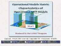
Operational Models Matrix: Characteristics of Operational NWP Models, part of the Numerical Weather Prediction Professional Development Series, contains information about the characteristics and architecture of commonly used operational models, their operationally significant strengths and weaknesses, and model assessment tools. The information is updated whenever significant model changes are made.
The module is linked to the Impact of Model Numerics on Weather Depiction module (also in the NWP PDS), which provides background information about model components.
The subject matter expert for this module is Dr. Ralph Petersen of the National Centers for Environmental Prediction, Environmental Modeling Center (NCEP/EMC).
Estimated time to complete: 3-5 h
Includes audio: no
Required plug-ins:  Flash Flash  RealPlayer RealPlayer  Java Java  Adobe® Reader® Adobe® Reader®
* Plug-in information
Last published on: 2007-10-19
close
|

|
Real-Time Mesoscale Analysis (RTMA): What is the NCEP RTMA and how can it be used?
description (click to show/hide) |
Quiz
|
 Description: Description:
The NCEP Real-Time Mesoscale Analysis (RTMA), provides current conditions in digital form on the NWS National Digital Forecast Database (NDFD) 5-km grid. This product was upgraded in early July 2007 to the point where its use by forecast offices is now encouraged for situational awareness, creating short-term forecast grids, and evaluating recent forecast grids and forecast bias. Unique to the RTMA is an uncertainty or error estimate for some of its analysis parameters. These uncertainty estimates perhaps could be used to determine when a forecast is “good enough”. This Webcast discusses why the RTMA and its parent project, the Analysis of Record, were created, how the RTMA is generated, and its capabilities, limitations, and possible applications. The Webcast includes extensive discussion about how representative individual observations are and how they are handled by the analysis. The topics covered include:
* The context for developing the RTMA and related future developments
* Use of the RTMA in the human forecast process
* The steps in generating RTMA products: forecast, downscaling, observation data sets, quality control, two-dimensional variational analysis (2d-var), “uncertainty” estimates, multisensor precipitation analysis, and GOES Effective Cloud Amount
* Limitations related to how RTMA products are generated
* How an observation affects the 2d-var analysis
* Issues raised by the analysis using accurate observations which are not representative of their surrounding area
* Preliminary performance assessment over complex terrain
* Key changes under development for future RTMA implementations
Objectives:
- Big picture - Understand why RTMA was created and how it fits into the Analysis of Record project
- Be able to apply RTMA in your forecast operations
- Be aware of which data types are used/not-used
- Recognize that a perfect analysis should not exactly fit observations
- Be familiar with what products exist
- Be familiar with how the products are made and therefore understand their capabilities and limitations
- Be aware of how future changes already under development will affect the RTMA product suite
Estimated time to complete: 1 h
Includes audio: yes
Required plug-ins:  Flash Flash  RealPlayer RealPlayer  Java Java  Adobe® Reader® Adobe® Reader®
* Plug-in information
Last published on: 2007-08-14
close
|

|
Ten Common NWP Misconceptions
description (click to show/hide) |
Quiz
|
 Description: Description:
This module introduces forecasters to ten of the most commonly encountered or significant misconceptions about NWP models. This list of ten misconceptions includes issues surrounding data assimilation, model resolution, physical parameterizations, and post-processing of model forecast output.
Estimated time to complete: 100 min
Includes audio: yes
Required plug-ins:  Flash Flash  RealPlayer RealPlayer  Java Java  Adobe® Reader® Adobe® Reader®
* Plug-in information
Last published on: 2002-05-02
close
|

|
The Balancing Act of Geostrophic Adjustment
description (click to show/hide) |
Quiz
|
 Description: Description:
This 7-page module provides a primer on geostrophic adjustment concepts. It discusses their application for understanding and forecasting real weather features, interpreting model forecasts, and recognizing the type and duration of impact that observations exert on the model forecast. The module also includes an interactive Exercises section.
Estimated time to complete: 1 h
Includes audio: no
Required plug-ins:  Flash Flash  RealPlayer RealPlayer  Java Java  Adobe® Reader® Adobe® Reader®
* Plug-in information
Last published on: 2002-11-25
close
|

|
The NCEP NAM WRF Model (Full version)
description (click to show/hide) |
Quiz
|
 Description: Description:
NCEP is replacing the NAM Eta model with a version of NAM WRF on June 20, 2006. COMET has created The NCEP NAM WRF Model Webcast to describe changes in the model and analysis system, highlighting how these changes impact the model forecast. The new Gridpoint Statistical Interpolation (GSI) analysis introduced with this change will also be implemented in the Real-Time Mesoscale Analysis later in 2006 and in the GFS, RUC, and Hurricane-WRF models over the next two years. In addition to discussing the GSI, the Webcast covers the change in vertical coordinate and terrain, nonhydrostatic effects, a change in the precipitation type algorithm, and some background on the WRF concept and the previous operational uses of the NCEP Nonhydrostatic Mesoscale Model.
Objectives:
At the end of this Webcast, you will be able to
• Describe the WRF concept and how it differs from other NWP model implementations
• Describe how GSI improves the analysis
• Define and describe the use of anisotropic background error covariances
• State differences between the vertical coordinate systems in Eta and NMM and how they affect the forecast
• Anticipate nonhydrostatic effects on model forecasts
• Describe several new WRF output variables, including precipitation type and simulated radar reflectivity
Estimated time to complete: 65 min
Includes audio: yes
Required plug-ins:  Flash Flash  RealPlayer RealPlayer  Java Java  Adobe® Reader® Adobe® Reader®
* Plug-in information
Last published on: 2006-06-12
close
|

|
The NCEP NAM WRF Model (Short version)
description (click to show/hide) |
Quiz
|
 Description: Description:
NCEP is replacing the NAM Eta model with a version of NAM WRF on June 20,
2006. COMET has created The NCEP NAM WRF Model (Short Version) Webcast to describe changes in the model and analysis system, highlighting
how these changes impact the model forecast. (A full version of this Webcast
is also available.) The new Gridpoint Statistical Interpolation
(GSI) analysis introduced with this change will also be implemented in the
Real-Time Mesoscale Analysis later in 2006 and in the GFS, RUC, and
Hurricane-WRF models over the next two years. In addition to discussing the
GSI, the Webcast covers the change in vertical coordinate and terrain,
nonhydrostatic effects, a change in the precipitation type algorithm, and
some background on the WRF concept and the previous operational uses of the
NCEP Nonhydrostatic Mesoscale Model.
Objectives:
At the end of this Webcast, you will be able to
• Describe the WRF concept and how it differs from other NWP model implementations
• Describe how GSI improves the analysis
• Define and describe the use of anisotropic background error covariances
• State differences between the vertical coordinate systems in Eta and NMM and how they affect the forecast
• Anticipate nonhydrostatic effects on model forecasts
• Describe several new WRF output variables, including precipitation type and simulated radar reflectivity
Estimated time to complete: 40 min
Includes audio: yes
Required plug-ins:  Flash Flash  RealPlayer RealPlayer  Java Java  Adobe® Reader® Adobe® Reader®
* Plug-in information
Last published on: 2006-06-09
close
|

|
Top Ten Misconceptions about NWP Models: Teletraining Archive
description (click to show/hide) |
No Quiz
|
 Description: Description:
The material in this session is designed to introduce you to ten of the most commonly encountered or significant misconceptions about NWP models, and to dispel these misconceptions with the truth about what these models actually do and how they may be used intelligently. This "top ten" list should not be considered exhaustive, by any means, but rather a sample of misconceptions from each of the main components of NWP models, including:
o Data assimilation.
o Numerical calculation methods, including model resolution.
o Physical parameterizations.
o Post-processing of model forecast output, including MOS.
We hope to encourage use of the COMET web-based training on NWP through giving a flavor of the material therein contained in this lesson.
Estimated time to complete: 75 min
Includes audio: yes
Required plug-ins:  Flash Flash  RealPlayer RealPlayer  Java Java  Adobe® Reader® Adobe® Reader®
* Plug-in information
Last published on: 2001-03-20
close
|

|
Understanding Data Assimilation: How Models Create Their Initial Conditions
description (click to show/hide) |
Quiz
|
 Description: Description:
This module explains the process by which data are used in NWP models and the ever-increasing importance that data assimilation has on the quality of numerical forecasts. It provides learners an appreciation for how models use data as a function of model resolution and data type, how data influence the analysis, the limitations of data assimilation systems, the importance of initial conditions on the quality of NWP guidance, as well as the challenges of assessing the quality of NWP guidance based on the initial conditions.
The subject matter expert for this module is Dr. Ralph Petersen of the National Centers for Environmental Prediction, Environmental Modeling Center (NCEP/EMC).
Estimated time to complete: 3-4 h
Includes audio: yes
Required plug-ins:  Flash Flash  RealPlayer RealPlayer  Java Java  Adobe® Reader® Adobe® Reader®
* Plug-in information
Last published on: 2001-01-31
close
|

|
Using the WRF Mesoscale Model
description (click to show/hide) |
Quiz
|
 Description: Description:
This module provides insights on how to best use WRF mesoscale model guidance in the forecast process. Using two cases in southwest Asia where AFWA WRF is currently in use, it examines improvements offered by the WRF for forecasting fronts, topographic impacts, precipitation type, and hazards to aviation. The module also discusses some mesoscale model limitations, and offers strategies for transitioning between using mesoscale and global NWP guidance for medium-range forecasts, even when the models differ significantly.
Objectives:
1. Apply knowledge of the unique strengths of high resolution NWP models to guide forecast decisions in the following situations:
1.1 When topography (e.g., elevation change, coastlines, complex terrain) impacts the weather event
1.2 When frontal structure depiction is critical to the forecast
1.3 When forecasting precipitation type
1.4 When forecasting hazards to aviation (e.g., icing, turbulence, visibility)
2. Identify limitations of high-resolution NWP models, and anticipate situations where those limitations will impact the validity of the model guidance. For example, mesoscale models do well in forecasting the character and organization of convection, but not in forecasting timing and location.
3. For forecasts beyond approximately 48 hours, apply knowledge of NWP models, recent model performance, and current trends in the atmospheric evolution to determine a general strategy for transitioning between the use of mesoscale and global NWP guidance, particularly when they differ significantly.
Estimated time to complete: 2.5 h
Includes audio: yes
Required plug-ins:  Flash Flash  RealPlayer RealPlayer  Java Java  Adobe® Reader® Adobe® Reader®
* Plug-in information
Last published on: 2006-11-01
close
|

|
Wave Ensembles in the Marine Forecast Process
description (click to show/hide) |
Quiz
|
 Description: Description:
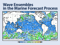
The NCEP Marine Modeling and Analysis Branch (MMAB) Ensemble Global Ocean Wave Forecast System (EGOWaFS) provides five-day forecasts of global winds, wind wave and swell conditions in probabilistic terms. This product became available early in 2007 both through an NCEP non-operational web page and, for raw data, through FTP for use by marine forecasters at NWS WFOs and other locations.
The data from the EGOWaFS can be used in a number of ways, including:
* As input to probabilistic marine forecasts for wind waves and swell
* As input to a local wave ensemble, such as Simulated Waves Nearshore (SWAN)
* As input to develop probabilistic forecasts for rip current development
This webcast has been developed to introduce the EGOWaFS to the marine forecasting community. Topics discussed include:
- The unique basis for ensemble prediction of ocean waves
- Graphics of EGOWaFS product output and their interpretation
- Case examples showing examples of EGOWaFS, including:
- Potential for EGOWaFS forecast bias resulting from systematic errors in wind forcing,
- Use of EGOWaFS data to provide boundary conditions for local near-shore wave models, and
- Application of EGOWaFS data to create a probabilistic forecast for the occurrence of rip currents.
Objectives:
1. Understand that the basis for ocean wave ensemble forecasting depends on the uncertainty in the near-surface wind forecasts, rather than uncertainty in the wave initial conditions.
2. Learn how to use the web-based graphics at NCEP for probabilistic forecasting of ocean waves.
3. Understand how bias in the wind forcing affects wave forecasts.
4. Learn potential uses for the wave ensemble forecasts, including local near-shore wave models and probabilistic forecasts of rip current.
Estimated time to complete: 1 h
Includes audio: yes
Required plug-ins:  Flash Flash  RealPlayer RealPlayer  Java Java  Adobe® Reader® Adobe® Reader®
* Plug-in information
Last published on: 2007-12-03
close
|

|
What Can You Expect From the Eta-12?
description (click to show/hide) |
No Quiz
|
 Description: Description:
The NCEP Eta model is now running with a grid spacing of 12 km and mixed-phase microphysics which includes advection of falling condensate. What have we learned so far about what the model is and is not capable of forecasting well? This session focuses on case examples illustrating various aspects of model performance related to how the model parameterizations work and how much detail related to topography and surface forcing can be seen in the model fields. Some forecast verification statistics are also shown for different regions, indicating regional variation in performance related to the topics discussed. A model fix to heat fluxes through snowcover is explained and its impact on the forecast and analysis is shown. Finally, two new developments being tested are summarized - use of a nonhydrostatic, hybrid sigma-pressure coordinate model for the high-resolution window runs and interfacing with the HYSPLIT dispersion model for use in emergency hazardous release situations.
Estimated time to complete: 75 min
Includes audio: yes
Required plug-ins:  Flash Flash  RealPlayer RealPlayer  Java Java  Adobe® Reader® Adobe® Reader®
* Plug-in information
Last published on: 2000-04-26
close
|
return to top^
Case Studies
| |
Case Title and Link |
| |
A Comparison of Diagnosed Vs. Predicted Precipitation Type in the Eta Forecast Model: 3-6 December 2002
description (click to show/hide) |
Description:
When the new grid-scale precipitation scheme was implemented in the Eta model on November 27, 2001, precipitation type became available as a forecast variable. This variable can be used to complement the diagnosed precipitation type based on forecasted vertical temperature and moisture profiles. In this case, the diagnosed precipitation type from the NCEP (a.k.a Baldwin/Schichtel) algorithm is compared to the predicted precipitation type in the experimental/parallel version of the 12-km Eta model for an early winter storm in the southern and eastern U.S.
Estimated time to complete: 40 min
Includes audio: no
Required plug-ins:  Flash Flash  RealPlayer RealPlayer  Java Java  Adobe® Reader® Adobe® Reader®
* Plug-in information
Last published on: 2003-03-03
close
|
| |
Allison Rains in Houston, Texas
description (click to show/hide) |
Description:
This is the first of three cases examining numerical weather prediction (NWP) aspects of Tropical Storm Allison, which moved into Texas from the Gulf of Mexico on 5 June 2001. The Houston, TX area was inundated by up to three feet of rain between 5 and 8 June, most of which occurred on June 8th, three days after the storm made landfall. Twenty-two deaths resulted, many of which were the result of cars being swept away by flash flooding. Importantly, flash flood watches and warnings were made in a timely manner by the Houston/Galveston TX WFO, in spite of the Eta forecast problems.
This first case mainly considers whether the volume of rain that occurred over the Houston, TX area, particularly on 8 June, was predictable using the Eta-22 and Eta-10 (threats nest) models from the National Centers for Environmental Prediction (NCEP).
Estimated time to complete: 30 min
Includes audio: no
Required plug-ins:  Flash Flash  RealPlayer RealPlayer  Java Java  Adobe® Reader® Adobe® Reader®
* Plug-in information
Last published on: 2002-01-23
close
|
| |
Allison Rains in the Philadelphia, PA Area
description (click to show/hide) |
Description:
This last of three cases examines numerical weather prediction (NWP) aspects of Tropical Storm Allison, which moved past the Philadelphia area on 16 – 17 June 2001. Neshaminy Creek overflowed its banks on 16 June after the area it drains received 6-10" of rain over a 12-hour period. The Neshaminy Creek watershed is only about 750 km2 in size, or about 7 grid squares in size for the Eta-12 (less than 2 grid squares for the mesoscale model in operation at the time, the Eta-22!). This is obviously too small for the computer models to capture the details of the small-scale heavy rains which unfortunately happened to center over the Neshaminy basin.
This final case mainly considers what the computer models, particularly the Eta-22 and nested Eta-10, showed in their forecasts, including QPF, and what other considerations, including construction of a crude ensemble forecast, might be helpful in the decision-making process for flash flood watches and warnings in the Philadelphia area.
Estimated time to complete: 30 min
Includes audio: no
Required plug-ins:  Flash Flash  RealPlayer RealPlayer  Java Java  Adobe® Reader® Adobe® Reader®
* Plug-in information
Last published on: 2002-01-25
close
|
| |
Applications of NWP Concepts
description (click to show/hide) |
Description:
This is a planned series of short case studies demonstrating critical thinking in the use of NWP products based on an understanding of the characteristics and limitations of NWP models and the NWP forecast process.
We welcome any comments you may have regarding the case content, its discussion, or the instructional use and benefits of this material. In particular, we are interested in any additions or modifications to this type of case discussion that would make it more relevant and useful for the training of your forecasters.
Estimated time to complete: 30-60 min
Includes audio: no
Required plug-ins:  Flash Flash  RealPlayer RealPlayer  Java Java  Adobe® Reader® Adobe® Reader®
* Plug-in information
Last published on: 2003-01-01
close
|
| |
Climatology of Forecast and Observed Precipitation
description (click to show/hide) |
Description:
This brief case study provides maps to compare model-predicted and observed frequency of 24-hour and 48-hour precipitation exceeding various thresholds to serve as a reference of characteristic model behavior.
Estimated time to complete: 1 h
Includes audio: no
Required plug-ins:  Flash Flash  RealPlayer RealPlayer  Java Java  Adobe® Reader® Adobe® Reader®
* Plug-in information
Last published on: 2002-01-07
close
|
| |
Eta-12 Forecast for Historic Lake Effect Snow in Buffalo, NY
description (click to show/hide) |
Description:
An examination of how the updated Eta-12 model, with its higher resolution, improved topography, and upgraded cloud and precipitation package, performed in forecasting the initiation and evolution of the first portion of the Buffalo, NY historic lake effect snow event (24-26 December 2001).
Estimated time to complete: 45 min
Includes audio: no
Required plug-ins:  Flash Flash  RealPlayer RealPlayer  Java Java  Adobe® Reader® Adobe® Reader®
* Plug-in information
Last published on: 2002-03-05
close
|
| |
GFS T170 Grid-Scale Precipitation Bomb during Flood Event in IA
description (click to show/hide) |
Description:
This case discusses one occurrence of a well-known problem with the GFS; grid-scale precipitation bombs at T170L42 resolution. Anecdotal evidence suggests that these precipitation bulls'-eyes have been more frequent this warm season, particularly in the central and northern Plains and Midwest. The time-scale, spatial scale, and effect of the GFS precipitation bombs on the forecast are examined. We also discuss whether GFS forecasts that produce such features can be useful to the operational meteorologist.
Estimated time to complete: 1 h
Includes audio: no
Required plug-ins:  Flash Flash  RealPlayer RealPlayer  Java Java  Adobe® Reader® Adobe® Reader®
* Plug-in information
Last published on: 2002-11-25
close
|
| |
How Different Data Types Impact the Eta Analysis
description (click to show/hide) |
Description:
A discussion of how different data types impact the analysis and forecast, based on the results of the Zapotocny et al. case study published in Weather and Forecasting (2000)
Estimated time to complete: 30 min
Includes audio: no
Required plug-ins:  Flash Flash  RealPlayer RealPlayer  Java Java  Adobe® Reader® Adobe® Reader®
* Plug-in information
Last published on: 2002-01-31
close
|
| |
How Good Data Can Lead to a Poor Model Analysis
description (click to show/hide) |
Description:
This case study highlights limitations in observing mesoscale features and incorporating observations of mesoscale features into the Eta model analysis. The interactive presentation brings out practical ramifications of data assimilation concepts.
Estimated time to complete: 30 min
Includes audio: no
Required plug-ins:  Flash Flash  RealPlayer RealPlayer  Java Java  Adobe® Reader® Adobe® Reader®
* Plug-in information
Last published on: 2001-10-03
close
|
| |
Improved Light Precipitation Forecasts in New Eta-12
description (click to show/hide) |
Description:
This is a brief on an improvement in precipitation forecasts that has, in general, continued to be noticed since the new grid-scale precipitation scheme went into effect when the new Eta-12 became operational on 27 November 2001. One of the elements in the new scheme is the addition of vertical diffusion of cloud water between model layers. The main purpose for this change was to improve erroneous forecasts of warm-season light precipitation in the mid-Atlantic and southeastern U.S. during periods of moist onshore flow, and in the coastal and offshore areas of the West Coast under the marine stratus regime.
Estimated time to complete: 30 min
Includes audio: no
Required plug-ins:  Flash Flash  RealPlayer RealPlayer  Java Java  Adobe® Reader® Adobe® Reader®
* Plug-in information
Last published on: 2002-01-16
close
|
| |
Initial Conditions & SREF Forecasts for 6-7 Jan. 2002 NE U.S. Snowstorm
description (click to show/hide) |
Description:
This case discusses the failure of the Short-Range Ensemble Forecast (SREF) system to capture a significant snowfall over the interior northern Mid-Atlantic states and New England that occured on January 6-7, 2002. While this is a winter case, the lessons learned herein are applicable to use of the SREF in all seasons.
Estimated time to complete: 1 h
Includes audio: no
Required plug-ins:  Flash Flash  RealPlayer RealPlayer  Java Java  Adobe® Reader® Adobe® Reader®
* Plug-in information
Last published on: 2002-06-04
close
|
| |
Interpretation of Global Forecast Model 'Flipflops'
description (click to show/hide) |
Description:
All forecasters are familiar with occasional run-to-run changes in forecast direction that occur with medium-range (and sometimes even short-range) forecasts in the Global Forecast Model (aka AVN/MRF). This case describes two recent model "flipflops" in a pair of time-adjacent operational MRF runs, and shows how MRF ensemble forecasts shed light on what is actually going on in the operational MRF seasons.
Estimated time to complete: 30 min
Includes audio: no
Required plug-ins:  Flash Flash  RealPlayer RealPlayer  Java Java  Adobe® Reader® Adobe® Reader®
* Plug-in information
Last published on: 2002-06-04
close
|
| |
Spurious Grid-Scale Convection in the Eta Model
description (click to show/hide) |
Description:
The AVN produces spurious precip "bombs." Now the Eta does too. This case provides a detailed look at Eta model forecast fields leading up to and during an event, including forecast impact and explanation of what's going on inside the model.
Estimated time to complete: 1.5 h
Includes audio: no
Required plug-ins:  Flash Flash  RealPlayer RealPlayer  Java Java  Adobe® Reader® Adobe® Reader®
* Plug-in information
Last published on: 2002-02-26
close
|
| |
Tropical Storm Allison in the Southeastern U.S.
description (click to show/hide) |
Description:
After looping through east Texas and flooding the Houston metropolitan area with as much as 36" of rain over 4 days, Tropical Storm Allison moved back over the Gulf of Mexico, only to make landfall again over southern Louisiana. This second of three cases on this storm examines the predictability of its behavior over the southeastern United States, as Allison moved steadily east-northeastward from the Louisiana coast over the course of 3 days, before stalling over eastern North Carolina.
This portion of the storm's history was remarkable for:
* Maintenance of storm circulation
* Maintenance of some aspects of its tropical characteristics
* Inability of the mesoscale models at NCEP (both Eta-22 and 10-km nests) to capture the behavior of the storm
This case examines the behavior of the Eta model in forecasting the movement and precipitation from Allison as it moved through the Southeast.
Estimated time to complete: 30 min
Includes audio: no
Required plug-ins:  Flash Flash  RealPlayer RealPlayer  Java Java  Adobe® Reader® Adobe® Reader®
* Plug-in information
Last published on: 2001-12-20
close
|
| |
When Good Models Go Bad
description (click to show/hide) |
Description:
On 29 December 2000, forecasters from Washington to Boston were watching with concern a powerful upper-air disturbance moving southeastward from south-central Canada into the Midwest. All the forecast models were predicting rapid cyclogenesis and subsequent explosive deepening somewhere on or near the U.S. Mid-Atlantic coast during the night of the 29th and morning of the 30th. With cold air in place over the Northeastern U.S., it was clear that a major snowstorm was about to occur, though it was not clear where. All the models agreed there would be a sharp back edge to the precipitation swath and that there would be rain to the east of the cyclone center, which might or might not track across Massachusetts. The location of cyclogenesis and the subsequent track and orientation of the storm would result in significant differences in where the impacts would be in the Washington to Boston urban corridor. Thus, the forecast problems of the day were:
How far south and how close to the East Coast would the initial cyclogenesis take place?
How rapidly would the storm deepen once it developed, and what path would it take?
How much precipitation would wrap around the cyclone as it developed, and how would the precipitation bands be oriented?
How much moisture would be available to wrap into the storm after a previous southern-stream wave had swept out most of the moisture?
Estimated time to complete: 30 min
Includes audio: no
Required plug-ins:  Flash Flash  RealPlayer RealPlayer  Java Java  Adobe® Reader® Adobe® Reader®
* Plug-in information
Last published on: 2001-01-25
close
|
return to top^
Translated Modules
content level: 0=for non-scientists, 1=basic, 2=intermediate, 3=advanced
| Language |
Level |
Module Title and Link |
Quiz Link |
| Español
|

|
Fundamentos de los modelos
description (click to show/hide) |
Quiz
|
 Description: Description:
Describe los componentes de los modelos de PNT, cómo encajan en el proceso el desarrollo del pronóstico y por qué es necesario parametrizar muchos procesos físicos en los modelos de PNT.
Estimated time to complete: 1 h
Includes audio: no
Required plug-ins:  Flash Flash  RealPlayer RealPlayer  Java Java  Adobe® Reader® Adobe® Reader®
* Plug-in information
Last published on: 2005-08-23
close
|
| Español
|

|
Impacto de la estructura y dinámica de los modelos
description (click to show/hide) |
Quiz
|
 Description: Description:
Brinda información importante desde el punto de vista operativo sobre el tipo de modelo, la resolución horizontal, los sistemas de coordenadas verticales, la resolución vertical y las condiciones de dominio y de frontera. Se analiza como cada uno de estos aspectos afecta a la capacidad del modelo de describir y pronosticar las condiciones meteorológicas.
Estimated time to complete: 3-5 h
Includes audio: no
Required plug-ins:  Flash Flash  RealPlayer RealPlayer  Java Java  Adobe® Reader® Adobe® Reader®
* Plug-in information
Last published on: 2005-08-23
close
|
| Español
|

|
¿Cómo producen los modelos la precipitación y las nubes?
description (click to show/hide) |
Quiz
|
 Description: Description:
Brinda información importante desde el punto de vista operativo sobre los esquemas de parametrización de nubes y precipitación y los esquemas de parametrización de la convección. Analiza cómo estas parametrizaciones pueden afectar a la capacidad del modelo de representar y pronosticar la precipitación.
Estimated time to complete: 3 h
Includes audio: no
Required plug-ins:  Flash Flash  RealPlayer RealPlayer  Java Java  Adobe® Reader® Adobe® Reader®
* Plug-in information
Last published on: 2005-08-23
close
|
| Español
|

|
Explicación del pronóstico por conjuntos
description (click to show/hide) |
Quiz
|
 Description: Description:
Este módulo, el más reciente de nuestra serie de predicción numérica del tiempo (PNT), abarca la teoría y el uso de los sistemas de predicción por conjuntos (SPC). El objetivo de este módulo es ayudarle a desarrollar su comprensión de los conceptos fundamentales de los sistemas de predicción por conjuntos y la capacidad de interpretar los productos del conjunto, así como proporcionarle algunas estrategias para usarlos en el proceso de pronóstico. El módulo comprende seis secciones: la Introducción presenta un breve panorama teórico; la sección Generación del conjunto describe la creación de los SPC; Conceptos estadísticos ofrece un breve repaso de los conocimientos necesarios para interpretar los productos generados por el conjunto; Resumen de los datos presenta los productos de pronóstico por conjuntos más comunes; en Verificación se explica cómo evaluar y documentar la actuación de los SPC; y Ejemplos de aplicación ofrece enlaces a varios casos de pronóstico (en inglés) que ilustran el uso de los SPC en el proceso de pronóstico. A lo largo del módulo encontrará preguntas y ejercicios con ejemplos prácticos que le permitirán averiguar lo que ha aprendido. El módulo incluye también una prueba final.
Objectives:
Explicar las bases del pronóstico numérico por conjuntos y lo que significa decir que la atmósfera es caótica (es decir, sensible a las condiciones iniciales).
Describir la variedad de métodos empleados para generar los miembros del sistema de predicción por conjuntos, incluyendo los aspectos de perturbación de las condiciones iniciales, condiciones de frontera y configuraciones del modelo.
Entender los conceptos estadísticos básicos y los métodos usados en el desarrollo de los productos del conjunto, incluyendo las distribuciones de probabilidad, la centralidad, la variabilidad y las características de la forma de la distribución.
Reconocer e interpretar los distintos productos de pronóstico por conjuntos, incluyendo los gráficos de predicción puntuales y espaciales, y aquellos que muestran los regímenes de flujo, como los de medida relativa de predictibilidad, que revelan los sesgos y los errores de los modelos de PNT.
Interpretar los productos de verificación del conjunto y aplicarlos al uso de pronósticos por conjuntos.
Estimated time to complete: 3-4 h
Includes audio: no
Required plug-ins:  Flash Flash  RealPlayer RealPlayer  Java Java  Adobe® Reader® Adobe® Reader®
* Plug-in information
Last published on: 2006-10-13
close
|
| Español
|

|
Diez conceptos equivocados comunes sobre PNT
description (click to show/hide) |
Quiz
|
 Description: Description:
Este módulo presenta diez de los conceptos equivocados más comunes o importantes sobre los modelos de PNT. Los diez conceptos equivocados abarcan asuntos relacionados con la asimilación de datos, la resolución del modelo, las parametrizaciones físicas y el postprocesamiento de la salida del pronóstico del modelo.
Estimated time to complete: 1 h
Includes audio: no
Required plug-ins:  Flash Flash  RealPlayer RealPlayer  Java Java  Adobe® Reader® Adobe® Reader®
* Plug-in information
Last published on: 2006-12-13
close
|
| Español
|

|
Funcionamiento de los modelos de mesoescala
description (click to show/hide) |
Quiz
|
 Description: Description:
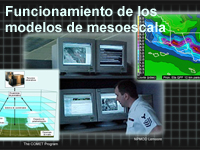
El objetivo de este módulo de capacitación es ayudarle a aumentar su grado de comprensión del funcionamiento de los modelos de mesoescala. A su vez, dicha comprensión puede ayudarle a evaluar de forma más eficiente y precisa los productos de pronóstico generados por los modelos numéricos.
Objectives:
Objetivos finales
Cuando termine de estudiar este módulo podrá:
1. Describir cómo funcionan los modelos de mesoescala.
2. Evaluar los puntos fuertes y débiles de los diferentes modelos de PNT.
Objetivos de capacitación
Cuando termine de estudiar este módulo podrá:
1. Describir las ventajas y limitaciones de los modelos de PNT de mesoescala.
2. Describir la relación entre el espaciado de malla y la resolución para los modelos de PNT.
3. Describir las ventajas y desventajas de aumentar la resolución del modelo.
4. Describir el equilibrio hidrostático y cómo los modelos de PNT hidrostáticos difieren de los no hidrostáticos.
5. Definir los esquemas de coordenadas verticales Eta, sigma y de presión, y describir sus respectivas ventajas.
6. Definir la parametrización y describir los beneficios de su uso en los modelos de PNT.
7. Enumerar al menos tres procesos que suelen parametrizarse.
8. Describir los conceptos de modelo de área limitada, fase de inicialización y arranque en caliente, así como la relación que existe entre ellos.
9. Describir los beneficios y las limitaciones del arranque en caliente.
Estimated time to complete: 30 min
Includes audio: yes
Required plug-ins:  Flash Flash  RealPlayer RealPlayer  Java Java  Adobe® Reader® Adobe® Reader®
* Plug-in information
Last published on: 2007-05-21
close
|
| Français
|

|
Dix idées fausses en PNÉT
description (click to show/hide) |
Quiz
|
 Description: Description:
This module introduces forecasters to ten of the most commonly encountered or significant misconceptions about NWP models. This list of ten misconceptions includes issues surrounding data assimilation, model resolution, physical parameterizations, and post-processing of model forecast output.
Estimated time to complete: 100 min
Includes audio: no
Required plug-ins:  Flash Flash  RealPlayer RealPlayer  Java Java  Adobe® Reader® Adobe® Reader®
* Plug-in information
Last published on: 2007-06-01
close
|
| Français
|

|
Principes fondamentaux des modèles
description (click to show/hide) |
Quiz
|
 Description: Description:
Model Fundamentals, part of the Numerical Weather Prediction Professional Development Series and the NWP Distance Learning Course, describes the components of an NWP model and how they fit into the forecast development process. It also explores why parameterization of many physical processes is necessary in NWP models.
The module covers background concepts and terminology necessary for learning from the other modules in this series on NWP.
The subject matter expert for this module is Dr. Ralph Petersen of the National Centers for Environmental Prediction, Environmental Modeling Center (NCEP/EMC).
Estimated time to complete: 1 h
Includes audio: no
Required plug-ins:  Flash Flash  RealPlayer RealPlayer  Java Java  Adobe® Reader® Adobe® Reader®
* Plug-in information
Last published on: 2007-06-01
close
|
| Français
|

|
Conséquences de la structure et de la dynamique des modèles
description (click to show/hide) |
Quiz
|
 Description: Description:
Impact of Model Structure & Dynamics, part of the Numerical Weather Prediction Professional Development Series and the NWP Distance Learning Course, provides operationally significant information about model type, horizontal resolution, vertical coordinate systems, vertical resolution, and domain and boundary conditions, with an emphasis on how each aspect can affect a model's ability to depict and forecast weather.
The subject matter expert for this module is Dr. Ralph Petersen of the National Centers for Environmental Prediction, Environmental Modeling Center (NCEP/EMC).
Estimated time to complete: 3-5 h
Includes audio: no
Required plug-ins:  Flash Flash  RealPlayer RealPlayer  Java Java  Adobe® Reader® Adobe® Reader®
* Plug-in information
Last published on: 2007-06-01
close
|
| Français
|

|
Comment les modèles produisent les précipitations et les nuages
description (click to show/hide) |
Quiz
|
 Description: Description:
Part of the Numerical Weather Prediction Professional Development Series, this module explores how NWP models handle precipitation and cloud processes through parameterizations and/or explicit methods, with an emphasis on how a model's treatment of these processes affects its ability to depict and forecast precipitation and other related forecast variables.
The subject matter expert for this module is Dr. Ralph Petersen of the National Centers for Environmental Prediction, Environmental Modeling Center (NCEP/EMC).
Estimated time to complete: 3-6 h
Includes audio: no
Required plug-ins:  Flash Flash  RealPlayer RealPlayer  Java Java  Adobe® Reader® Adobe® Reader®
* Plug-in information
Last published on: 2007-08-08
close
|
| Français
|

|
Influence de la physique des modèles de prévision numérique des
éléments du temps (PNÉT)
description (click to show/hide) |
Quiz
|
 Description: Description:
This module describes model parameterizations of sub-surface, boundary-layer,and free atmospheric processes, such as surface snow processes, soil characteristics, vegetation, evapotranspiration, PBL processes and parameterizations, and trace gases, and their interaction with the radiative transfer process. It specifically addresses how models treat these physical processes and how they can influence forecasts of sensible weather elements.
Objectives:
Working through the material will help you to
• Develop a basic understanding of how radiation and associated processes are emulated in NWP models
• Understand when model physics are most important to the model forecast (versus model dynamics)
• Understand that model physics are specifically tuned to work best in certain situations and specific models
• Understand that model physics parameterizations affect other parameterizations, model dynamics, and data assimilation, which may result in feedbacks
• Identify impacts of model physics and their errors on model forecasts both at and around the forecast location
• Identify effects that are smaller than the model can emulate (for example, the resolution of surface characteristics is coarse but real effects occur at fine resolution)
Estimated time to complete: 1.5 h
Includes audio: no
Required plug-ins:  Flash Flash  RealPlayer RealPlayer  Java Java  Adobe® Reader® Adobe® Reader®
* Plug-in information
Last published on: 2007-08-21
close
|
| Français
|

|
Utilisation intelligente des produits dérivés des modèles
description (click to show/hide) |
Quiz
|
 Description: Description:
This module was developed and released in three sections: Postprocessing/Products, Statistical Guidance, and Assessment Tools. Specific topics covered include the impact of postprocessing and how to account for it, the statistical methods used to enhance raw model output including how statistical guidance products like MOS are generated, as well as NWP verification methodologies and use of daily model diagnostics.
The subject matter expert for this module is Dr. Ralph Petersen of the National Centers for Environmental Prediction, Environmental Modeling Center (NCEP/EMC), and J. Paul Dallavalle of the National Weather Service (NWS), Meteorological Development Laboratory, Statistical Modeling Branch (MDL/SMB). The primary content author was Kirby Cook, NWS, Western Region Headquarters (WRH)/Scientific Services Division (SSD).
Estimated time to complete: 1-2 h
Includes audio: no
Required plug-ins:  Flash Flash  RealPlayer RealPlayer  Java Java  Adobe® Reader® Adobe® Reader®
* Plug-in information
Last published on: 2007-10-02
close
|
| Español
|

|
Matriz de modelos operativos: características de los modelos de PNT operativos
description (click to show/hide) |
No Quiz
|
 Description: Description:
Este módulo, que forma parte de la Serie de Formación Profesional (Professional Development Series, PDS) de PNT, contiene información sobre las características y la arquitectura de los modelos operativos de uso común, sus principales puntos fuertes y puntos débiles para las operaciones y herramientas de evaluación del modelo. La información se actualiza siempre que se realicen cambios significativos en el modelo.
El módulo está vinculado al módulo Impact of Model Numerics on Weather Depiction (que también integra la Serie de Formación Profesional de PNT), el cual brinda información de fondo acerca de los componentes del modelo.
El experto en la materia para este módulo es el Dr. Ralph Petersen del Centro de Modelado Ambiental de los Centros Nacionales de Predicción Ambiental (National Centers for Environmental Prediction/Environmental Modeling Center, NCEP/EMC).
Estimated time to complete: 3-5 h
Includes audio: no
Required plug-ins:  Flash Flash  RealPlayer RealPlayer  Java Java  Adobe® Reader® Adobe® Reader®
* Plug-in information
Last published on: 2007-10-19
close
|
| Français
|

|
Comprendre l'assimilation des données: Comment les modèles créent leurs conditions initales
description (click to show/hide) |
Quiz
|
 Description: Description:
This module explains the process by which data are used in NWP models and the ever-increasing importance that data assimilation has on the quality of numerical forecasts. It provides learners an appreciation for how models use data as a function of model resolution and data type, how data influence the analysis, the limitations of data assimilation systems, the importance of initial conditions on the quality of NWP guidance, as well as the challenges of assessing the quality of NWP guidance based on the initial conditions.
The subject matter expert for this module is Dr. Ralph Petersen of the National Centers for Environmental Prediction, Environmental Modeling Center (NCEP/EMC).
Estimated time to complete: 3-4 h
Includes audio: no
Required plug-ins:  Flash Flash  RealPlayer RealPlayer  Java Java  Adobe® Reader® Adobe® Reader®
* Plug-in information
Last published on: 2007-11-19
close
|
| Français
|

|
La prévision d'ensemble expliquée
description (click to show/hide) |
Quiz
|
 Description: Description:
This module, the latest in our series on Numerical Weather Prediction, covers the theory and use of ensemble prediction systems (EPSs). The module will help forecasters develop an understanding of the basis for EPSs, the skills to interpret ensemble products, and strategies for their use in the forecast process. It contains six sections: an Introduction that briefly presents background theory; Generation, which describes how ensemble systems are constructed; Statistical Concepts, which provides a brief refresher on knowledge required for ensemble product interpretation; Summarizing Data, which describes common ensemble forecast products; Verification, which discusses how EPSs performance is assessed and documented; and Case Applications, which provides links to a number of forecast cases illustrating the use of EPSs in the forecast process. Questions and Exercises are offered throughout to help you test your learning and provide practical examples. The module also includes a pre-assessment and module final quiz.
Objectives:
Explain the basis for NWP ensemble prediction, and what we mean when we say that the atmosphere is chaotic (i.e. sensitive to initial conditions).
Describe the variety of methods used to generate the ensemble members of an ensemble prediction system, including perturbation of initial conditions, boundary conditions, and model configurations.
Understand the basic statistical concepts and methods used in the development of ensemble products, including probability distributions and their middleness, variability, and shape characteristics.
Recognize and interpret the variety of ensemble forecast products, including spatial and point forecast graphics, and including those that account for flow regimes (RMOP) and reveal NWP model bias and errors.
Interpret ensemble verification products, and apply them in using ensemble forecasts.
Estimated time to complete: 4-5 h
Includes audio: no
Required plug-ins:  Flash Flash  RealPlayer RealPlayer  Java Java  Adobe® Reader® Adobe® Reader®
* Plug-in information
Last published on: 2007-12-07
close
|
return to top^
|
 Description:
  Description:
  Description:
  Description:
  Description:
  Description:
  Description:
  Description:
  Description:
  Description:
  Description:
  Description:
  Description:
  Description:
  Description:
  Description:
  Description:
  Description:
  Description:
  Description:
  Description:
  Description:
  Description:
  Description:
  Description:
  Description:
  Description:
  Description:
  Description:
  Description:
  Description:
  Description:
  Description:
  Description:
  Description:
  Description:
  Description:
  Description:
  Description:
  Description:
  Description:
 .gif)
