|
HOME > Monitoring and Data > Oceanic & Atmospheric Data > Monthly Atmospheric and SST Indices
|
| |

|
| |
|
General Information
|
|
Winds
|
200 millibar (mb) Zonal Winds Equator (165°West-110°West):
|
|
850 mb Trade Wind Index (135°East-180°West) 5°North-5°South West Pacific:
|
|
850 mb Trade Wind Index (175°West-140°West) 5°North-5°South Central Pacific:
|
|
850 mb Trade Wind Index (135°West-120°West) 5°North-5°South East Pacific:
|
|
QBO.U30.Index (replaces 30 mb Singapore Winds [refer to Frequently Asked Questions]):
|
|
QBO.U50.Index (replaces 50 mb Singapore Winds [refer to Frequently Asked Questions]):
|
|
Sea Level Pressure (SLP)
|
|
Darwin Sea Level Pressure (1951 - Present):
|
|
Tahiti Sea Level Pressure (1951 - Present):
|
|
Darwin (SLP) 1882 - 1950:
|
|
Tahiti (SLP) 1882 - 1950:
|
|
Southern Oscillation Index (SOI)
|
|
(Stand Tahiti - Stand Darwin) Sea Level Pressure:
|
|
(Stand Tahiti - Stand Darwin) SLP 1882 - 1950:
|
|
Equatorial SOI
|
|
Indonesia SLP (Standardized Anomalies):
|
|
Equatorial Eastern Pacific SLP (Standardized Anomalies):
|
|
Equatorial SOI:
|
|
Sea Surface Temperature (SST)
|
|
Weekly Niño 1+2 (0-10°South)(90°West-80°West) Niño 3 (5°North-5°South)(150°West-90°West) Niño 4 (5°North-5°South) (160°East-150°West) Niño 3.4 (5°North-5°South)(170-120°West):
|
|
Monthly Niño 1+2 (0-10°South)(90°West-80°West) Niño 3 (5°North-5°South)(150°West-90°West) Niño 4 (5°North-5°South) (160°East-150°West) Niño 3.4
(5°North-5°South)(170-120°West): (NOTICE: ON AUGUST 1, 2001 THE BASE PERIOD USED TO CALCULATE THE MONTHLY NIÑO REGION ANOMALIES WERE CHANGED FROM (1961-1990) TO (1971-2000). THIS CHANGE HAS CAUSED SOME SMALL VARIATIONS IN THE NINO REGION ANOMALIES.)
|
|
North Atlantic (5-20°North, 60-30°West), South Atlantic (0-20°South, 30°West-10°East), Global Tropics (10°South-10°North, 0-360):
|
|
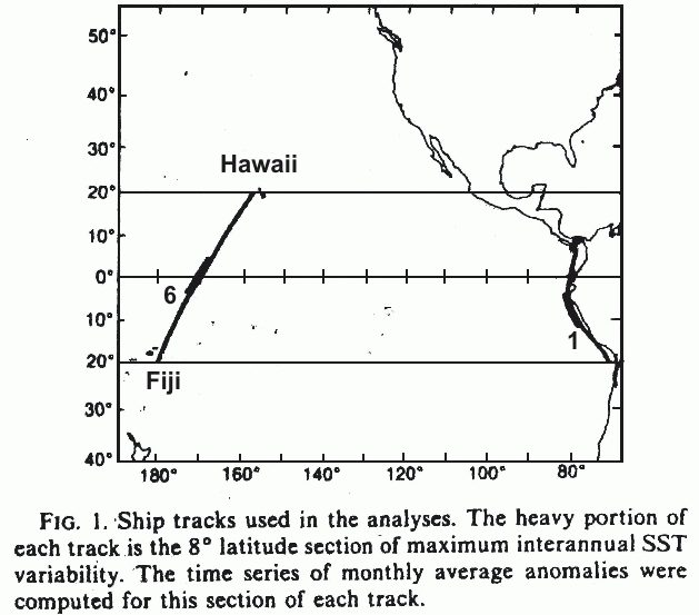
West Coast of Americas SST (Known as Ship Track 1):
|
|
Hawaii Fiji SST (Known as Ship Track 6):
|
|
West Coast of Americas SST 1921 - 1950 (Ship Track 1):
|
|
West Coast of Americas SST 1921 - 1950 (Ship Track 6):
|
|
Temperatures
|
|
Zonally Average 500 MB Temperature Anomalies:
|
|
Outgoing Long Wave Radiation (OLR)
|
|
Outgoing Long Wave Radiation Equator (160°E-160°W):
|


