| Level |
Module Title and Link |
Quiz Link |

|
Advanced Fire Weather Forecasters Course Orientation
description (click to show/hide) |
No Quiz
|
 Description: Description:
The “Advanced Fire Weather Forecasters Course Orientation” module introduces the organization of the course, the topics presented, and the intended audience, as well as the motivation for converting this course to online training. This web module is part of the Advanced Fire Weather Forecasters Course..
Objectives:
At the end of this module you should be able to:
1. Describe the structure of the Advanced Fire Weather Forecasters Course and component modules.
Estimated time to complete: 15 m
Includes audio: yes
Required plug-ins:  Flash Flash  RealPlayer RealPlayer  Java Java  Adobe® Reader® Adobe® Reader®
* Plug-in information
Last published on: 2008-06-12
close
|

|
Assessing Fire Danger
description (click to show/hide) |
Quiz
|
 Description: Description:
The “Assessing Fire Danger” distance learning module explores techniques for recognizing weather and fuel conditions contributing to fire danger. The module includes a matrix of data sources offering useful weather, fuels, and other information related to fire ignition, spread, and intensity. An overview of situational awareness practices provides information relevant to forecasters in the office or field. This module is part of the Advanced Fire Weather Forecasters Course.
Objectives:
At the end of this module you should be able to:
1. Describe the fire “setup” stage and identify weather patterns that lead to fuel dryness,
2. understand fuel dryness evolution and how it relates to the National Fire Danger Rating System (NFDRS),
3. describe specific fire weather and fuel data sources that aid in determining fuel susceptibility,
4. apply situational awareness concepts to fire weather forecasting operations.
Estimated time to complete: 1 h
Includes audio: no
Required plug-ins:  Flash Flash  RealPlayer RealPlayer  Java Java  Adobe® Reader® Adobe® Reader®
* Plug-in information
Last published on: 2008-03-31
close
|

|
Dispersion Basics
description (click to show/hide) |
Quiz
|
 Description: Description:
A webcast presentation by Dr. Timothy Spangler (Director of the COMET Program and a former air quality consultant). This 25-minute lecture provides an overview of the basics of dispersion, the effects of different atmospheric conditions on dispersion, and how dispersion is commonly modeled after an accidental release of a hazardous material.
Objectives:
- Define what is meant by the terms “dispersion” and “exposure”
- List the main factors that determine dispersion and exposure
- Differentiate between the 5 main plume types
- Explain the factors involved in plume rise and why plume rise is important
- Discuss the main components involved in calculating concentration
- Describe the differences between a Gaussian model, a Gradient Transport Model, and a Puff Model
- List important situations in which common dispersion models may not provide good concentration estimates
Estimated time to complete: 25 min
Includes audio: yes
Required plug-ins:  Flash Flash  RealPlayer RealPlayer  Java Java  Adobe® Reader® Adobe® Reader®
* Plug-in information
Last published on: 2002-11-12
close
|

|
Fire Behavior
description (click to show/hide) |
Quiz
|
 Description: Description:
This module provides a comprehensive overview of the three main dimensions of the fire environment triangle: fuels, topography, and weather. Five interactive case studies illustrate the interdependent influences these three dimensions have on fire behavior. A wide range of fire behavior is also discussed in terms of the environmental factors that support or suppress fire ignition and spread. As part of the Advanced Fire Weather Forecasters Course, this module is meant to introduce forecasters to science of fire behavior.
Objectives:
1. Identify key factors contributing to the fuels dimension of the fire environment triangle, including fuel properties, components, complexes, states, moisture levels, and continuity.
2. Identify key factors contributing to the topography dimension of the fire environment triangle, including slope, aspect, elevation, and soil moisture.
3. Identify key factors contributing to the weather dimension of the fire environment triangle, including temperature, humidity, winds, and instability.
4. Given a case situation including descriptions of fuels, topography, and weather, identify the fire behavior most likely to occur.
Estimated time to complete: 1.5 h
Includes audio: yes
Required plug-ins:  Flash Flash  RealPlayer RealPlayer  Java Java  Adobe® Reader® Adobe® Reader®
* Plug-in information
Last published on: 2008-03-19
close
|

|
Fire Model Matrix
description (click to show/hide) |
No Quiz
|
 Description: Description:
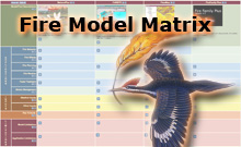
The Fire Model Matrix is an on-line resource that presents four fire community models in a matrix that facilitates the exploration of the characteristics of each model. As part of the Advanced Fire Weather Forecasters Course, this matrix is meant to sensitize forecasters to the use of weather data in these fire models to forecast potential fire activity.
Estimated time to complete: 45 min
Includes audio: no
Required plug-ins:  Flash Flash  RealPlayer RealPlayer  Java Java  Adobe® Reader® Adobe® Reader®
* Plug-in information
Last published on: 2008-02-05
close
|

|
Fire Weather Climatology
description (click to show/hide) |
Quiz
|
 Description: Description:
The “Fire Weather Climatology” module provides a comprehensive look at fire regions across the United States and characteristics of typical fire seasons in each region. In addition, critical fire weather patterns are described in terms of their development, duration and impact on fire weather. Numerous case studies provide examples and opportunities to practice recognizing these critical patterns and how they can affect fire ignition and spread. This module is part of the Advanced Fire Weather Forecasters Course.
Objectives:
At the end of this module you should be able to:
1. Identify critical fire weather patterns across North America and describe:
* Basic set-up, effects on fire weather elements, and typical duration of each pattern
* Characteristics of each pattern that contribute to fire ignition, spread and intensification.
2. Describe locations of key large-scale air-mass source regions and the air mass characteristics that impact fire weather.
3. Identify typical fire seasons for fire climatological regions of the United States and Canada and the critical fire weather patterns that affect these regions.
Estimated time to complete: 3-4 h
Includes audio: no
Required plug-ins:  Flash Flash  RealPlayer RealPlayer  Java Java  Adobe® Reader® Adobe® Reader®
* Plug-in information
Last published on: 2008-04-28
close
|

|
Fire Weather Forecasting: Clear Communications
description (click to show/hide) |
Quiz
|
 Description: Description:
The “Fire Weather Forecasting: Clear Communications” distance learning module offers best practices for Fire Weather Forecasters needing to communicate weather information when deployed in the field. The 30-minute module defines strategies for communicating with Weather Forecast Offices and with customers. Examples include writing a useful fire weather forecast discussion and undertaking proper planning to quickly and accurately disseminate information. This distance learning module is part of the Advanced Fire Weather Forecasters Course.
Objectives:
At the end of this module you should be able to:
1. Identify audiences of fire weather forecasts, forecast discussions, and spot forecasts
2. Demonstrate an understanding of the importance of IMET/WFO coordination
3. Describe best practices for writing an effective and useful fire weather forecast discussion
Estimated time to complete: 30 min
Includes audio: no
Required plug-ins:  Flash Flash  RealPlayer RealPlayer  Java Java  Adobe® Reader® Adobe® Reader®
* Plug-in information
Last published on: 2008-03-05
close
|

|
Fire Weather Grid Techniques: Relative Humidity and Dewpoint Temperature
description (click to show/hide) |
Quiz
|
 Description: Description:
Fire Weather Grid Techniques: Relative Humidity and Dewpoint describes techniques and best practices for creating scientifically consistent grids of fire weather parameters. A case study is used to apply Smart Tools to model guidance to edit relative humidity and dew point temperature grids, and to demonstrate the advantages of editing dew point temperature rather than relative humidity to best represent the moisture in the atmosphere.
Objectives:
1. State how calculating 24-hour “change grids” can help forecasters generate more realistic forecast grids.
2. Explain the need to carefully check trends and values when forecasting changes to parameters used for calculating other grids.
3. Explain how examining recent observational data – either via observational grids or point observations – is essential to making realistic forecast grids.
Estimated time to complete: 30 min
Includes audio: yes
Required plug-ins:  Flash Flash  RealPlayer RealPlayer  Java Java  Adobe® Reader® Adobe® Reader®
* Plug-in information
Last published on: 2007-09-19
close
|

|
History of the Incident Meteorologist Program
description (click to show/hide) |
Quiz
|
 Description: Description:
The “History of the Incident Meteorologist Program” describes the evolution of fire weather support by National Weather Service meteorologists, including the more recent expansion to other hazardous incidents and significant national events. This webcast also reviews the evolution of the Air-Transportable Meteorological Unit (ATMU) into today’s AMRS/FxNet system used by Incident Meteorologists today. This short webcast is part of the Advanced Fire Weather Forecasters Course.
Objectives:
At the end of this module you should be able to:
• Identify key events and milestones in the NWS Fire Weather and IMET program
• Describe the ATMU and its evolution into today's AMRS/FxNet system used by IMETs today
• Describe important customer issues that arose in the 1990s and steps made in recent years to resolve these issues and improve/expand IMET services
Estimated time to complete: 15 min
Includes audio: yes
Required plug-ins:  Flash Flash  RealPlayer RealPlayer  Java Java  Adobe® Reader® Adobe® Reader®
* Plug-in information
Last published on: 2008-02-29
close
|

|
Imaging with NPOESS VIIRS: A Convergence of Technologies and Experience
description (click to show/hide) |
Quiz
|
 Description: Description:
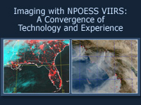
This module introduces the NPOESS VIIRS imager that will fly on the NPOESS Preparatory Project and the NPOESS satellites. The VIIRS imager has many advanced features that will improve both spectral and temporal resolution. Ninety-five percent of VIIRS data will be available within 28 minutes of overpass time, providing consistent, high-quality, high-resolution data to users. This module covers the improvements to VIIRS by examining the systems that contributed to its development. Special attention is paid to the Day/Night Visible channel as VIIRS will be the first civilian satellite to image atmospheric and terrestrial features with and without moonlight.
Objectives:
• Name the important heritage instruments that led to the development of NPOESS
• State the advantages of multispectral imagery in fire and hot spot detection/interpretation
• Use true color imagery to identify surface, atmospheric, and ocean
surface features and characteristics
• Discriminate between nadir and edge of scan passes from AVHRR
• Describe the difference between fine and smooth OLS data
• State the advantages of the nighttime visible channel on OLS
• State features that can be seen during no-moon, half-moon, and full-moon illuminations
• Identify features in no-moon, half-moon, and full-moon illuminations
Estimated time to complete: 45 min
Includes audio: yes
Required plug-ins:  Flash Flash  RealPlayer RealPlayer  Java Java  Adobe® Reader® Adobe® Reader®
* Plug-in information
Last published on: 2004-10-25
close
|

|
Introduction to Fire Behavior: Influences of Topography, Fuels, and Weather on Fire Ignition and Spread
description (click to show/hide) |
Quiz
|
 Description: Description:
This website provides an overview of factors that affect the ignition and spread of wildfire. Information is presented with 3-dimensional graphics and animations as well as audio descriptions and commentary provided by a fire behavior expert. You don't need extensive background in fire science or weather forecasting to use this site.
Estimated time to complete:
Includes audio: yes
Required plug-ins:  Flash Flash  RealPlayer RealPlayer  Java Java  Adobe® Reader® Adobe® Reader®
* Plug-in information
Last published on: 2002-08-21
close
|

|
Mesoscale Meteorology Effects on Fire Behavior
description (click to show/hide) |
Quiz
|
 Description: Description:
The “Mesoscale Meteorology Effects on Fire Behavior” module reviews the development of thermally forced winds in complex terrain and explores how these winds combine with the effects of terrain to influence fire spread. Three-dimensional conceptual animations illustrate these effects through a 24-hr period, as members of the team working this theoretical fire describe different aspects of weather, fire behavior, and operational fire fighting decisions at specific times during this day. This module is part of the Advanced Fire Weather Forecasters Course.
Objectives:
At the end of this module you should be able to:
1. Describe the effects of thermally forced winds in complex terrain on fire behavior
2. Identify how suppression operations are related to fire and smoke conditions in complex terrain
Estimated time to complete: 30 min
Includes audio: yes
Required plug-ins:  Flash Flash  RealPlayer RealPlayer  Java Java  Adobe® Reader® Adobe® Reader®
* Plug-in information
Last published on: 2008-04-28
close
|

|
Multispectral Satellite Applications: Monitoring the Wildland Fire Cycle
description (click to show/hide) |
Quiz
|
 Description: Description:
This module describes current and future satellite instruments and products used for monitoring the fire cycle, with an emphasis on polar-orbiting satellites. Product information is presented in the context of the fire cycle: from assessing the pre- and post-fire environment to detecting and monitoring active fires, smoke, and aerosols. Product information is also consolidated in the Fire Product Suite, available in the module and as a PDF file. The module concludes with an interactive fire case study, supplemented with observations from a National Weather Service forecaster who experienced the fire. The module is intended for a wide range of users involved with wildfire detection and monitoring, including land use managers, hydrologists, weather forecasters, and researchers.
Objectives:
* Demonstrate the advantages and limitations of using multi-sensor multispectral analysis for monitoring the fire cycle.
* Describe some of the remote sensing products and systems used for detecting and monitoring the wildland fire cycle. For each product, identify its capabilities, limitations, and applications.
* Identify the common thermal emission regions used to detect fires in both polar-orbiting and geostationary satellites.
* Identify the capabilities and limitations of geostationary vs. polar-orbiting satellites, shortwave vs. longwave imagery, and true vs. false color products in detecting and monitoring the fire cycle.
* Identify the essential steps in automated and semi-automated smoke forecasting.
* Identify the capabilities of the upcoming NPOESS VIIRS sensor with regard to the fire cycle.
Estimated time to complete: 1.5 – 2 h
Includes audio: yes
Required plug-ins:  Flash Flash  RealPlayer RealPlayer  Java Java  Adobe® Reader® Adobe® Reader®
* Plug-in information
Last published on: 2007-11-14
close
|

|
PBL in Complex Terrain - Part 1
description (click to show/hide) |
Quiz
|
 Description: Description:
This is part 1 of a 2-part Webcast based on a presentation by Dr. David Whiteman on August 11, 2004 in Boulder, CO. Dr. Whiteman presents conceptual and practical information regarding winds in the planetary boundary layer in complex terrain. Part 1 topics include diurnal wind systems, mountain-plain wind systems, and slope wind systems.
Objectives:
- Identify the characteristics of diurnal wind systems
- Identify the characteristics of mountain-plain wind systems
- Identify the characteristics of slope wind systems
Estimated time to complete: 1 h
Includes audio: yes
Required plug-ins:  Flash Flash  RealPlayer RealPlayer  Java Java  Adobe® Reader® Adobe® Reader®
* Plug-in information
Last published on: 2007-03-22
close
|

|
PBL in Complex Terrain - Part 2
description (click to show/hide) |
Quiz
|
 Description: Description:
This is part 2 of a 2-part Webcast based on a presentation by Dr. David Whiteman on August 11, 2004 in Boulder, CO. Dr. Whiteman presents conceptual and practical information regarding winds in the planetary boundary layer in complex terrain. Part 2 topics include valley wind systems, cross-valley wind systems, diurnal mountain-wind systems, and plateau-basin wind systems.
Objectives:
- Identify the characteristics of valley wind systems
- Identify the characteristics of cross-valley wind systems
- Identify the characteristics of diurnal mountain-wind systems
- Identify the characteristics of plateau-basin wind systems
Estimated time to complete: 75 min
Includes audio: yes
Required plug-ins:  Flash Flash  RealPlayer RealPlayer  Java Java  Adobe® Reader® Adobe® Reader®
* Plug-in information
Last published on: 2007-04-06
close
|

|
Polar Satellite Products for the Operational Forecaster (POES) Module 1: POES Introduction
description (click to show/hide) |
Quiz
|
 Description: Description:
This Web-based module is a component of the Integrated Sensor Training (IST) Professional Development Series (PDS) Professional Competency Unit #6-Satellite Data and Products. Dr. Stan Kidder of the Cooperative Institute for Research in the Atmosphere (CIRA) at Colorado State University is the principal science advisor for this module with significant assistance from Dr. Gary Hufford (NWS Alaska Region). The module provides an overview of current polar satellite products and their applications in forecasting situations and also contains a summary of instruments currently in use and a short history of the U.S. polar satellite program. The module is the first in a series focusing on polar satellite products and applications.
Objectives:
• Describe polar satellite orbits
• List channels available from AVHRR on NOAA polar-orbiting satellites
• Describe multispectral imagery products for fog/stratus detection, volcanic ash detection, fire detection, and precipitation products
Estimated time to complete:
Includes audio: no
Required plug-ins:  Flash Flash  RealPlayer RealPlayer  Java Java  Adobe® Reader® Adobe® Reader®
* Plug-in information
Last published on: 1999-03-25
close
|

|
Satellite Meteorology: GOES Channel Selection
description (click to show/hide) |
Quiz
|
 Description: Description:
This Web module was adapted from the CD-ROM module Satellite Meteorology: Using the New GOES Imager, and uses Macromedia® Flash to deliver audio over the Web.
The 60-minute presentation provides a review of the five GOES imager channels and their use, along with operational examples. The module also includes updated information on the 6.7 micrometer (water vapor) channel and the new 13.3 micrometer channel that will appear on the GOES N-P satellites.
Objectives:
• Identify sun glint in visible imagery
• State the advantages of adjusting enhancement tables in visible imagery for cloud feature identification
• Describe emissivity differences of cirrus and stratus clouds in the short-wave infrared channel (3.9 micron) and the infrared window channel (11 micron)
• Describe differences in how thick and thin cirrus clouds appear in the short-wave infrared channel (3.9 micron) and the infrared window channel (11 micron)
• Describe differences in how water and ice clouds appear in the short-wave infrared channel (3.9 micron) and the infrared window channel (11 micron)
• Describe how the fog/stratus product in derived
• State ways to distinguish low-level fog and stratus from higher water clouds
• Explain how the subpixel effect highlights fires and hot spots short-wave infrared channel (3.9 micron) imagery
• Explain the differences in appearance between ice clouds, stratus, and snow on the ground in short-wave infrared (3.9 micron), visible, and infrared window (11 micron) channel imagery
• Explain how the reflected component of the short-wave infrared channel (3.9 micron) channel affects imagery from this channel
• Explain how the reflected product is derived
• Describe advantages of using the reflected product in feature identification
• State the part of the atmosphere sensed by the water vapor (6.7 micron) channel
• Explain how storm relative loops are created
• State the improvements to the water vapor (6.7 micron) channel on the GOES N/O/P satellites
• List products derived using the split-window channel
• List the products derived from the carbon dioxide channel
Estimated time to complete: 1 h
Includes audio: yes
Required plug-ins:  Flash Flash  RealPlayer RealPlayer  Java Java  Adobe® Reader® Adobe® Reader®
* Plug-in information
Last published on: 2002-10-02
close
|

|
Stability, Smoke Management, and Fire Weather Forecasting
description (click to show/hide) |
Quiz
|
 Description: Description:
The “Stability, Smoke Management, and Fire Weather Forecasting” module examines the effects of atmospheric stability on fire behavior and the transport of smoke, as well as fire and smoke management operations. Topics covered include the impacts of the formation, persistence, and dissipation of inversions and how best to relate forecast information on these phases to customers. Calculation and application of the Haines Index is applied through the highly interactive Haines Game. In addition, the influence of stability on the transport and dispersion of fire related smoke is covered in the context of smoke management programs and the critical information provided by fire weather forecasters. This web module is part of the Advanced Fire Weather Forecasters Course.
Objectives:
At the end of this module you should be able to:
1. Describe various atmospheric stability profiles in terms of their potential influences on fire behavior
a. Characterize influences of stability on fire behavior
b. Describe impacts of inversion formation, persistence, weakening, and dissipation on fire behavior
c. Describe, interpret, and apply the Haines Index
d. Identify impacts of inversions on fire management operations
2. Demonstrate an understanding of the smoke management process and the forecaster's role in that process
a. Correctly identify statements describing the purposes for, and importance of smoke management
b. Identify consequences of accurate/inaccurate smoke management-related forecasts
c. Identify the factors that influence smoke-management decision-making
d. Calculate and interpret ventilation index values in support of smoke management operations
Estimated time to complete: 90 min
Includes audio: yes
Required plug-ins:  Flash Flash  RealPlayer RealPlayer  Java Java  Adobe® Reader® Adobe® Reader®
* Plug-in information
Last published on: 2008-03-28
close
|

|
The Structure of the NWS Fire Weather Program
description (click to show/hide) |
Quiz
|
 Description: Description:
The Structure of the NWS Fire Weather Program explores the joint agreement between NOAA’s NWS and land management agencies to develop an appreciation of the contribution each agency makes in providing the best possible fire weather services. As part of the Advanced Fire Weather Forecasters Course, this module focuses on the NWS Fire Weather Program itself to set the stage for other course modules.
Objectives:
At the end of this module you should be able to:
* Describe the components and responsibilities in the NWS Fire Weather Program, including the objectives of fire weather services provided by the NWS in support of fire weather customers.
* Identify and use the three primary policy and guidance documents defining fire weather services to answer questions about the NWS Fire Weather Program.
* Define the terms "Red Flag Warning" and "Fire Weather Watch" and determine the appropriate actions to take given a fire weather scenario.
* Explain the actions customers take in response to an issuance of Fire Weather Watches and Red Flag Warnings.
Estimated time to complete: 90 min
Includes audio: yes
Required plug-ins:  Flash Flash  RealPlayer RealPlayer  Java Java  Adobe® Reader® Adobe® Reader®
* Plug-in information
Last published on: 2007-11-22
close
|
 Description:
  Description:
  Description:
  Description:
  Description:
  Description:
  Description:
  Description:
  Description:
  Description:
  Description:
  Description:
  Description:
  Description:
  Description:
  Description:
  Description:
  Description:
  Description:
  Description:
 .gif)
