USGS
South Florida Information Access
SOFIA home
Help
Projects
by Title
by Investigator
by Region
by Topic
by Program
Results
Publications
Meetings
South Florida Restoration Science Forum
Synthesis
Information
Personnel
About SOFIA
USGS Science Strategy
DOI Science Plan
Education
Upcoming Events
Data
Data Exchange
Metadata

A History of the Everglades of Florida

Maps
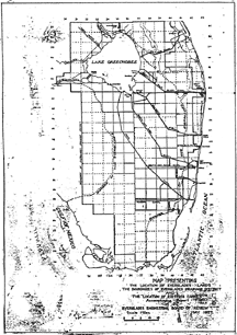
map showing location of the Everglades Location of the Everglades, from Anson Marston, S. H. McCrory, and George B. Hills, Report of the Everglades Engineering Board of Review to Board of Commissioners of Everglades Drainage District, figure number 1. [larger image]

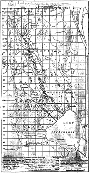
map of watershed of Lake Okeechobee Watershed of Lake Okeechobee, from Anson Marston, S. H. McCrory, and George B. Hills, Report of the Everglades Engineering Board of Review to Board of Commissioners of Everglades Drainage District, figure number 5. [larger image]

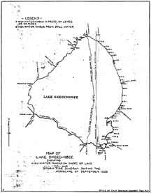
map of high water marks on the shore of Lake Okeechobee,  Hurricane of September 1928 High Water Marks on the Shore of Lake Okeechobee, September, 1928, Hurricane, from Frederick C. Eliot, Biennial Report, 1927-1928, to the Board of Commissioners of Everglades Drainage District, 28. [larger image]

< Return to Junius E. Dovell main page


| Disclaimer | Privacy Statement | Accessibility |

U.S. Department of the Interior, U.S. Geological Survey
This page is: http://sofia.usgs.gov/memorials/dovell/thesis/maps.html
Comments and suggestions? Contact: Heather Henkel - Webmaster
Last updated: 01 November, 2006 @ 01:22 PM(TJE)