Kamchatka Peninsula (KM/KL)
Pronunciation: (kamchat´ke)
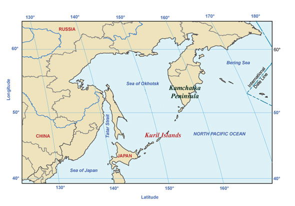
Kamchatka Peninsula separates the Sea of Okhotsk from the Bering Sea and North Pacific Ocean. To the south lies the Kuril Strait, which separates the peninsula from the Kuril Islands. Extending from lat. 51°N to lat. 61°N, it is 750 mi (1,207 km) long and terminates in the south in Cape Lopatka, beyond which lie the Kuril Islands. Petropavlovsk is the chief city. There are many rivers and lakes, and the eastern shore is deeply indented by gulfs and bays. The peninsula's central valley, drained by the Kamchatka River, is enclosed by two parallel volcanic ranges that extend north-south; there are about 120 volcanoes, 20 of which are active. The highest point is Klyuchevskaya Sopka (15,600 ft/4,755 m), itself an active volcano. Kamchatka is covered with mountain vegetation, except in the central valley and on the west coast, which has peat marshes and tundralike moss. The climate is cold and humid. There are numerous forests, mineral springs, and geysers.
Kuril Islands (KM/KL)
Pronunciation:(kyoor´el, koorel´) or Kuriles
Pronounced Chishima-Retto in Japanese and Kurilskiye Ostrova in
Russian.
Kuril Islands is an archipelago located between the Kamchatka Peninsula and Japan separating the Sea of Okhotsk from the North Pacific Ocean. The archipelago is comprised of 30 large and many small islands which are still active causing frequent earthquakes. The low temperature, high humidity, and persistent fog make the islands unpleasant for human habitation. There are, however, communities engaged in sulfur mining, hunting, and fishing.