

 NCDC
/ Climate Monitoring
/ Regional Precip Ranks
/ Search
/ Help
NCDC
/ Climate Monitoring
/ Regional Precip Ranks
/ Search
/ Help

|
|
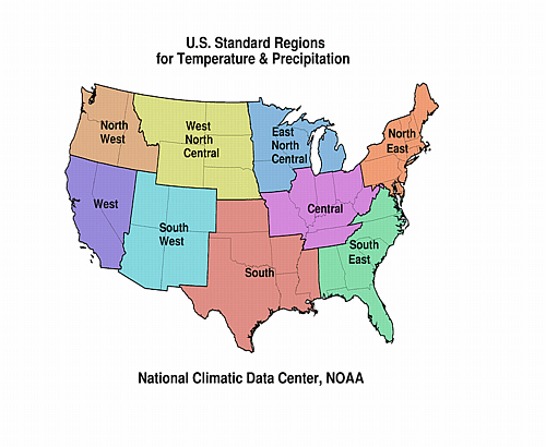
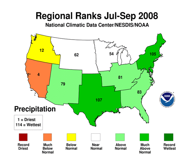
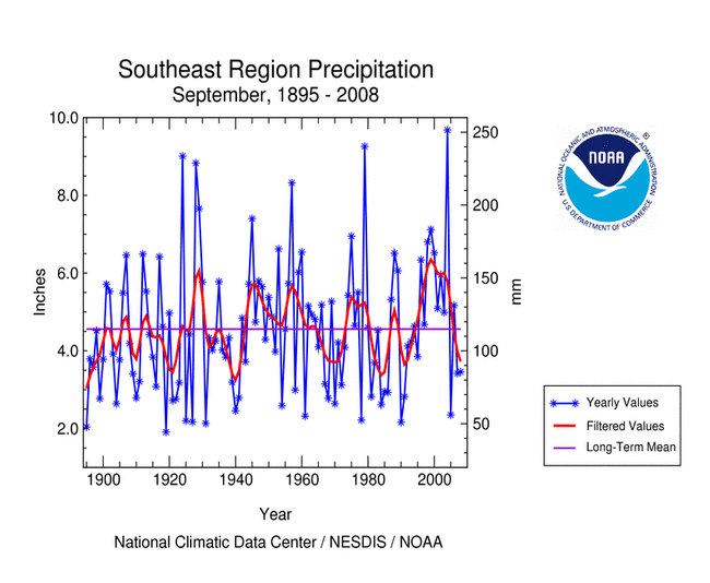
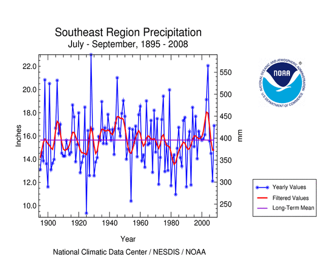
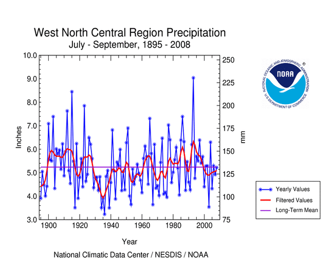
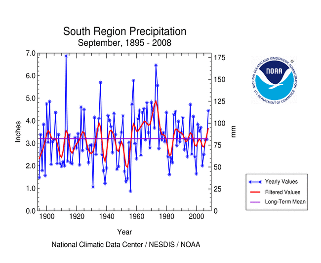
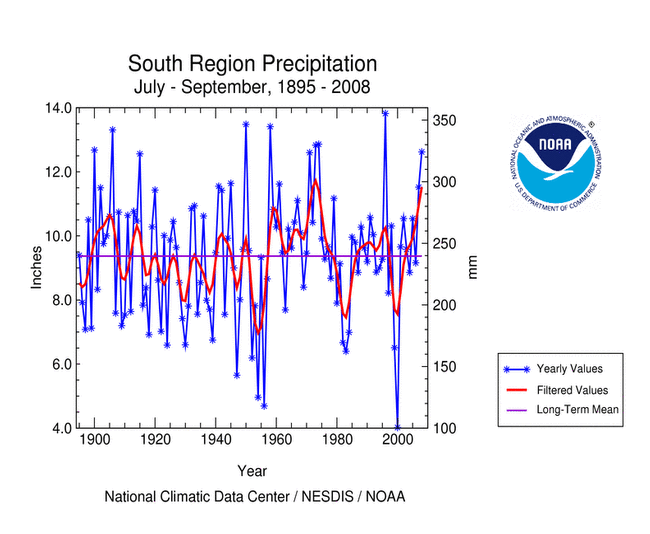
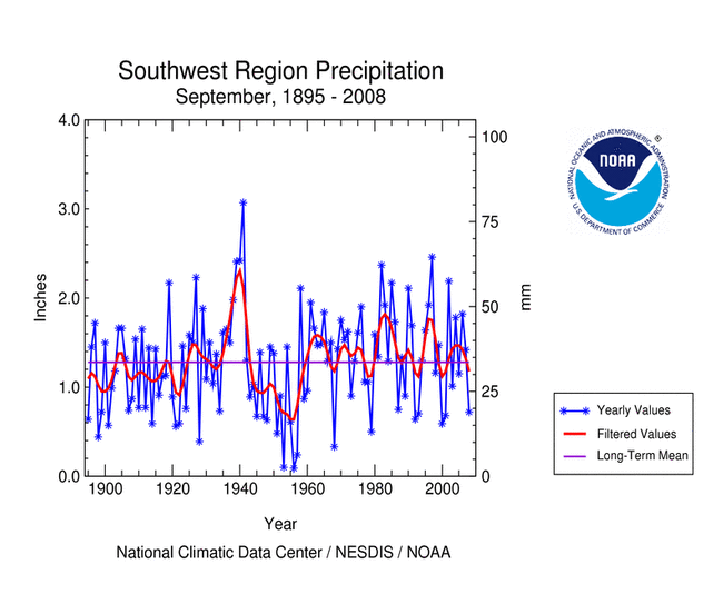
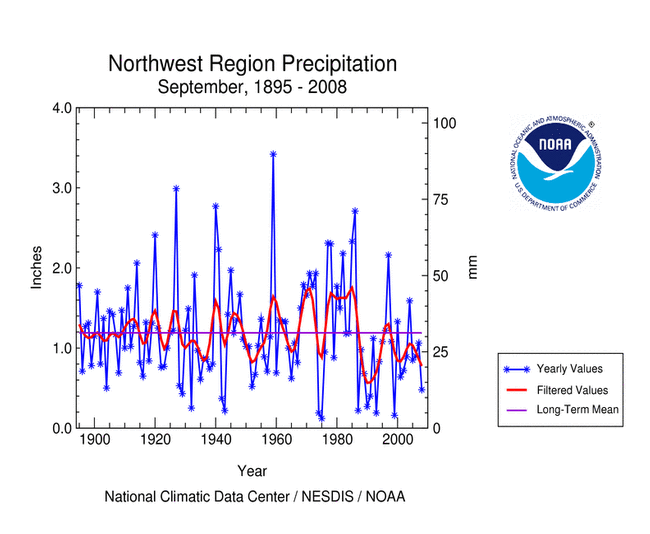
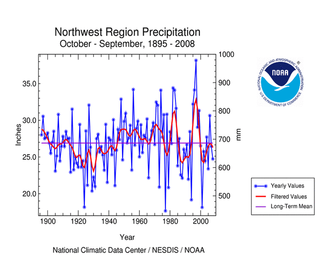
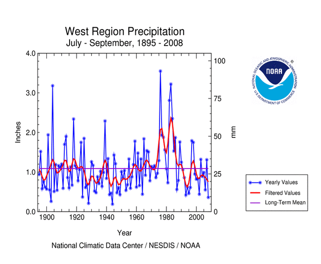
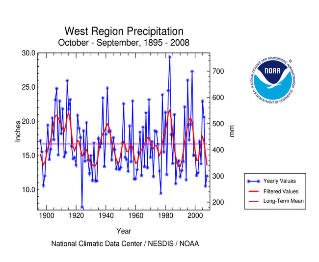
The following table shows the precipitation ranks for the nine standard
U.S. regions for August 2008, the three-month
period June - August 2008, and the twelve-month period September 2007 - August 2008.
A rank of 1 is driest and 114 (113 for September - August ) is wettest.
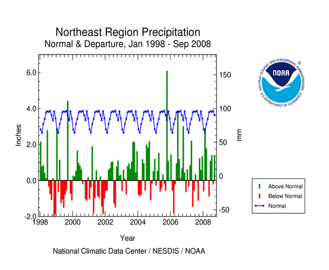
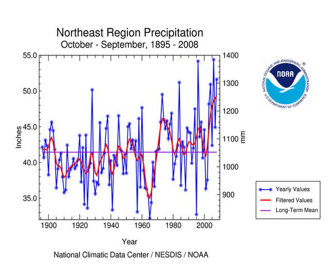
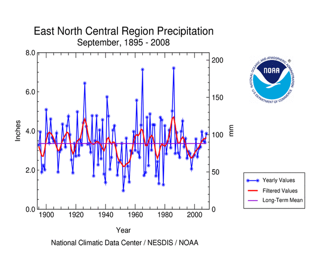
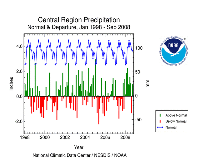
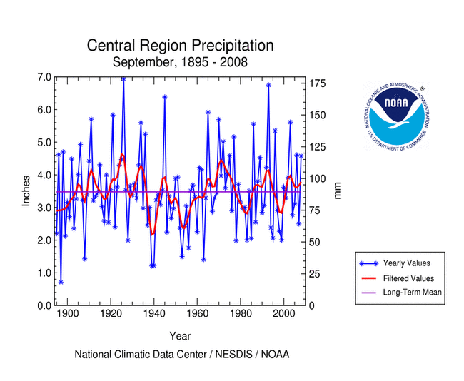
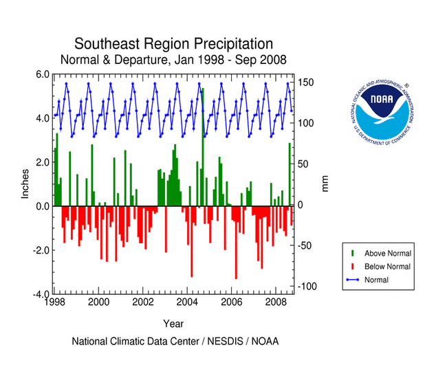
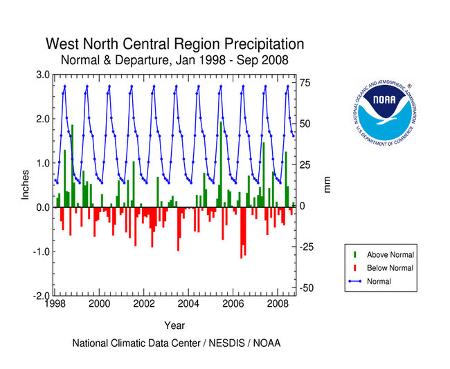
(Clicking on the number in the body of the table will bring up a time series graph of precipitation from 1895 to present for the region. Clicking on the region name will bring up a time series graph of normal precipitation and departure from normal precipitation for the last few years for the region. Clicking on the month name in the column headings will bring up a map showing the regional precipitation ranks.) |
 NCDC
/ Climate Monitoring
/ Regional Precip Ranks
/ Search
/ Help
NCDC
/ Climate Monitoring
/ Regional Precip Ranks
/ Search
/ Help

