Global Analysis / Global Hazards / United States / U.S.
Drought / Extremes
Use these links to access detailed analyses of Global and U.S. data.

 Drought & Heat | Flooding | Storms | Tropical Cyclones | Extratropical Cyclones | Severe Winter Weather


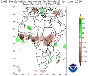
Africa Rainfall Anomalies
|
Wet-season rainfall alleviated dryness in parts of the Greater Horn of Africa during May and June 2006. Despite the welcome rainfall, long-term drought persisted in central and eastern Kenya as well as eastern Ethiopia and central Somalia. For the
latest African analysis and forecast, see the Famine Early Warning System Network.
|


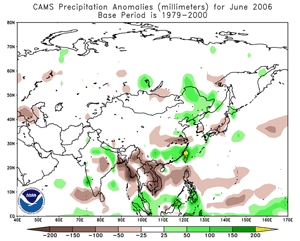
In southern China, rainfall rates on the order of 99 mm (3.5 inches) in two hours forced the Bashili River out of its banks, flooding 11 villages in Fujian province. In the southwestern province of Sichuan, a landslide prompted by heavy rainfall killed 11 people on the 19th in Shiji Village (Xinhua). On the 25th, flash flooding in the Hunan province of southern China killed 11 people (Associated Press). The Chinese government characterized the summer flooding as the worst in 30 years in parts of the country, with 349 weather-related deaths in June (Associated Press/AFP). |

Asia Rainfall Anomalies For June 2006
|

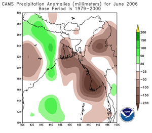
India Rainfall Anomalies
|
In India, monsoon rainfall produced flooding and landslides in the northeastern states of Assam and Tripura. There were 8 reported deaths and 75,000 people displaced from their homes by the second week of June. Nationwide, an early onset of the monsoon season (late May 2006) resulted in 308 reported fatalities due to flooding by the end of June (AFP/DPA).
|

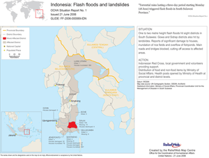
Flooding In Indonesia
|
In Indonesia, torrential rainfall produced flooding on eastern Sulawesi Island in the South Sulawesi province on the 19th-20th. In the hardest-hit district of Sinjai, at least two roads were blocked by landslides, and water and mud reached 2.1 meters (7 feet) high. There were at least 216 reported fatalities (Associated Press/Reuters/IFRC).
|
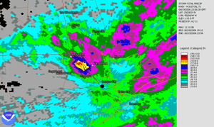
In the United States, persistent heavy rainfall deposited up to 280 mm (11 inches) of rain in the greater Houston, Texas area on the 19th. Widespread flash flooding was the result in south and east sections of the city. The Houston Fire Department rescued more than 500 people from flood waters with no serious injuries or fatalities reported (Reuters). |

Houston Flooding
|

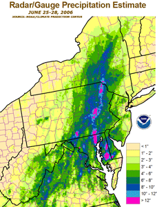
Northeast U.S. Rainfall
|
Across the Mid-Atlantic and Northeast, exceptionally heavy rainfall occurred during June 22-28. Rain amounts exceeded 254 mm (10 inches) in some areas, with numerous daily and monthly rainfall records set. Flooding was widespread throughout the greater Washington, DC area, northward through parts of Pennsylvania and New York. As the Susquehanna River rose above flood stage, up to 200,000 people in the Wilkes-Barre, PA area were forced to evacuate. Regionally, there were 16 deaths blamed on the flooding, along with preliminary damage estimates exceeding $100 million (USD) (CNN/Reuters).
|
In northern Romania, heavy rainfall caused a deadly mudslide on the 21st that killed at least 9 people in the Bistriat Nasaud area (AFP). |


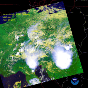
Severe thunderstorms in Germany on the 29th produced large hail the size of tennis balls in Villingen-Schwenningen. About 100 people were injured, mostly from cuts to the head. One man drowned due to flooding near Offenburg (BBC News). |

Thunderstorms In Europe
|


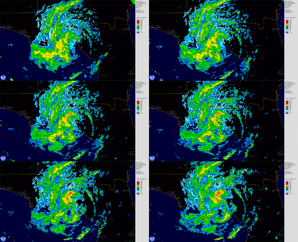
Tropical Storm Alberto
|
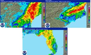
Tropical Storm Alberto developed as a depression in the northwestern Caribbean Sea on the 10th. The cyclone reached tropical storm strength the next day as it moved into the Gulf of Mexico. Alberto made landfall in Apalachee Bay along the Florida panhandle around midday on the 15th with maximum sustained winds near 85 km/hr (40 knots or 50 mph). The primary impacts from Alberto were heavy rainfall and flooding, with areas of western Cuba receiving as much as 305 mm (12 inches) of rain during the 10th-11th.
|

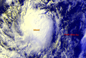
Tropical Storm Jelawat
|
Tropical Storm Jelawat formed in the South China Sea on the 26th and made landfall in southeast China's Guangdong province on the 29th near Zhanjiang. Jelawat weakened below tropical storm intensity before landfall, with maximum sustained winds near 55 km/hr (30 knots or 35 mph). The primary impact from this system was heavy rainfall in areas of Guangdong and Guangxi provinces.
|


No reports of significant extratropical cyclones were received during June 2006 |


For all climate questions other than questions concerning this report,
please contact the National Climatic Data Center's Climate Services
Division:
- Climate Services Division
NOAA/National Climatic Data Center
151 Patton Avenue, Room 120
Asheville, NC 28801-5001
fax: 828-271-4876
phone: 828-271-4800
email: ncdc.orders@noaa.gov
|

For further information on the historical climate perspective presented in this report, contact:
- Scott Stephens
NOAA/National Climatic Data Center
151 Patton Avenue
Asheville, NC 28801-5001
fax: 828-271-4328
email: Scott.Stephens@noaa.gov
|
|


