Global Analysis / Global Hazards / United States / U.S.
Drought / Extremes
Use these links to access detailed analyses of Global and U.S. data.

 Drought & Heat | Flooding | Storms | Tropical Cyclones | Extratropical Cyclones | Severe Winter Weather


Across the United States, significant drought extended from the Desert Southwest eastward through the Southern Plains. Exceptional drought classification was noted across Deep South Texas. |
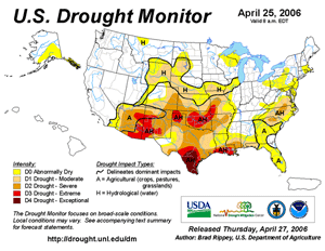
U.S. Drought Monitor
|
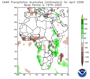
Africa Rainfall Anomalies
|
A severe long-term drought continued throughout areas of Ethiopia, Somalia and Kenya. The most severely affected areas included the Gedo region of Somalia, the Somali region in Ethiopia and the Mandera district in Kenya (ICRC). The beginning of the rainy season brought limited relief to the region by mid to late month. For the
latest African analysis and forecast, see the Famine Early Warning System Network.
|
A sandstorm originating along the China/Mongolia border affected Beijing on the 17th. It was the eighth sandstorm of 2006 for the Chinese capital, and reportedly the worst so far this year. Reduced visibilities also spread eastward to the Korean Peninsula (BBC News). |
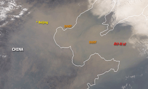
China Sandstorm
|


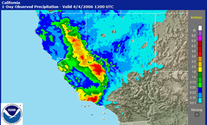
California Precipitation
|
In the United States, heavy rainfall across coastal and valley areas of California produced flooding during April 3-5. Streams and creeks rose out of their banks, and an earthen dam near Valley Springs threatened to rupture on the 5th, forcing the evacuation of about 100 homes (Associated Press). Heavy snow fell throughout mountainous areas.
|
By the 13th, California governor Arnold Schwarzenegger declared nine counties a disaster area due to heavy rainfall and flooding since the beginning of the month (Associated Press). Precipitation surpluses since the 1st were more than 200 mm (8 inches) in some areas of the state. |
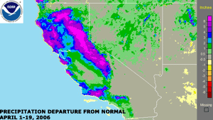
California Precipitation Departures
|
In Australia, flooding in the outback town of Katherine forced the evacuation of nearly 600 people. Days of heavy rainfall caused the Katherine River to rise above the flood stage. The town of Katherine, population 2,000, is located about 300 km (185 miles) south of Darwin in the Northern Territory (Reuters). |
Thunderstorms in Yemen produced flash flooding during the 3rd-5th. At least 25 people were killed from the storms and flooding, including a number lightning-related deaths (AFP). |
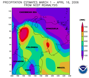
Colombia Rainfall Estimates
|
Flooding in Colombia was prompted by heavy rainfall that began in early March 2006 and continued through much of April. At least 70 people were killed by flooding and mudslides since the rains began. The worst disaster occurred along the Pacific coastline near the city of Buenaventura, where a landslide killed 31 people on the 13th. More than 225 homes were destroyed and 2,000 damaged (AFP).
|
Heavy rainfall and snowmelt produced extensive flooding along the Danube River in April. The river reached its highest level in 111 years (Xinhua). Areas of Hungary, Bulgaria, Serbia and Romania were the hardest hit, with many roads and bridges in the region damaged and expansive areas of farmland flooded. Thousands of people were displaced from their homes (Reuters, Associated Press). |
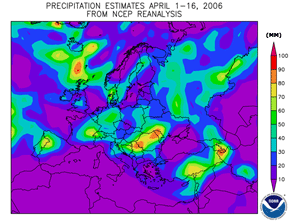
Europe Rainfall Estimates
|
In Indonesia, monsoon-related rainfall produced flooding in East Java during mid-April. At least 23 deaths were reported by the 20th, with most of the fatalities occurring in the Bendungan subdistrict (AFP). |
Across northern Argentina, heavy rainfall produced flooding in the northern provinces of Salta, Jujuy and Formosa. By late in the month, at least 150 homes and several bridges were destroyed, displacing as many as 6,000 people (IFRC). |


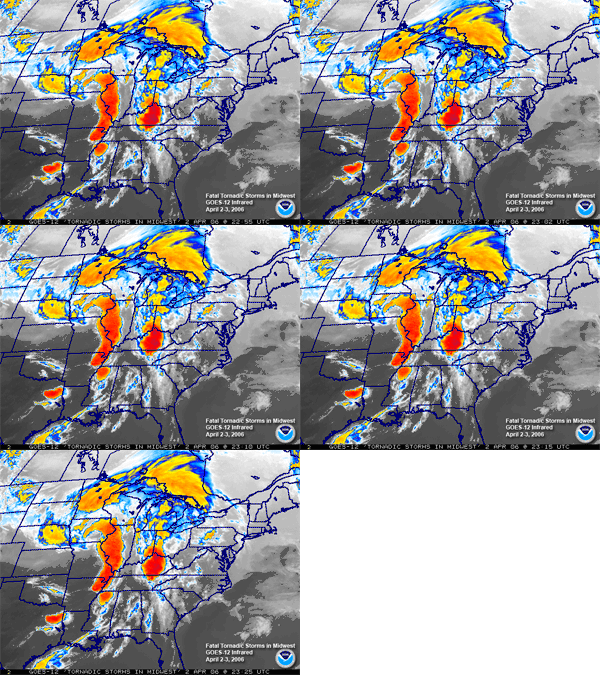
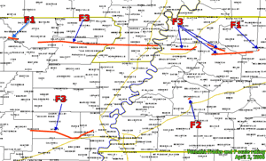
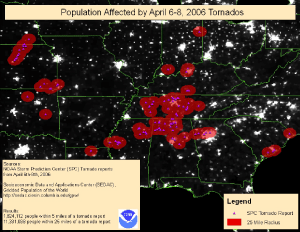
On April 13, severe thunderstorms produced a tornado that ripped through eastern Iowa, including Iowa City and the University of Iowa campus where significant damage occurred. There was one fatality in the state (Associated Press). For a complete analysis on tornado outbreaks during March and April 2006 in the United States, please see this special report. |
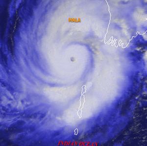
Across eastern India, strong thunderstorms produced heavy rainfall and strong winds in the city of Kolkata and surrounding districts on the 25th. Winds gusting as high as 109 km/hr (68 mph) temporarily knocked out power to much of the city. There were nine fatalities (AFP). |


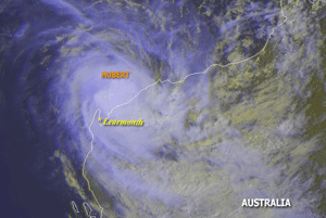
Tropical Cyclone Hubert
|
Tropical Cyclone Hubert developed in the southern Indian Ocean on the 5th, reaching the coast of Western Australia near Onslow on the 7th. Maximum sustained winds at the time of landfall were near 100 km/hr (55 knots or 65 mph), with heavy rainfall as the primary impact.
|
Tropical Cyclone Monica developed in the Coral Sea on the 17th and reached Australia's Cape York Peninsula in northern Queensland near Cape Sidmouth by the 19th with maximum sustained winds near 150 km/hr (80 knots or 90 mph). Monica was the fourth tropical cyclone to strike Australia since the beginning of March 2006. |
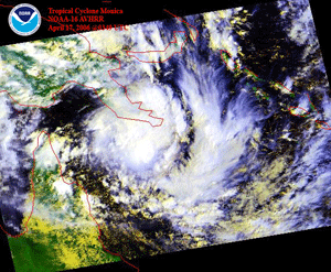
Tropical Cyclone Monica
|
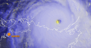
Tropical Cyclone Monica
|
Monica re-strengthened over the warm waters of the Gulf of Carpentaria, reaching maximum sustained wind speeds of 290 km/hr (155 knots or 180 mph) before making landfall in the vicinity of Maningrida on the 24th. Strong winds and heavy rains lashed the region. Monica contributed to a record amount of April rainfall at Darwin, where 383 mm (15.1 inches) were recorded through the 27th. The old April rainfall record was 357 mm (14.1) observed in 1953 (News Limited). Monica was the strongest tropical cyclone on record to affect the Northern Territory (Australian Bureau of Meteorology).
|


No reports of significant extratropical cyclones were received during April 2006 |


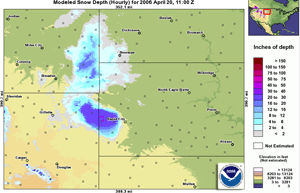
Snowfall In The Black Hills
|
In the United States, a late season winter storm dumped heavy snow on the Black Hills of South Dakota and adjacent states during the 18th-19th. While the heaviest snowfall was rather localized, a report of 151 cm (59.4 inches) of storm total snowfall was received at Lead, South Dakota.
|

For all climate questions other than questions concerning this report,
please contact the National Climatic Data Center's Climate Services
Division:
- Climate Services Division
NOAA/National Climatic Data Center
151 Patton Avenue, Room 120
Asheville, NC 28801-5001
fax: 828-271-4876
phone: 828-271-4800
email: ncdc.orders@noaa.gov
|

For further information on the historical climate perspective presented in this report, contact:
- Scott Stephens
NOAA/National Climatic Data Center
151 Patton Avenue
Asheville, NC 28801-5001
fax: 828-271-4328
email: Scott.Stephens@noaa.gov
|
|


