


|

|


Welcome to the National Climatic Data Center's (NCDC) Climate Maps Of The United States database (CLIMAPS)!
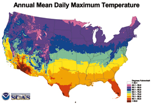
In here you will find over 2000 climate maps of the United States, including Alaska and Hawaii.
These full color maps are available for climatic elements such as temperature, precipitation, snow, wind, pressure, etc., chosen to portray the climate of the U.S.
The period of record of the data for most of the maps is 1961-1990. Most of the maps can be downloaded in a high resolution Adobe PDF format, or as ESRI Shape Files. A sample PDF is available.
|
|
All of these products are now available FREE of charge.
To get started, click on the Quick Search or Most Popular buttons at the left.
From Quick Search, you can find maps of a specific weather element and period.
The entire set of climate maps available here is also available for purchase on NCDC's Climate Atlas Of The Contiguous United States CD-ROM.
There is an online version of the Climate Atlas, viewable at no charge.
Documentation is also available for the Climate Atlas maps.
|
|