background image NOAAVents ProgramAcoustics Program
  Monitoring the global ocean through underwater acoustics
non-clickable
non-clickable go to Acoustics home non-clickable scroll down for Methods non-clickable scroll down for Results non-clickable scroll down for Multimedia non-clickable
non-clickable non-clickable non-clickable non-clickable
 

Read This Before Selecting Data Files

The NOAA T-Phase data are organized into 1-Day files. The file names reflect the Hydrophone General Location, Year and Julian Date of the data. The nomenclature can be used for selecting the data files of interests. The format of these 1-Day NHP (NOAA HydroPhone) data files is described on the NHP Internal Format page.


Structure of the NHP file name
The NHP file name in general is as follows:

H##[N/S]xxx[E/W]YrDay[A/B/..../Y/Z].nhp
where ## and xxx are integers for latitude and longitude in degrees respectively; Yr is last 2 digits, such as '99' = Year 1999 and '00' = Year 2000 etc.; Day is Julian Date, day of the year in 001 to 366; the nhp suffix indicates it is the NOAA Hydrophone data file.

The first part of the file name H##[N/S]xxx[E/W] shows the general location of the Hydrophone. The "N" or "S" and "E" or "W" will be used to indicate the hemispheres of latitude and longitude. Yr and Day indicate the Date of the data.

The time range of data is indicated by a letter "A" to "Z" after YrDay. When the letter "Z" is shown, the NHP file is a 1-Day file from time 00:00:00 to 23:59:59. NHP files with the letters "A" to "Y" are not whole day files. For NHP files with the letter "A", the data are from the beginning of the date, 00:00:00, to some time before the NHP file with the letter "B" (if it exists) of the same Year and Day. For NHP files with the letter "Y", the data are from some time after the end time of the NHP file with the letter "X" (if it exists) of the same Year and Day to the end of the day, 23:59:59. For other NHP files with the letters "B" to "X" of the same Year and Day, their times are in between the end time of file with "A" and the start time of the file with "Y". An example of the nomenclature of NHP files is:

H*YrDayA.nhp < H*YrDayB.nhp < ... < H*YrDayX.nhp < H*YrDayY.nhp
A-00:00:00 to t1 | B-t1 to t2 | X-tn-1 to tn | Y-tn to 23:59:59
Where t1 to tn are times in between 00:00:00 and 23:59:59.

1-Day File: H*YrDayZ.nhp from 00:00:00 to 23:59:59.

In most cases, only NHP files with "Z", "A" and "Y" will be found and a few files with "B" also exist. When NHP files with the letters "A" and "Y" of the same day and year are used, there is a time (data) gap during that day.

Examples of the NHP File Names

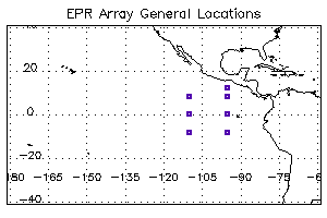
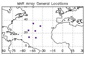
H16N049W99362Z.nhp is a 1-Day file of Year 1999 Julian Date 362 at the general location of 16oN and 49oW.
H16N049W00057A.nhp and H16N049W00057Y.nhp show two data files of the same day with a time gap after time 00:00:00 and before 23:59:59.
H08S110W02111Z.nhp another 1-Day file of Year 2002 Julian Date: 111 from a different location.

Select NHP Data Files

The following links point to the ftp sites that contain the NHP data files. Choose a location of interest and select a NHP data file to down load. Note that since the Year is represented by 2 digits, e.g. "99" for 1999 and 00 for 2000, NHP data files for 1999 may be shown at the bottom of screen.


East Pacific Rise Array
1999 to 2002

Time Ranges and Data Gaps

12N 095W
2000-(318) to 2002-(285), 2002-(285 to 288)
08N 095W
1996-(129) to 1997-(039), 1997-(039 to 273) 1998-(046 to 292) , 1998-(315) to 2001-(326) 2001-(326) to 2002-(287), 2002-(287 to 320)
08N 110W
1996-(144) to 1997-(235), 1997-(058) to 1998-(296) 1998-(296) to 1999-(316), 2000-(297) to 2001-(310) 2001-(320) to 2002-(305), 2002-(306) to 2003-(022)
00N 095W
1996-(130) to 1998-(300), 1998-(311) to 2000-(329) 2000-(330) to 2002-(254)
00N 110W
1996-(140) to 1997-(232), 1997-(232) to 1998-(300) 1998-(300) to 2000-(302), 2000-(303) to 2002-(015)

  Map of the EPR Array General Locations08S 095W
1996-(133) to 1997-(046), 1997-(046) to 1998-(300) 1998-(307) to 2001-(308), 2001-(308) to 2002-(294)
08S 110W
1996-(137) to 1997-(050), 1997-(051) to 1998-(057) 1999-(135) to 2001-(311), 2001-(312) to 2002-(298)
     

Mid-Atlantic Ridge Array
February 1999 to April 2004

Time Ranges and Data Gaps

35N 043W
1999-(037)to 2001-(084), 2003-(110) to 2004-(094)
32N 035W
1999-(039)to 2003-(114), 2004-(090) to 2005-(161)
26N 050W
1999-(044) to 2002-(039) 2002-(040) to 2003-(119) , 2004-(273) to 2005-(154)
26N 040W
1999-(042) to 2002-(041) 2002-(042) to 2003-(116) 2004-(087) to 2005-(163),

  Map of the MAR Array General Locations 16N 049W
1999-(052) to 2004-(010), 2004-(074) to 2005-(091)
16N 043W
1999-(048)to 2002-(047), 2004-(081) to 2005-(165)


Request

If you use the data in publications, please acknowledge the NOAA/ PMEL Acoustics Project Office, Woods Hole Oceanographic Institution, and Lamont-Doherty Earth Observatory. Also, we would appreciate receiving a preprint and/or reprint of those publications utilizing the data for inclusion in the NOAA Acoustics Project bibliography. Relevant publications should be sent to:
Dr. Robert Dziak, NOAA Vents Program, 2115, SE OSU Drive, Newport, Oregon 97365.


Acknowledgements
The MAR and EPR data were made available online through grants from the:
and
the
     
Both projects are also supported by the NOAA/ PMEL Vents Program
 
Vents Home Contacts-Credits Bibliography Links Disclaimer Privacy Policy