 |
Most of the storm histories were
from the preliminary
storm reports
provided by the National
Hurricane Center or from their online archive of Monthly
Weather Review annual articles from 1871 forward. The National
Climatic Data Center was the source for satellite
imagery, rainfall reports by state, and special
hurricane related reports. The Hydrometeorological
Prediction Center was the source for the daily rainfall
maps, which were originally produced over the decades for verification
of their rainfall forecasts. The Comision Nacional del Agua,
parent agency
of Servicio Meteorologico Nacional, Mexico's National Weather Service,
was the source of rainfall information for Mexico. The National
Weather Service offices
at San
Juan PR, Wilmington NC,
Wakefield VA, Houston/Galveston TX, Charleston SC, Peachtree City GA, and Miami FL were also of great
help to this project. Rainfall mesonets maintained by CoCoRaHS, South
Florida Water Management District, Southwest
Florida Water Management
District, Chester
County PA rainfall network, Jefferson County
TX Drainage
District 6, and the Harris County Office
of Emergency Management were of great help in finding the absolute
maximum from several tropical cyclones. The tropical cyclone
rainfall forecasting document linked on the main page was composed by
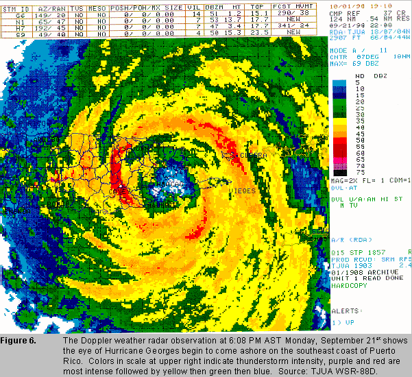
Wes Junker of HPC. The radar image to the
left of Georges making
landfall upon Puerto Rico was provided by the San Juan Weather Service
Office.
|
