| USGCRP
Home |
| Search |
| USGCRP
Home |
| Search |
Updated 20 August 2008
|
OUR CHANGING PLANET
A Report by the Climate Change Science Program and |
|
PDF version of this section of the report PDF version of the full report The hardcopy version of this report is available free of charge from the GCRIO Online Catalog
|
4. Land Use and Land Cover Change
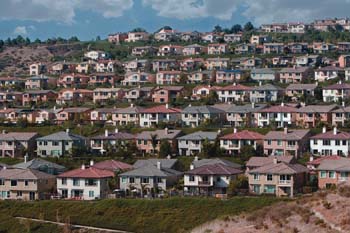
The global climate system is affected by land-use and land-cover changes through biogeophysical, biogeochemical, and energy exchange processes. These changes in turn affect climate at local, regional, and global scales. Key processes include uptake and release of greenhouse gases by the land cover of the terrestrial biosphere to and from the atmosphere through photosynthesis, respiration, and evapotranspiration; the release of aerosols and particulates from surface land-cover change perturbations; variations in the exchange of sensible heat between the surface and atmosphere due to land-cover changes; variations in absorbance and reflectance of radiation as land-cover changes affect surface albedo; and surface roughness effects on atmospheric momentum that are land cover-dependent. While human activity can alter many of these processes, weather, climate, and geological processes are also important.
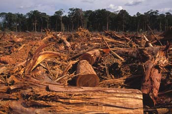
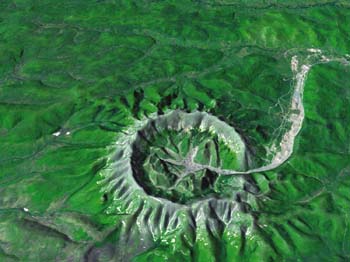
For example, changes in land cover modify the reflectance of the land surface, determining the fraction of the Sun’s energy absorbed by the surface and thus affecting heat and moisture fluxes. These processes also alter vegetation transpiration and surface hydrology and determine the partitioning of surface heat into latent and sensible heat fluxes. At the same time, vegetation and urban structure determine surface roughness, thus air momentum and heat transport. In addition, deforestation and forest fires alter ecosystems and release carbon dioxide (CO2), methane (CH4), carbon monoxide, and aerosols to the atmosphere. Land-use and land-cover change studies also provide valuable information for largescale vegetation biomass and forest cover assessments that are key components of the carbon cycle. Future land-use and land-cover change goals include (1) very accurate biomass estimates, thus refining knowledge of carbon storage in vegetation, (2) understanding regional land-use changes that affect biomass, and (3) quantifying linkages and feedbacks between land-use and land-cover change, climate change forcings, climate change, and other related human and environmental components. Research that examines historic, current, and future land-use and land-cover change, its drivers, feedbacks to climate, and its environmental, social, economic, and human health consequences is therefore of great importance for understanding climate and requires interagency and intergovernmental cooperation. One example of a multiagency effort is the Congo Basin Forest Partnership, which focuses on conserving this rainforest in equatorial Africa, the second largest tropical rainforest in the world. Satellite data are used to map forest extent, determine habitat fragmentation, enforce conservation laws, and thus minimize greenhouse gas emissions from deforestation land-use changes. Another example is the North American Carbon Initiative that seeks to understand the carbon cycle for North America.
HIGHLIGHTS OF RECENT RESEARCHThe following are selected highlights of recent research into land-use and land-cover change issues supported by CCSP-participating agencies. A Basin-Scale Econometric Model for Projecting Future Amazonian Landscapes.1,2 A team of U.S. and Brazilian researchers collaborated in a study predicting the intensity of deforestation of the Amazon Basin resulting from four different economic development scenarios. Projections were generated from results of econometric modeling based on economic theory and detailed local observation. The projections considered scenarios defined by three factors, including trends in population growth (expected and low rates), the nature of anticipated infrastructure investments (Avança Brasil and successor projects, or not), and efforts at governance (unofficial road building), reflected by the depth of control over forest conservation in protected areas and on private holdings. The study considered potential variations among these three factors to predict the relative percentage of closed forest cleared by 2020. For the scenarios chosen, the resulting projected percentage deforestation (in parentheses) are as follows:
North American Vegetation Dynamics Observed with Multi-Resolution Satellite Data.3 Normalized difference vegetation index (NDVI) data from Advanced Very High- Resolution Radiometer (AVHRR) instruments were used from 1982 to 2005 to identify regions in North America that experienced increases in annual photosynthetic capacity from 1982 to 2005. The identified regions were next investigated with Landsat imagery, Ikonos data, aerial photography, and ancillary data to determine the cause of the increase in photosynthesis. Not surprisingly, a range of causes for the NDVI increases were found: increased precipitation; warmer spring conditions; severe drought and subsequent recovery; expansion of irrigated agriculture; logging and subsequent regeneration; and forest fires with subsequent regeneration. Higher latitude areas were affected solely by the climatic influences of warmer temperatures. In other areas, however, land-use and land-cover changes were responsible for the changes in photosynthesis observed. In the Southern Great Plains, a semi-arid region, a massive expansion of center-pivot irrigated agriculture occurred that was responsible for the regional changes observed (see Figures 10 and 11). Large-scale logging, referred to as “progressive clear cuts,” was found to be responsible for significant changes in photosynthesis in the province of Quebec. The logged areas first experienced a decrease in photosynthesis immediately following clearing, followed by a gradual recovery of photosynthesis over the next 10 to 15 years.
This work shows the value of using different types of satellite data to study climate and land-use and land-cover change. Coarse-resolution time series “survey” data are used to identify areas where variations in photosynthesis have occurred, then Landsat and climate data are used to understand possible land-use changes and/or climatic variation in the specific “survey” areas identified. Identifying Land-Use and Land-Cover Change in Central America.4,5,6 Seasonal tropical forests of the southern Yucatan Peninsula form the largest expanse of this ecosystem type remaining in Mexico. It forms an ecocline between a drier region to the north and humid forest to the south in Guatemala. Increasing population and intensification of agriculture since the 1960s has raised international concerns about the effects of these land-use changes on this large carbon and biodiversity reservoir. This led to the creation of the Calakmul Biosphere Reserve to preserve this unique forested area. The Southern Yucatan Peninsular Region Project is currently engaged in an assessment of the vulnerability/resilience of the coupled human-environment system in the face of multiple and highly dynamic land-use changes underway in the region. It addresses the consequences to ecosystem services, forest structure, and land surface temperatures and fire potential in the face of increasing settlement and expansion and intensification of agriculture throughout the region. The project employs Landsat, Moderate Resolution Imaging Spectrometer (MODIS), and AVHRR satellite imagery, ecological information, and socioeconomic studies. Recent biodiversity studies have found that the current landscape matrix maintains the biotic diversity of the reserve but this is threatened by the loss of humid forests to the south and the interruption of biotic flow across the ecocline due to habitat fragmentation. Current land uses also threaten overall biomass productivity due to declining nutrient conservation.
Map of Russian Forest Biomass.7 Scientists at the Woods Hole Research Center and Oregon State University have collaborated with Russian scientists to produce two maps of forest biomass for Russia. Both maps were based on a regression-tree analytical approach that determined the relationship between ground data collected at 12 sites across Russia and satellite data for all the forests of Russian as part of a forest inventory study in 2000. The total Russian forest biomass estimates ranged from 46 to 67 Gt dry matter. This is important initial work to determine carbon stocks in Russian boreal forests. North American Native Tallgrass Prairie: High Carbon Storage, Rapid Loss from Cultivation, Slow Increase from Restoration.8,9 Tallgrass prairie is the most extensive grassland type in North America, ranging from Texas to Minnesota and north into Canada, but over 95% of the original prairie has been converted to agricultural row crops. There is increasing interest in restoring these grassland systems for conservation, biodiversity, carbon sequestration, and other conservation goals. A recent study sampling native prairie, converted prairie in row crops, and restored prairie showed that the largest pools of soil organic carbon in the United States are in prairie grass that survived from earlier times and that, on average, cultivation reduced soil carbon by nearly 30%. However, the carbon content of many restored prairies still did not approach that of native prairie after as long as 60 years, and only at the Texas site did restoration result in significantly higher soil carbon. The effects of land-use change were highly site-specific such that the effects of land use on carbon storage in this region defy any broad generalizations.
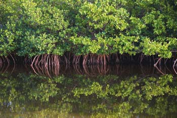
Mangrove Forest Losses in Tsunami-Affected Area of Asia.10 It is estimated that mangrove forests, including associated soils, can sequester approximately 1.5 metric tons of carbon per hectare each year, while disturbance or destruction of these forests can lead to the release of much of this carbon as the greenhouse gases CO2 or CH4. Time-series Landsat data from 1975, 1990, 2000, and 2005 were used to identify the present distribution, rate of change, and major causes of change in the tsunami-affected countries of South and Southeast Asia. The analyses for the first time show that (1) the region lost 12% of its mangrove forests from 1975 to 2005 (their present extent is about 1,670,000 ha); (2) annual deforestation during the same period was highest in Burma (~1%) and lowest in Sri Lanka (0.1%); and (3) net deforestation peaked at 137,000 ha during 1990 to 2000, increasing from 97,000 ha during 1975 to 1990, and declining to 14,000 ha during 2000 to 2005. The major causes of deforestation in the region were agricultural expansion (81%), aquaculture (12%), and urban development (2%), but there are major differences between countries. For example, in Burma, illegal logging and fuel wood collection coupled with degradation due to erosion and sedimentation are major factors, while urban development is a dominant factor in Malaysia and aquaculture is the most important cause in Indonesia. Information generated from this study can be used to identify potential rehabilitation sites and priority conservation areas.
HIGHLIGHTS OF PLANS FOR FY 2009The NASA-USGS Global Land Survey 2005. In order to quantify changes in land cover around the globe, suitable data sets must be made available to the science community. Landsat data are a very suitable source of satellite imagery to identify and map land-use and land-cover changes. A new global satellite data set—the Global Land Survey 2005 (GLS-2005 previously entitled the Mid-Decadal Global Land Survey)—is being prepared by NASA and USGS. The project team is assembling substantially cloud-free Landsat images for the Earth’s land areas centered on the 2004 to 2007 period, which are processed into an orthorectified data set. This project follows from previous efforts to assemble global Landsat collections centered on 1975, 1990, and 2000, and will provide a basis for rigorous assessment of land-cover changes during the last several years. Initial GLS-2005 products were released in early 2008, with the complete data set to be available at no cost from USGS by the end of 2008. While relying primarily on Landsat-7 and Landsat-5, GLS-2005 will also include imagery from the Earth Observing-1 (EO-1) Advanced Land Imager (ALI) and Terra Advanced Spaceborne Thermal Emission and Reflection Radiometer (ASTER) instruments as needed. In addition to the data processing activities, a CCSP agency Land-Use and Land-Cover Change initiative is funding a number of peer-reviewed proposals to generate land cover and land-cover change products and to analyze vegetation dynamics from GLS-2005 as well as the older GLS data from the 1970 to 2000 period. This activity will address CCSP Goals 1 and 2 and Questions 6.1 and 6.2 of the CCSP Strategic Plan. Land-Use/Land-Cover Change Effects on Soil and Water. USDA research funded through the Cooperative State Research, Education, and Extension Service (CSREES) is developing baseline stratigraphic markers for use in identifying effects of land-use change on riparian soil attributes. The research work will develop a quantitative technique that can be consistently applied over a region to identify layers in riparian soils affected by land-use changes. The ultimate goal is to establish pedologic and floristic changes represented by pollen profiles that are regionally correlated with specific dates and land-use/land-cover changes, and are recognizable from basin to basin. The work is being conducted in the southern New England region of the United States, focusing on Narragansett Bay, the Pawcatuck River, and the Thames River. Other research is developing adaptive agricultural management models that identify the best cropping systems for coping with climate and land-use changes in two watersheds of the Flathead River Basin, Montana. Research objectives include constructing plausible future climate and land-use change scenarios in terms of agriculturally sensitive climate variables, including precipitation, temperature, and CO2 concentrations. Best cropping systems will be determined in terms of profit or net return per unit land area, and water quality and the rate of soil erosion at the edge of the soil mapping unit. By making the model and associated data sets usable and accessible via an interactive website, agricultural producers will be able to adaptively manage their operations for climate and land-use changes. This activity will address CCSP Goals 1, 2, 3, and 4 and Questions 6.2, 6.4, and 6.5 of the CCSP Strategic Plan. Land-Use and Land-Cover Change Cross-Cuts with Ecosystems and the Global Carbon Cycle. Newly funded USDA research projects through CSREES cut across various CCSP program elements. A new research project has been initiated to integrate the effects of land-use change on invasive plant species distribution into an invasive plant atlas for the mid-southern United States. The project will quantify the relationships of weed distribution and spread with land use, and use that information directly in educating agriculture stakeholders, natural resource managers, and other interested parties on potential human-induced opportunities for invasive species spread. This project addresses objectives of the Land-Use and Land-Cover Change and Ecosystems research elements. Another cross-cutting project has been funded to assess the effects of land-cover and land-use change on carbon stocks in the southern United States, giving special attention to translating site-specific carbon pools to landscape scales. This project will investigate soil carbon in relation to land use, land cover, hydrology, topography, and other landscape attributes. The work addresses issues common to the Land-Use and Land- Cover Change and Global Carbon Cycle research elements. It also addresses USDA’s priority research areas, including spatially explicit soil carbon modeling. This activity will address CCSP Goals 1, 2, 3, and 4 and Questions 6.2, 6.3, and 6.4 of the CCSP Strategic Plan. Impacts and Interactions with Socioeconomic Factors. New projects at NSF will focus on the impacts and interactions among socioeconomic factors, including economic globalization, land-use and land-cover change, and climate change, particularly in Arctic and boreal regions. This activity will address CCSP Goals 1, 2, and 4 and Questions 6.1, 6.2, and 6.5 of the CCSP Strategic Plan. LAND-USE AND LAND-COVER CHANGE CHAPTER REFERENCES1) Perz, S.G., C. Overdevest, M.M. Caldas, R.T. Walker, and E.Y. Arima, 2007: Unofficial road building in the Brazilian Amazon: Dilemmas and models for road governance. Environmental Conservation, 34(2), 112-121, doi:10.1017/S0376892907003827. 2) Caldas, M., R.T. Walker, S. Perz, E. Arima, S. Aldrich, and C. Simmons, 2007: Theorizing land cover and land use change: The peasant economy of colonization in the Amazon Basin. Annals of the Association of American Geographers, 97(1), 86-110. 3) Neigh, C.S.R., C.J. Tucker, and J.R.G. Townshend, 2008: North American vegetation dynamics observed with multi-resolution satellite data. Remote Sensing of Environment, 112, 1749-1772. 4) Vester, H.F., D. Lawrence, J.R. Eastman, B.L. Turner II, S. Calme, R. Dickson, C. Pozo, and F. Sangermano, 2007: Land Change in the southern Yucatan and Calamul biosphere reserve: Effects on habitat and biodiversity. Ecological Applications, 17, 989-1003. 5) Lawrence, D., P. D’Odorico, L. Diekmann, M. DeLonge, R. Das, and J. Eaton, 2007: Ecological feedbacks following deforestation create the potential for a catastrophic ecosystem shift in tropical dry forest. Proceedings of the National Academy of Sciences, 104, 20696-20701. 6) Manson, S.M. and T. Evans, 2007: Land change science special feature: Agent-based modeling of deforestation in southern Yucatán, Mexico, and reforestation in the Midwest United States. Proceedings of the National Academy of Sciences, 104, 20678-20683. 7) Houghton, R.A., D. Butman, A. Bunn, O.N. Krankina, P. Schlesinger, and T.A. Stone, 2007: Mapping Russian forest biomass with satellites and forest inventories. Environmental Research Letters, 2(4), doi:10.1088/1748-9326/2/4/045032. 8) McCulley, R.L., N. Fierer, and R.B. Jackson, 2007: Restoration of grasslands after agriculture: Insights from regional chronosequences. Abstracts of the Ecological Society of America Annual Meeting, 5-10 Aug 2007, San Jose, California. Available at <eco.confex.com/eco/2007/techprogram/ P1427.HTM>. 9) McCulley, R.L., T.W. Boutton, and S.R. Archer, 2007: Soil respiration in a subtropical savanna parkland: Response to water additions. Soil Science Society of America Journal, 71, 820-828. 10) Giri, C., Z. Zhu, L.L. Tieszen, A. Singh, S. Gillette, and J.A. Kelmelis, 2008: Mangrove forest distribution and dynamics (1975-2005) of the tsunami-affected region of Asia. Journal of Biogeography, 35(3), 519–528. |
|