
- HOME
- EXPLORE
- Oceans
- Coasts
- Coastal Decision-making Tools
- Coastal Ecosystem Science
- Coastal Zone Management
- Coastal Monitoring and Observations
- Contaminants in the Environment
- Ecological Forecasting
- Harmful Algal Blooms
- National Estuarine Research Reserves
- Natural Hazards Assessment
- Natural Resource Restoration
- Training and Capacity- Building
- Charting and Navigation
- EDUCATION
- DATA EXPLORER
- NEWS
- OFFICES
- Center for Operational Oceanographic Products and Services
- International Program Office
- Management and Budget Office
- National Centers for Coastal Ocean Science
- National Geodetic Survey
- Office of National Marine Sanctuaries
- NOAA Coastal Services Center
- Office of Coast Survey
- Office of Ocean and Coastal Resources Management
- Office of Response and Restoration
- OUTREACH
- PUBLICATIONS
- WEB SITES
- ABOUT

|
|
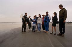
The NOAA Coastal Services Center (CSC) and other NOAA offices provide skills and information resources to state and local coastal resource managers. CSC personnel work directly with state and local partners to resolve site-specific issues by offering help with training needs, data and information needs, management strategies, and new and underutilized technology. The Center’s Web site summarizes many of these efforts. Many of these services are provided through the NOAA Coastal Services Center. The Center is a partner in projects geared toward resolving coastal issues in specific local, state, and regional locations. NOS's Office of Response and Restoration also provides coastal tools and technologies. Nontechnical Tools One of the challenges in coastal management is balancing the relationship between people and the environment. In an effort to meet this challenge, NOAA is continuing to invest in the scientific study of people, one of the social sciences. A Web site, HD.gov, created by the Center, is quickly becoming the preferred information resource for social science information. The site includes data sources, data analysis tools, on-line articles, user-submitted case studies, and an interactive forum. Specific assistance is also available through two publications. “Introduction to Survey Design and Delivery” and “Introduction to Stakeholder Participation” are good guides for programs that want to use social science tools. These publications can be obtained from the publications page of the Center’s Web site. Another nontechnical tool is Coastal Services, a bimonthly trade magazine for coastal managers. The publication is an information resource that showcases innovative ways in which state coastal programs address the many issues that confront them. The Coastal Management Fellowship Program brings new people and expertise to help state programs. Under the Program, postgraduate students in the field of coastal resource management spend two years working for a state coastal management program. The students bring new expertise to the state efforts, and the fellows receive valuable work experience.
Technical Tools NOS offers an entire suite of remote sensing products and services and a variety of geographic information system (GIS) services. Remote sensing involves the use of satellites, aircraft, and other sensing devices to gather information about land and water. NOS provides remote sensing data to state coastal programs, including land cover, topography, and benthic habitat data. Remote sensing also is used to measure water quality. GIS is a mapping information tool used within the coastal management community. NOS provides a variety of GIS data products, including digital shoreline data, a database of hurricane information, watershed database and mapping projects, and a GIS for the southeastern Atlantic Ocean. Other GIS tools include environmental sensitivity index maps, which help to identify coastal areas vulnerable to contamination. GIS also is used to help people gain access to the data contained in the extensive habitat characterizations produced by NOS for many regions in the coastal zone. The Integration and Development Program highlights additional GIS-related projects and services. GIS training and remote sensing training courses also are available.
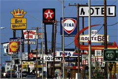
Smart Growth"Smart Growth" is a term frequently used by coastal communities as they struggle to maintain the balance between growth and preservation. The Web site Alternatives for Coastal Development: One Site, Three Scenarios is a tremendous tool for this effort. |
Educational ResourcesCoastal Decision-Making Tools Lesson Plans
Managing Coastal Growth: Summer 2004
|
|||||||||||||||||||

- NOS Program Offices
- Center for Operational Oceanographic Products and Services
- National Centers for Coastal Ocean Science
- NOAA Coastal Services Center
- National Geodetic Survey
- Office of Coast Survey
- Office of National Marine Sanctuaries
- Office of Ocean and Coastal Resource Management
- Office of Response and Restoration

Revised September 05, 2007
| Questions, Comments? Contact Us | Report
Error | Disclaimer | About
the Site | User Survey
National Oceanic and Atmospheric
Administration | U.S.
Department of Commerce | USA.gov
http://oceanservice.noaa.gov/topics/coasts/dmtools/welcome.html