WaterWatch -- Current Water Resources Conditions
| |||
|
|
WaterWatch -- Current water resources conditions
Display real-time streamgages in Google Earth. Google Earth is an interactive, 3D viewer that seamlessly zooms from a global scale down to less than a meter in many urban areas. To display USGS streamgages, download one of the following files and open it in Google Earth.
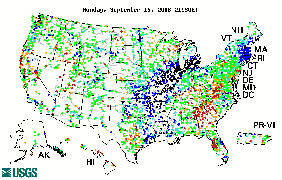
Map of Real-time Streamflow Conditions
Maps of all historical USGS streamgages, in KML format, also are available.

![]() U.S. Department of the Interior |
U.S. Geological Survey
U.S. Department of the Interior |
U.S. Geological Survey
URL: http://water.usgs.gov/waterwatch
Page Contact Information: Contact USGS
Page Last Modified: Tuesday, September 16, 2008
