Research Projects at ARL
The origins of NOAA ARL lie in the early need to predict
the transport and dispersion of radionuclides generated
by tests of nuclear weapons in the 1950s. Since those early
days, the relevance of this particular mainstream element
of ARL research has extended to a number of topical areas,
ranging from acid rain to emergency response; however,
the dominant research thrust of ARL remains the study and
the prediction of atmospheric transport and dispersion.
ARL conducts research into the processes that influence
atmospheric motions on virtually all scales, from local
(where topography often dominates) to global. ARL focusses
on those aspects of the overall transport and dispersion
problem that contribute the greatest uncertainty to predictions
and assessments.
 Meteorological
models have classically concentrated attention on those
regions of the atmosphere in which weather systems generate
and move. NOAA experience
in using these models has demonstrated the need for a more
comprehensive and physically correct way of expressing
boundary layer processes. This is especially important
for predicting air quality; the atmospheric features that
affect air quality tend to be strongly moderated by the
planetary boundary layer. (The PBL is defined as the lower
part of the atmosphere from the surface up to the level
of the geostrophic wind; it is that part of the atmosphere
in contact with the surface within which surface-generated
convection and mixing is enveloped.) Meteorological
models have classically concentrated attention on those
regions of the atmosphere in which weather systems generate
and move. NOAA experience
in using these models has demonstrated the need for a more
comprehensive and physically correct way of expressing
boundary layer processes. This is especially important
for predicting air quality; the atmospheric features that
affect air quality tend to be strongly moderated by the
planetary boundary layer. (The PBL is defined as the lower
part of the atmosphere from the surface up to the level
of the geostrophic wind; it is that part of the atmosphere
in contact with the surface within which surface-generated
convection and mixing is enveloped.)
Characteristics of the PBL are controlled by the surface
energy budget, terrain, and vegetation; in turn, the characteristics
of the PBL control wind fields and dispersion of trace
gases and particles carried by air near the surface. Thus,
it is a major thrust of ARL research to improve understanding
(and depictions) of all factors that influence the PBL,
especially the three central considerations of heat energy,
topography, and vegetation. It is for this fundamental
reason that ARL maintains and operates several research
networks, each designed to provide data with which to test
the new models as they are developed and to provide data
for future assimilation by these models. These surface
networks address various meteorological and air quality
properties, as well as surface radiation, which is the
driving force for mixing in the PBL. It is anticipated
that the next generation of meteorological models will
be driven by data derived from advanced networks such as
these, and will be adjusted according to observations of
key diagnostic variables such as air quality and atmospheric
deposition rates. It is recognized that modern models are
invariably data assimilative, and that modern monitoring
programs require coupled modeling activities for data interpretation.
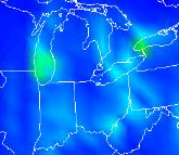 |
Increased awareness of national air quality issues
on the part of the media and the general public have
recently led to more demand for short-term (1-2 day)
air quality forecasts for use in assessing potential
health impacts (e.g., on children, the elderly, and
asthmatics) and potential mitigation actions in local
communities (e.g., increased use of carpools and mass
transit, decreased industrial operations). An emerging
collaborative partnership between U.S. EPA and NOAA
will bring the strengths of these two Agencies' capabilities
in atmospheric measurements and modeling in developing
an operational capability for producing national modeling
guidance for short-term air quality forecasts for ozone
and particulate matter in 2004. |
 Population
growth and associated increases in demand for energy, consumer
goods, and transportation are causing a slow deterioration
of almost all east coast aquatic ecosystems. The cause
is mainly eutrophication, due to excessive nitrogen and
resulting in nuisance algal blooms and loss of habitat.
In some areas, however, the problem is not nutrients so
much as toxic chemicals (e.g. mercury, in parts of Florida,
and persistent organic pollutants for the Great Lakes).
The nitrogen compounds of relevance in the East Coast case
come from a variety of sources, including sewage, waste
water run-off, and agricultural fertilizers, but it is
now known that a substantial part is derived from the atmosphere.
Regulatory strategies that fail to recognize that part
of the problem arises from atmospheric deposition will
not work as expected. There is urgent need for integrated
assessments that reveal the relative importance of atmospheric
deposition as a mechanism for loading to estuaries and
other coastal waters. NOAA is serving as a provider of
scientific guidance to the rapidly evolving community that
is coupling air and water issues in regulatory contexts. Population
growth and associated increases in demand for energy, consumer
goods, and transportation are causing a slow deterioration
of almost all east coast aquatic ecosystems. The cause
is mainly eutrophication, due to excessive nitrogen and
resulting in nuisance algal blooms and loss of habitat.
In some areas, however, the problem is not nutrients so
much as toxic chemicals (e.g. mercury, in parts of Florida,
and persistent organic pollutants for the Great Lakes).
The nitrogen compounds of relevance in the East Coast case
come from a variety of sources, including sewage, waste
water run-off, and agricultural fertilizers, but it is
now known that a substantial part is derived from the atmosphere.
Regulatory strategies that fail to recognize that part
of the problem arises from atmospheric deposition will
not work as expected. There is urgent need for integrated
assessments that reveal the relative importance of atmospheric
deposition as a mechanism for loading to estuaries and
other coastal waters. NOAA is serving as a provider of
scientific guidance to the rapidly evolving community that
is coupling air and water issues in regulatory contexts.
 Measurement
and modeling of atmospheric deposition are long-standing
ARL specialties. ARL personnel from three divisions (Research
Triangle Park, Oak
Ridge, and Silver Spring) have joined
forces to study the problem, concentrating primarily on
the Chesapeake Bay and its watershed but also reaching
out to the entire east coast, from Maine to Florida. ARL
is leading a large part of the integrated research effort
focusing on this issue. The research that is being conducted
stretches from exploratory studies of ammonia and ammonium
to the effects of plumes generated from urban areas. ARL
activities are coupled with those of all other agencies
active in the region, especially EPA, USDA,
and DoI. Measurement
and modeling of atmospheric deposition are long-standing
ARL specialties. ARL personnel from three divisions (Research
Triangle Park, Oak
Ridge, and Silver Spring) have joined
forces to study the problem, concentrating primarily on
the Chesapeake Bay and its watershed but also reaching
out to the entire east coast, from Maine to Florida. ARL
is leading a large part of the integrated research effort
focusing on this issue. The research that is being conducted
stretches from exploratory studies of ammonia and ammonium
to the effects of plumes generated from urban areas. ARL
activities are coupled with those of all other agencies
active in the region, especially EPA, USDA,
and DoI.
Understanding of how air pollution affects aquatic ecosystems
is necessary to ensure that future (and existing) regulatory
efforts to protect and restore estuaries and other habitats
along the East Coast will have the consequences that are
intended. If the atmosphere is not taken into account,
then there is fear that regulations to improve aquatic
habitats will be inadequate. We are striving for the understanding
required to have a "no surprises" regulatory
environment, and for the knowledge that will permit new
environmental policy to be appropriately targeted on the "pressure
points" where optimal results can be promised, with
minimal cost.
Climate research has a long history in ARL. Since 1962,
when ARL assumed responsibility for the monitoring programs
at Mauna Loa Observatory, ARL has been collecting and analyzing
climate data. Ozone monitoring began in the early 1960s.
The program at Mauna Loa became the nucleus of ARL's Geophysical
Monitoring for Climate Change program formed in the early
1970s. (GMCC became the principal component of the Climate
Monitoring and Diagnostic Laboratory when it was formed
in 1990.) ARL also established a solar radiation monitoring
network in 1975. Analyses of U.S. sunshine and cloudiness
records (from 1950 onward) and global temperatures (since
1958) were begun in the mid-1970s and analysis of global
tropospheric water vapor changes was added in the mid-1980s.
Current climate research has been stimulated by the potential
of human activities to bring about substantial changes
in the environment. However, an understanding of natural
variability, the "noise" from which any anthropogenic signal
must be extracted, is necessary before any change can be
unequivocally ascribed to human activities.
The ARL Climate Variability and
Trends Group studies diurnal to multi-decadal variations
in the global climate system, with a focus on analysis
of observational data. This involves extracting climate
signals from the noise inherent in standard surface and
upper-air meteorological observations, with particular
attention to data quality. We also investigate aspects
of climate variability that impact human health and environmental
quality, including stratospheric ozone, air quality,
and climate extremes.
The research program at the Surface
Radiation Research Branch of ARL is centered on the
interpretation of surface radiation measurements, instrument
characterization, and calibration. Currently, the areas
of emphasis are: 1) analyses of the surface radiation
for trends and regional characteristics, 2) modeling
the radiative transfer process as a means of inferring
the effects of clouds, aerosols and ozone on the transmission
of visible radiation and UV, 3) evaluating the field
performance characteristics of UV, visible and IR radiometers
to improve our understanding of their behavior, 4) developing
rigorous laboratory methods for characterizing and calibrating
UV instruments (because of the difficulty in making reliable
measurements in the UV-B region of the solar spectrum),
5) comparing surface measurements with those made or
inferred from other observing systems such as satellites,
and 6) the development of new instruments to provide
ancillary information that will aid in the interpretation
of the SURFRAD and other surface radiation measurements.
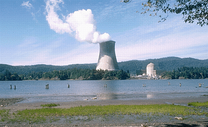
ARL serves as a center of activity for the provision
of specialized meteorological assistance in the event of
releases of hazardous materials into the atmosphere, such
as from volcanoes, nuclear
accidents, terrorist incidents,
and industrial disasters. NOAA provides
basic meteorological support in all such cases, but is
also expected to provide transport and dispersion guidance
to other Federal agencies.
Much of ARL's work in this area is in conjunction with
the NOAA National Weather
Service (NWS) and other Federal agencies. ARL provides
vital meteorological support to various agencies, (a) to
help predict the dispersion of material from an hazardous
release into the air, (b) to develop appropriate response
strategies,and (c) to provide meteorological assistance
in the event of an incdident requiring NOAA support. Work
concentrates on dispersion from releases of nuclear materials,
industrial accidents (e.g. Bhopal), and volcanic eruptions
(Mt. St. Helens, Mt. Redoubt). In this context, NOAA is
viewed by other agencies as a source of high-quality and
independent scientific and technical expertise.
For this purpose, ARL (as a joint activity with the NOAA National
Centers for Environmental Prediction - NCEP ) operates
a Regional Specialized
Meteorological Center for the WMO,
to provide emergency response assistance to the nations of
North and Central America in the event of a disastrous accident
that releases hazardous material into the atmosphere.
For the case of volcanoes,
ARL is joined with NOAA NCEP in a Volcanic Ash Advisory Center
activity, to disseminate warnings to air traffic about the presence
of volcanic ash clouds. The global array of VAACs is organized
under the sponsorship of the International Civil Aviation Organization
(ICAO).
|