skip to content program navigation
| Learn more about these CLIMATE RESEARCH areas... |
Modeling Climate
What is climate and why do we model it?
Climate refers to the average of weather conditions. It varies on timescales ranging from seasonal to centennial. Fluctuations result naturally from interactions between the ocean, the atmosphere, the land, cryosphere (frozen portion of the Earth's surface), and changes in the Earth's energy balance resulting from volcanic eruptions and variations in the sun's intensity. Since the Industrial Revolution significant changes in radiative forcing (Earth's heat energy balance) have resulted from the build up of greenhouse gases and trace constituents. The impacts on the planet of these anthropogenically-induced or man-made changes to the energy budget have been detected and are projected to become increasingly more important during the next century.
Computer models of the coupled atmosphere-land surface-ocean-sea ice system are essential scientific tools for understanding and predicting natural and human-caused changes in Earth's climate.
How do we model climate?
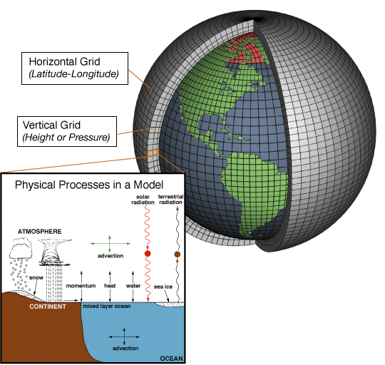
Climate models are systems of differential equations derived from the basic laws of physics, fluid motion, and chemistry formulated to be solved on supercomputers. For the solution the planet is covered by a 3-dimensional grid

to which the basic equations are applied and evaluated. At each grid point, e.g. for the atmosphere, the motion of the air (winds), heat transfer (thermodynamics), radiation (solar and terrestrial), moisture content (relative humidity) and surface hydrology (precipitation, evaporation, snow melt and runoff) are calculated as well as the interactions of these processes among neighboring points. The computations are stepped forward in time from seasons to centuries depending on the study.
State-of-the-art climate models now include interactive representations of the ocean, the atmosphere, the land, hydrologic and cryospheric processes, terrestrial and oceanic carbon cycles, and atmospheric chemistry.
The accuracy of climate models is limited by grid resolution and our ability to describe the complicated atmospheric, oceanic, and chemical processes mathematically. Much of the research in OAR is directed at improving the representation of these processes. Despite some imperfections, models simulate remarkably well current climate and its variability. More capable supercomputers enable significant model improvements by allowing for more accurate representation of currently unresolved physics.
Phenomena of interest
Climate Variability
Greenhouse Warming
Atmospheric Chemistry
Paleoclimates
Ocean Circulation
Climate and Extreme Events
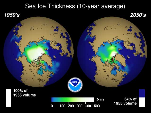
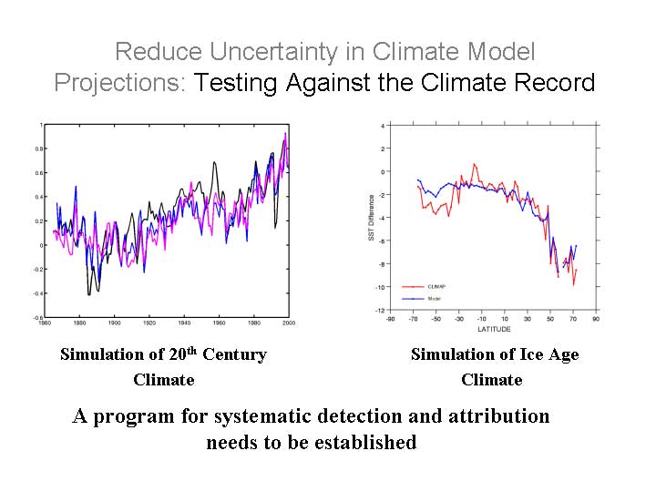
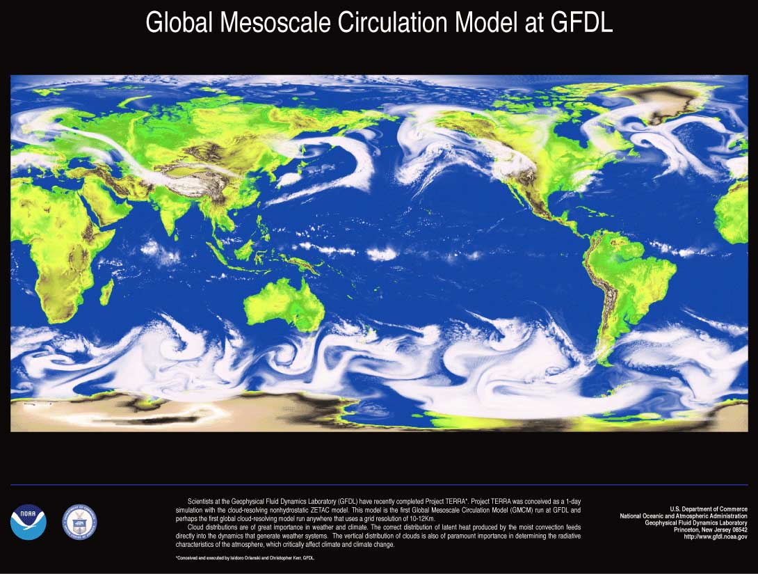
A new global coupled climate model can predict seasonal to interannual variability over the Pacific. Observations are on the left, and predictions with the coupled model are on the right. Sea Ice thickness (in centimeters) over the Arctic. A model projection of the pack ice for the 2050s (right) shows a substantial decrease in sea ice thickness over present era (left). Climate models can simulate temperature changes not only over the last century but also for climate during an Ice Age. Surface ocean currents in a model of the ocean circulation in the southern hemisphere. High horizontal resolution (1/6 degree, right) simulates ocean eddies more realistically than low resolution (1 degree, left). FLC animation (63 Mb) Eddies have a profound effect on ocean mixing processes. Models here at GFDL have improved model resolution to resolve smaller eddies, which previous models could not do. AVI Animation (29 Mb) Simulation of weather systems in a global model with explicit convection and a horizontal resolution of 10-12 km. Hurricane model imbedded within a global forecast model. In a climate with enhanced CO2 emissions, elevated temperatures and humidity provide additional energy for storms to strengthen. Wind speeds increase by about 10% in the strongest storms, and there is up to a 28% increase in near-storm rainfall. |


NOAA Research programs that Utilize or Support Climate Modeling
![]() Geophysical Fluid Dynamics Laboratory (GFDL)
Geophysical Fluid Dynamics Laboratory (GFDL)
![]() Climate Program Office (CPO)
Climate Program Office (CPO)
![]() Earth
System Research Laboratory (ESRL)
Earth
System Research Laboratory (ESRL)