United States Department of Agriculture
Natural Resources Conservation Service
National Water and Climate Center Go to Accessibility Information
Skip to Page Content
National Water and Climate Center


GIS Products

Water Supply Forecasts

Note: Please manually reload .PDF files in internet browser to ensure you have the latest data.

Streamflow Forecast Map      
1st of Month
West-wide maps % of Average
Regional maps % of Average for Alaska

% of Average by River Basin:
Arkansas, Colorado and Rio Grande
Columbia
Great Basin and California
Missouri

Description:

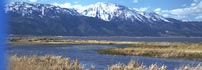
Maps display the 50% exceedance forecast.  Maps are published January through June. For the 90%, 70%, 30% and 10% exceedance forecasts, please consult the State Basin Outlook Reports.  For more information on how to interpret exceedance forecasts, check out our Streamflow Forecast Interpretation webpage.

Content Manager:

Jim Marron