 |
 |
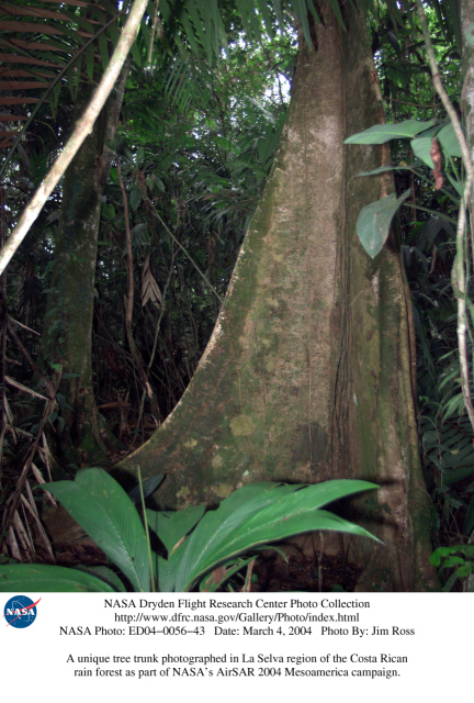 |
A unique tree trunk photographed in La Selva region of the Costa Rican rain forest as part of NASA's AirSAR 2004 Mesoamerica campaign. |
|
|
|
| Photo Number: | ED04-0056-043 |
| Photo Date: | |
|
|
|
| Formats: | 432x640 JPEG Image (246 KBytes) 863x1280 JPEG Image (826 KBytes) 2022x3000 JPEG Image (3306 KBytes) |
|
|
|
| Photo Description: |
A unique tree trunk photographed in La Selva region of the Costa Rican rain forest as part of NASA's AirSAR 2004 Mesoamerica campaign. AirSAR 2004 Mesoamerica is a three-week expedition by an international team of scientists that will use an all-weather imaging tool, called the Airborne Synthetic Aperture Radar (AirSAR) which is located onboard NASA's DC-8 airborne laboratory.
Scientists from many parts of the world including NASA's Jet Propulsion Laboratory are combining ground research done in several areas in Central America with NASA's AirSAR technology to improve and expand on the quality of research they are able to do. NASA's AIRSAR technolgy provides two essential elements to the ground-based scientists. First, it tests and provides accurate measurements of the forest structure. Secondly, AirSAR can study a larger area of the forest versus the smaller area that can be tested and plotted by the ground scientists. It also provides a unique one-of-a-kind system of measurement that obtains important information for the scientists, such as where forests are located and what exactly is in them. |
|
|
|
| Project Description: |
AirSAR collects multi-frequency and multi-polarization radar data for a variety of science applications. It also acquires data in interferometric modes, providing topographic information (cross-track mode) or ocean current information (along-track interferometry). This March 2004 deployment was planned to:
During the deployment data is collected over Central and South America and Antarctica. During the approximately 100 flight hours, AirSAR is expected to acquire polarimetric and/or interferometric data along a 20,000 km track, or about 200,000 sq. km of data over 40 sites for 30 scientists. AirSAR will collect data related to the following NASA Code YS science programs:
NASA used a DC-8 aircraft as a flying science laboratory. The platform aircraft, was based at NASA's Dryden Flight Research Center, Edwards, Calif., collected data for many experiments in support of scientific projects serving the world scientific community. Included in this community were NASA, federal, state, academic and foreign investigators. Data gathered by the DC-8 at flight altitude and by remote sensing has been used for scientific studies in archeology, ecology, geography, hydrology, meteorology, oceanography, volcanology, atmospheric chemistry, soil science and biology. |
|
|
|
| NASA Photo by: | Jim Ross |
|
|
|
| Keywords: | DC-8, Airborne Science, AirSAR, Airborne Synthetic Aperture Radar, Central America, Costa Rica, Juan Santamaria International Airport, La Selva, rain forest |
|
|||||||